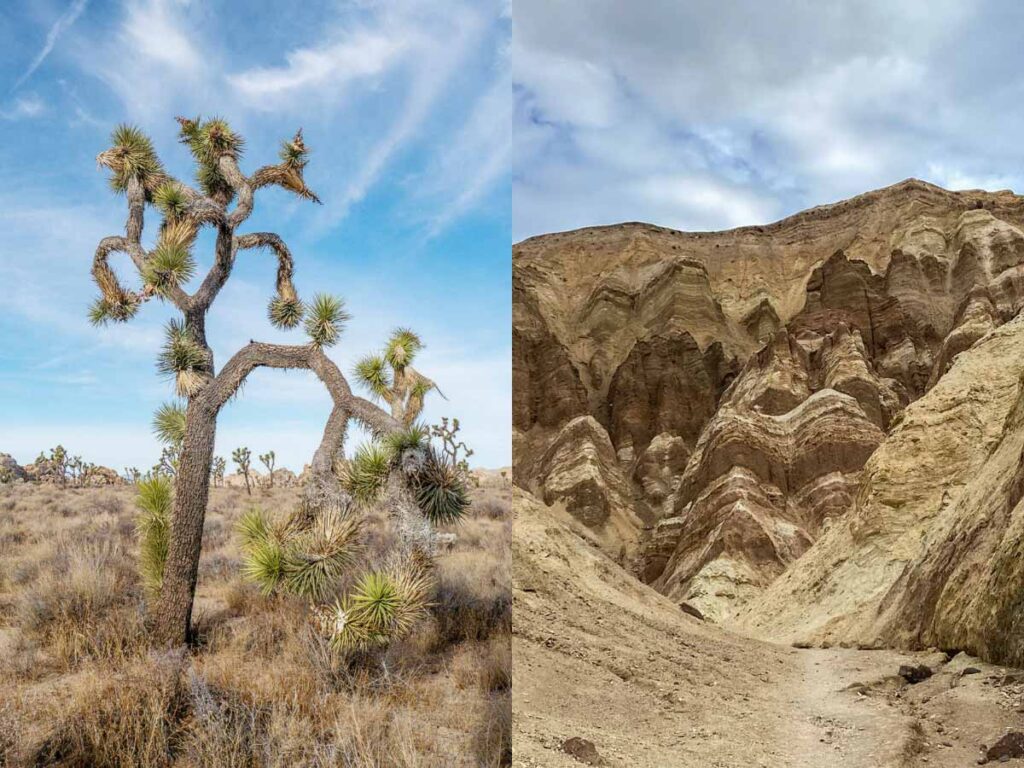
Road tripping from Joshua Tree to Death Valley is so worth it for experiencing the spare desert landscape of both the Sonoran and Mohave deserts.
There is a ton to do and see within these two CA National Parks, and you can spend plenty of time in each. But if you are doing a longer California road trip and driving from Joshua Tree to Death Valley (or the reverse – Death Valley to Joshua Tree), don’t be in a hurry. I’ve done it the slow way several times and it’s really worth it.
This itinerary is optimized for scenic stops, not speed. It’s organized south to north, starting in Joshua Tree, then going north to Death Valley. It includes specific routing ideas, key stops, and planning tips like when to visit, what to bring, and some suggestions for where to go after visiting Death Valley.
(This article contains affiliate links. This means that if you choose to purchase, I’ll make a small commission.)
Suggested Routing from Joshua Tree to Death Valley (and Beyond)
How Far is it from Joshua Tree to Death Valley?
The scenic route on this drive goes through the Mohave reserve. It’s 317 miles and 6 hours of driving without stops.
JT to DV Routing
I’ve done this route several times and you can’t trust Google maps to give you the scenic route. Google even suggests skirting Joshua Tree National park…which is beside the point!
To get a routing that goes through the Mohave Reserve, you’ll need to add in additional stops for Amboy Crater, Kelso Dunes and Shoshone in between Joshua Tree and Death Valley.
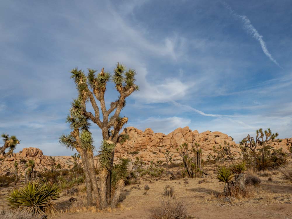
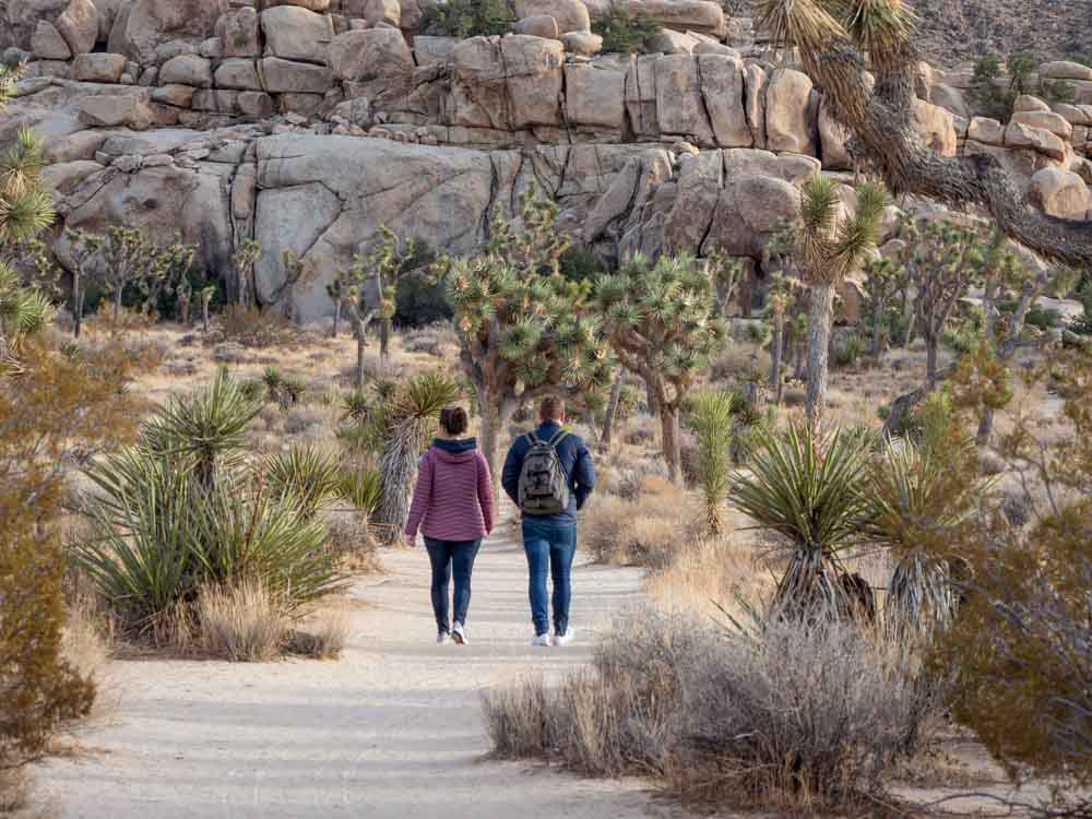
Top Stops in Joshua Tree
Start with our complete guide for JT, how to spend a day in Joshua Tree National Park and a whole article on Joshua Tree hikes. Be sure to leave some time for visiting the quirky art installations and sculpture gardens in Joshua Tree town. Here are the most popular stops in the park:
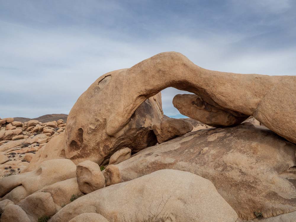
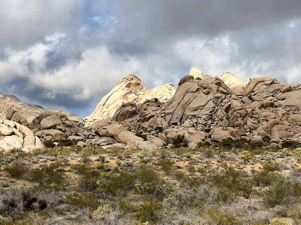
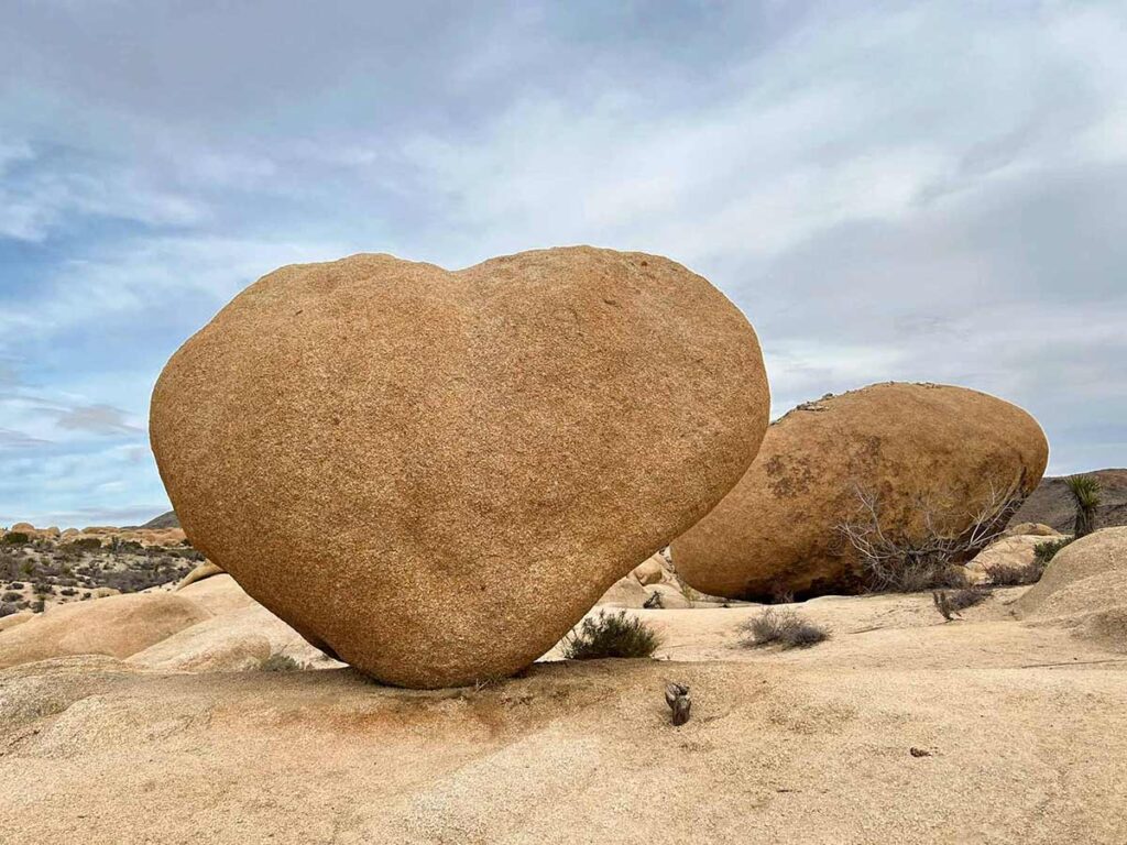
Arch Rock Trail
The Arch Rock loop does a kid-friendly short circuit near the White Tank campground. And for something extra, keep an eye out for the Heart Rock spur. To find the trailhead, park at the Twin Tanks parking lot and then follow the signs across the road. Then, take an immediate right (which isn’t well marked) and head toward the rock cluster.
Skull Rock
This creepy bit of geology is the result of relentless drips of rain, carving your next Halloween mask into the granite. In addition to scaring your children, there’s also a 1.4 mile nature trail.
Queen Valley Road and Desert Queen Mine Roads
Actually, this isn’t one of the more popular things to do in the park as most people don’t even know that the road is there. But it’s my favorite way to get between Skill Rock and the Barker Dam and Wall Street parking lots.
The dirt road is well graded and is fine for a passenger car, although I wouldn’t do it if the park has been experiencing one of its infrequent rains.
Barker Dam Loop and/or Wall Street Mill
During the late 1800’s and early 1900’s, cattle ranching was an important part of the region’s economic activity. The dam was built to provide year-round water for the cattle. There is a 1.3 mile interpretive loop that has nature markers and a small spur leading to Native American cave paintings.
Right next to Barker Dam is the 2.4 mile Wall Street Mill trial. The mill was originally owned by Bill Keys and the trail has informative signage, old mill equipment and Joshua Tree’s lovely landscape along the way.
Hidden Valley Loop
Hidden Valley is just down the road from Keys Ranch. It was once part of a cattle rustler’s hideout, and is now a popular picnic spot and rock-climbing area. You can walk the 1-mile loop trail.
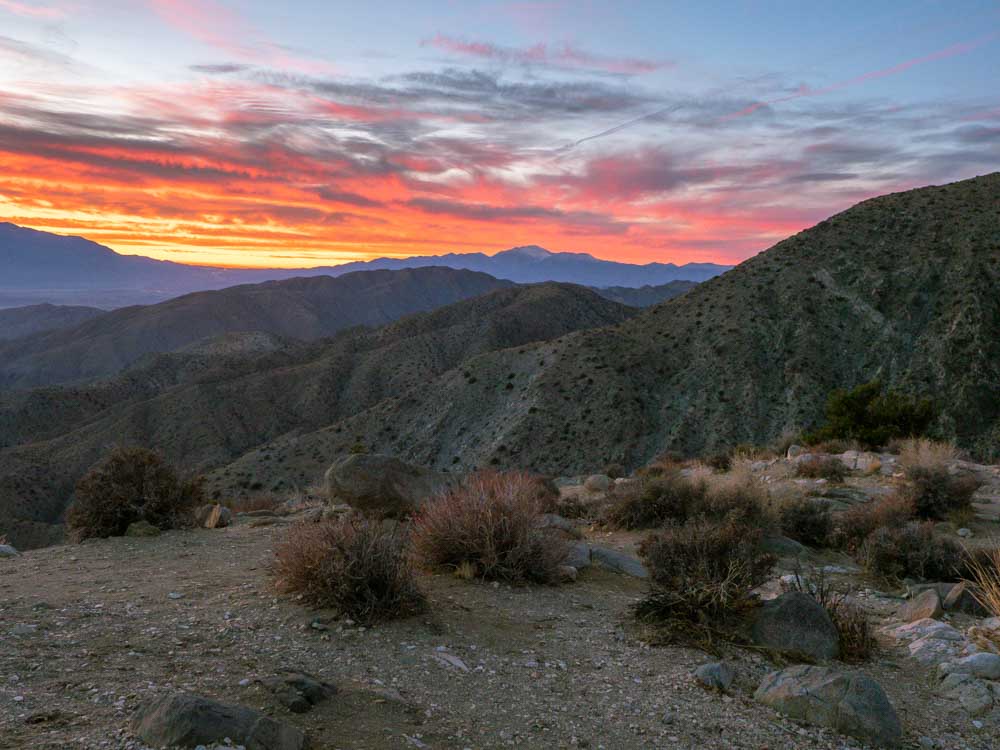
Sunset at Keys View
Actually, this is one of the most popular things to do in Joshua Tree and the views are great all day. The overlook offers a wide-angle view of the Coachella Valley and on a clear day, it feels like you could reach out and touch LA.
But, trust me, you’ll want clouds instead. At sunset, the setting sun sparks up the clouds in a flaming light show. To see the best of it, get there about 20 minutes before sunset and stay about 30 minutes after the sun has gone down behind the mountains.
Where to Stay in Joshua Tree
- The park itself has 494 camp spots. Most of them require advance reservations so check our JT campground guide for more information.
- Nearby 29 Palms and Joshua Tree have a range of accommodation from inexpensive motels to nice lodges. Options include the kitchy Pioneertown Motel, cheap and cheerful High Desert Motel, basic chain hotel Spark by Hilton, high design with Mohave Sands, or self-catering cabin rentals.
Top Stops Between Joshua Tree & Death Valley
These stops take in the often overlooked Mohave National Reserve.
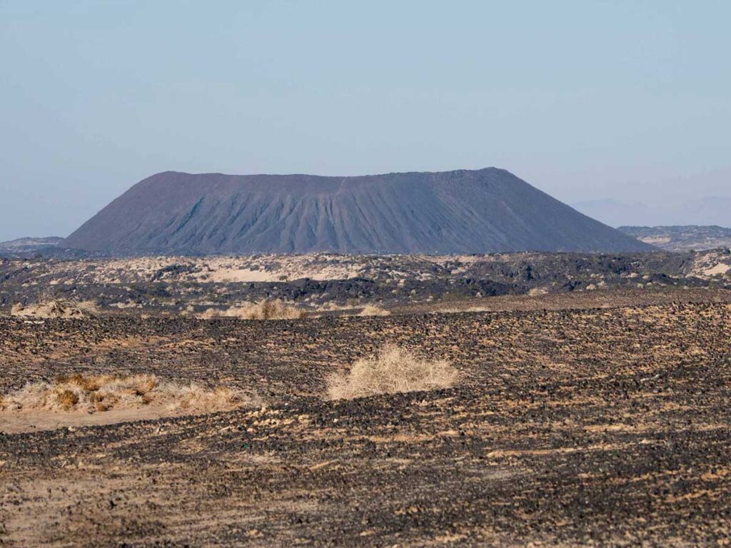
The Amboy Crater
This BLM landmark is one of the youngest volcanic fields in the US. It’s an ancient cinder cone and it’s such a moonscape that NASA used the area to test the Mars Rover. There is a 4 mile out and back hike to the crater and the parking area has explanatory signage and shaded picnic tables.
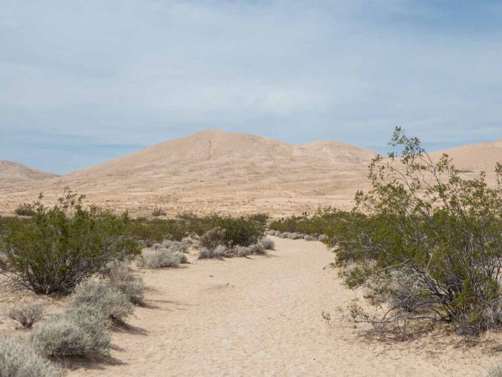
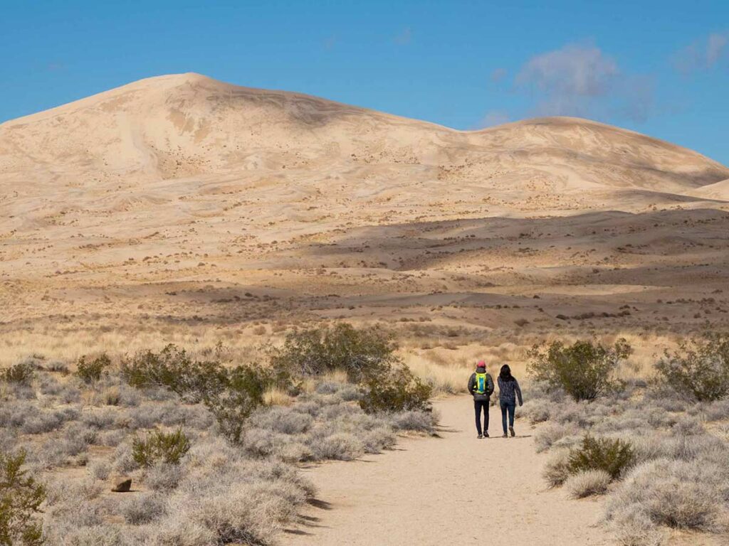
Kelso Dunes
At over 600 feet tall, the Kelso Dunes are among the tallest in the US. The dunes are home to some rare plant and insect species that aren’t found anywhere else. You can take a 3 mile round trip to the top of the dunes, although it’s a pretty strenuous hike. Or you can simply have a wander around bottom of the dunes.
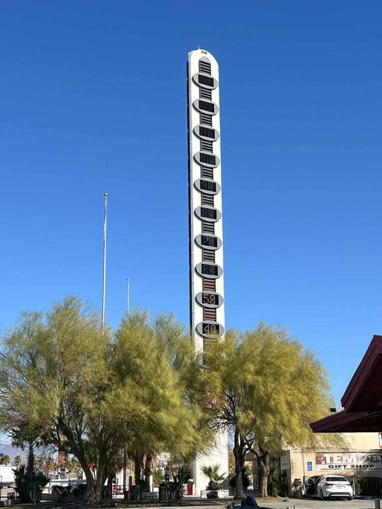
Tecopa’s World Tallest Thermometer
Because of course in some of the US’s hottest territory, you’d have a 135 foot tall thermometer. This goofy roadside attraction is definitely worth a stop. While you are in town, this is a good spot to top up your gas and get snacks.
China Ranch Date Farm
China Ranch is a small family farm just south of Tecopa. It’s worth the slight detour if you are the kind of person who like family farms, farmstands and locally made goods. They are open 9-5 every day.
Dublin Gulch Cave Homes
The Dublin Gulch cave home are a quick .5 mile trail in Shoshone. They were used by miners from the 1900’s-1960’s. It’s a quick pit stop before heading into Death Valley.
Top Stops in Death Valley
I have a full guide for Death Valley that will help you plan your time there. It includes 1-day and 2-day itineraries, a full campground guide and top things to do. Here are some highlights:
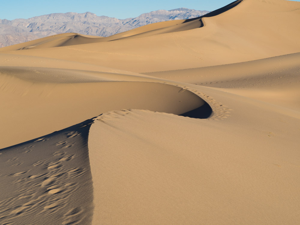
Mesquite Dunes
You can get to the Mesquite dunes with a fairly easy 15 minute drive from Stovepipe Wells. Then hike into the dunes for 20-30 minutes and simply explore at random. It’s best to go at sunrise, because the warm light against the orange sand is a beautiful wake-up call.
Badwater Basin
Badwater basin is the vast drainage aquifer for Death Valley, covering nearly 200 square miles of daunting salt flats. At -282 feet, it’s the lowest spot in the United States. It’s called “badwater” because a surveyor found that his mule wouldn’t drink the extremely salty water. You can visit anytime of day, but I prefer it at dusk.
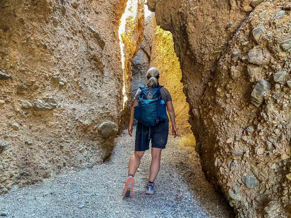
The Golden Canyon Gower Gulch Hike
The Golden Canyon trail in Death Valley is popular…and for good reason. While hiking you enter an ancient portal into Death Valley’s unique geology. You leave the flats of Badwater Basin behind and enter the canyon’s narrow runway, flanked by yellow and red rock formations and intriguing tentacles along Golden Canyon’s side shoots. Here’s our full guide for hiking Golden Canyon and Gower Gulch.
If you have extra time, we also recommend hiking the slot canyons in Sidewinder Canyon, which is also off of Badwater Basin road.
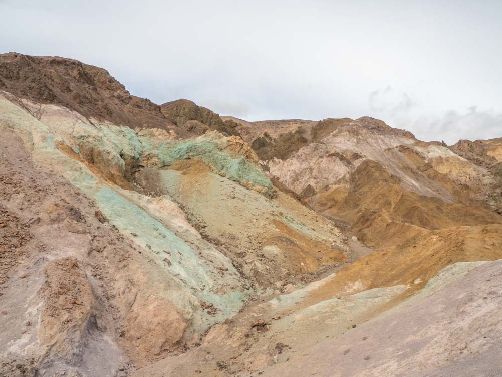
Artists Palette Drive
This scenic drive is located in the Badwater Basin, so you can add it on before or after doing the Golden Canyon hike or Badwater Basin viewpoint. The Artists Palette is a one-way, nine mile drive taking you through an amazing geologic rainbow. You’ll be rewarded if you get out of the car and hike closer to these multi-hued rock formations.
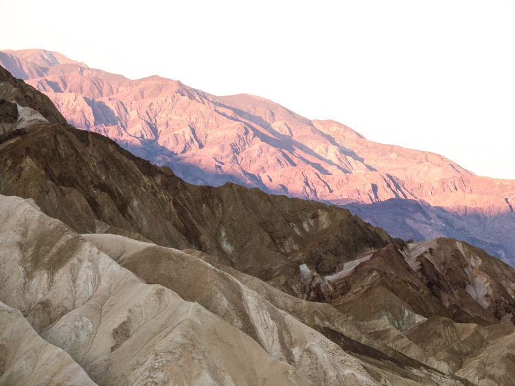
Zabriskie Point at Dawn
Zabriskie Point is another great spot for the pre-dawn photo shoots. The point has generous folds of sandstone in the foreground with the Panamint Mountains as a backdrop. Dawn is pretty enough with the morning sun lighting up the Panamint mountains in pink, but things get really interesting about 20 minutes later when the sun rises a bit more and starts throwing shadows onto the sandstone canyon below.
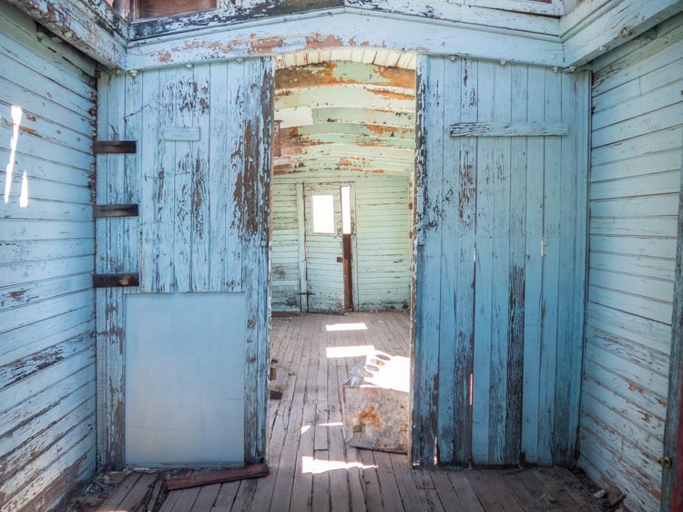
Ryolite Ghost Town
Technically, Rhyolite is just outside of the park boundary. But since mining was such an important part of Death Valley’s history, it’s worth visiting. Rhyolite’s crumbling infrastructure offers a great lesson on California’s unpredictable mining history. The town went from boom to bust in just 20 short years. On site, you can poke around the building ruins, old rail cars and a cool building make of soda bottles. You should also visit the nearby Goldwell Sculpture garden. Here’s our full guide to Rhyolite.
If you like dusty and abandoned spots, check out this guide to California ghost towns. It includes a few others that are near Death Valley.
Dante’s View
Dante’s View is 25 miles southeast of Furnace Creek. At a height of 5,400 feet, you’ll get wide angle panoramic views of the Badwater Basin and the Panamint mountain range.
The other cool thing about Dante’s View is that it’s the same view that Luke, Obi Wan, C3PO and R2D2 had when they were headed into Mos Eisley. And if you are a Star Wars nerd, the Twenty Mule Team Drive, Golden Canyon, Desolation Canyon, Mesquite Dunes and Artist’s Drive were also filming locations.
May the force be with you.
Where to Stay in Death Valley
There are 12 private and public campgrounds in Death Valley, dispersed across the 5,200 square miles of the National Park. Use our guide to all Death Valley campgrounds and find the right option for you. Hint: I prefer one of the campgrounds near the Furnace Creek visitor center for the central location.
If you prefer a hotel stay, there are three located within the park. They range in quality and, frankly, none are a fabulous deal for the money. But if you aren’t camping, it’s worth staying at one of these three places because the nearest lodging outside of the park is 60 miles away. However, book early because during high season, these lodgings fill up fast.
Our Death Valley hotel guide also offers some practical and budget-friendly places to stay outside of the park.
- The Inn at Death Valley is a fancy historic inn, with lovely grounds and a nice restaurant. Reviews and pricing here.
- The Ranch at Death Valley is a centrally located family-friendly place in Furnace Creek. Reviews and pricing here. This is my favorite place to stay for its central location.
- The Stovepipe Wells Village Hotel is a perfectly serviceable motel. They don’t have a lot of amenities, but there is a restaurant and small store onsite. Reviews and pricing here.
Three Ideas for Where to Go after Death Valley
If this is part of a larger California Road trip, we have 3 ideas for you on where to head next.
- If you are going back to LA: Exit Death Valley on west 190 and head south on Trona/Wildrose Road toward Ridgecrest. This will take you past Ballarat Ghost town. If you have a car with some clearance, hit up the Trona Pinnacles. Once on Highway 14 south, you can also stop at Red Rock Canyon Recreation area, which is like a little slice of Southern Utah.
- If you are going to Yosemite or Sequoia National Parks: Do the above, but once you are in Ridgecrest, take Highway 178 directly west through the Kern River Canyon. This lovely narrow canyon goes past Lake Isabella and spits out in Bakersfield. From there, head north on Highway 99.
- If you are doing the Eastern Sierras and Lake Tahoe: I have a whole extended itinerary for Highway 395, which includes stops in Lone Pine, Bishop, Convict Lake and Bodie Ghost town. It’s particularly lovely in the fall. I also have advice on the scenic Lake Tahoe Drive and Tahoe breweries.
Prepare for your Death Valley, Joshua Tree Drive
Our general advice for both parks is that you need to be well-prepared and self-sufficient. Drive in with a full tank of gas and bring your own supply of printed maps, food/lunch and twice as much water as you think you may need.
Is there Cell Service in Death Valley and Joshua Tree?
Both parks have very poor cell service, and certainly not in the more remote areas in the parks. Print our guides and cache your Google maps before you go.
Or better yet, get the California Road Atlas. I love this old school map and use it a lot for finding recreation areas and backroads.
What Kinds of Services do the Parks Offer?
Joshua Tree National Park has a visitor center, campgrounds, restrooms and picnic areas. But you will not find cafes, water or gas inside the park, so stock up before you head in.
Death Valley covers a huge geographic area. But most of the services are clustered in the center of the park around Furnace Creek and Stovepipe Wells. The main visitor center is in Furnace Creek. There are campgrounds and bathrooms scattered throughout the park. There are hotels, restaurants and gas at Furnace Creek and Stovepipe Wells.
Get Groceries in Joshua Tree
If you’re camping or want to stock your cooler with lunch and drink items, it’s best to do it before you leave Joshua Tree. There is a large Vons and Walmart in Yucca Valley, which is just west of Joshua Tree town. Otherwise, you’ll just find very small markets and gas station food for the rest of the trip. There is a small market in Furnace Creek in Death Valley, but their selection is limited and expensive.
How to Get to Joshua Tree
The closest airport to Joshua Tree is in Palm Springs, which is 40 miles from Joshua Tree town. However, for some people, it’s easier to fly into Los Angeles and rent a car. LAX is 143 miles from Joshua Tree.
How to Get to Death Valley
If you are starting in Death Valley and going south, the nearest airport to Death Valley is actually in Las Vegas, which is 120 miles and 2 hours away. If you are driving there from LA (and then heading south), plan for 272 miles and 5.5 hours. If you are road tripping from San Francisco, use our SF to Death Valley guide. This routing has four scenic drive options that are all roughly 450 miles and 8 hours of solid drive time.
When to Visit Joshua Tree & Death Valley
The short answer is March-April and October-November for warm days and cooler nights.
We’ve got articles on when to visit Death Valley and Joshua Tree, which go into more detail on what to expect season by season.
Learn Before You Go
Check out our article on fun facts about Joshua Tree, it shares info about how the Joshua Tree isn’t really a tree, how it got such a biblical name and how an enterprising but cranky miner got away with murder. Our fun facts about Death Valley will help you learn how how the pioneers were saved by a one-eyed donkey and how Scotty’s Castle didn’t really belong to Scotty.
Hi! Just wanted to let you know: the world’s biggest thermometer is in Baker not Tecopa, it’s called the Mojave National Preserve. Lost Horse Mine trail is 6.8 miles total, and it’s dispersed camping not disbursed. 🙂 Some other feedback might be to remind people of Leave No Trace. Thanks!
Thanks for the catch. I’m my own worst editor.