If you are embarking upon a San Francisco to Death Valley road trip, there are a couple ways that you can tackle the drive. There is no one right way to do it, and your own best route may depend upon how much time you have, the season and how keen you are to stop and smell the roses along the way.
My recommended routing from SF to Death Valley (and back again), suggests a loop that not only gets you to the National Park in decent time, but gives you plenty of options for stopping at cool state parks and scenic sites along the way. I’ve also got some advice for what you should do at a bare minimum, along with some additional cool ideas if you have more time.
Getting from San Francisco to Death Valley
This routing is the fastest way to get from San Francisco to Death Valley. However, rather than bombing it down there, I suggest that you make a few pit stops along the way.
Miles from SF to Death Valley: 456 miles
Active Drive Time: 7.5 hours
Routing & 4 Stops
San Francisco south on Highway 101 to south Highway I-5 >> Cut over to Highway 43 south to Colonel Allensworth State Park >> south on Highways 99 and 58 through Tehachapi >> Highway 14 to Red Rock Canyon State Park > east to Ridgecrest then Trona Road to the Trona Pinnacles >> then north to Highway 190, stopping at Ballarat >> east into Death Valley
- Colonel Allensworth State Park. This little known state park is nestled between I5 and Highway 99 just south of Fresno. The historic town was a social experiment developed in 1917 by Allensworth, who was a well respected African American civil war veteran. His vision was to develop a town specifically for African Americans where they would seek economic prosperity and control their destinies.
- Red Rock Canyon State Park. This is not long after you round the corner after Tehachapi. The short 1.5 mile Hagen Canyon trail is right off the road and has lovely red rocks of the sort you’d find in Utah.
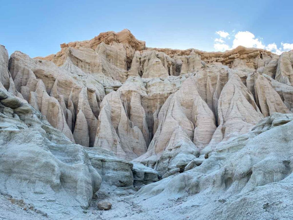
- Trona Pinnacles. These are northeast of Ridgecrest. They’re tufa spires that just pop out of the flat landscape like popsicles. This BLM site is only a short detour off the main road on a dirt washboard road.
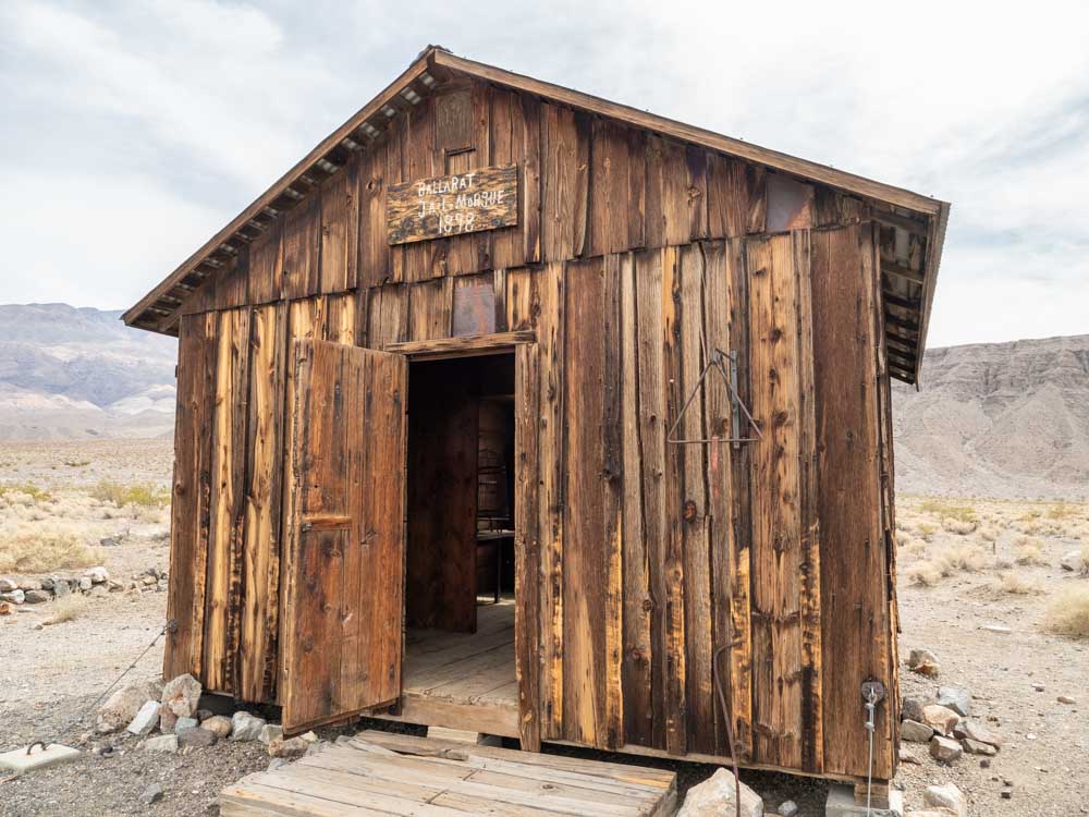
- Ballarat. North on the trona road, this mining town outpost makes our list of the best ghost towns in California (although this whole itinerary is packed with ghost towns).
What to Do in Death Valley
We offer a 1-day Death Valley Itinerary and a 2-day itinerary for the park. They both cover the “must see” sites but the two day itinerary has more on it and has a less demanding pace.
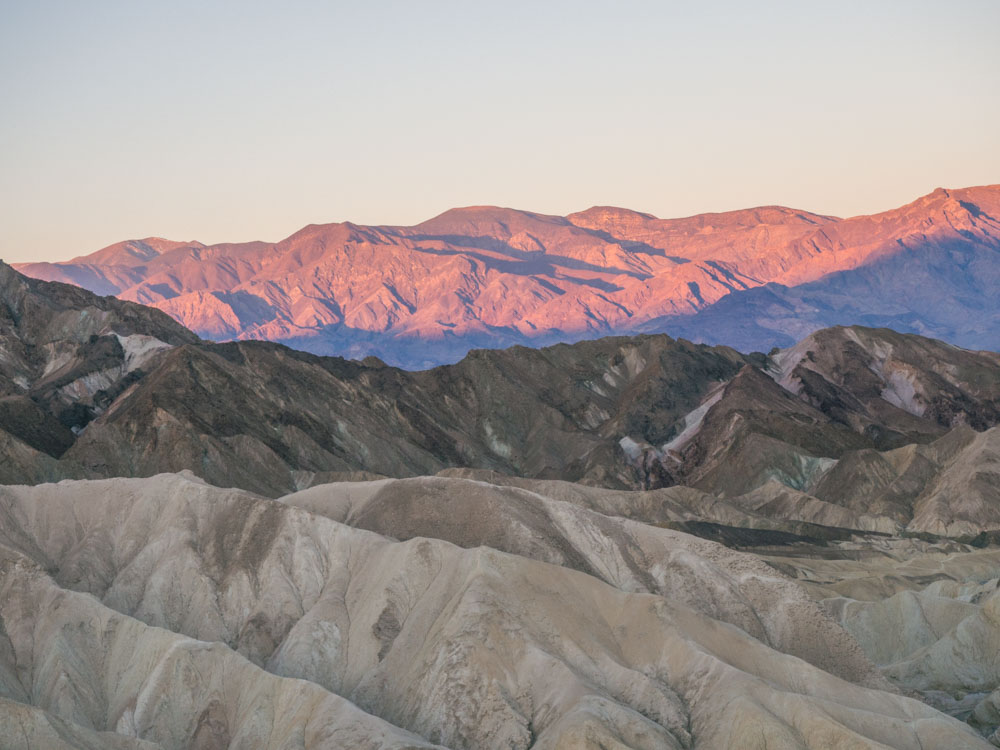
- If you only have a day: We recommend Badwater Basin, Artist Palette Drive, Zabriskie Point and Mesquite Dunes.
- If you have two days: Do Zabriskie Point or Mesquite Dunes at dawn, because the light is amazing. We would also add: Dante’s View, Rhyolite Ghost Town (and nearby sculptures) and the Ubehebe Crater.
- If you have three days: We recommend mixing in some hikes like: Golden Canyon/Gower Gulch, Sidewinder Canyon or Desolation Canyon. You could also squeeze in the 20-mule team drive and the Harmony Borax Works.
Our Death Valley hotel guide also offers some practical and budget-friendly places to stay outside of the park.
Getting from Death Valley to San Francisco
This routing takes a longer scenic way home via Highway 395.The Eastern Sierra range drive is one of my favorite scenic drives in California. But note that Tioga Pass through Yosemite is closed in the winter. So, you may need to add the extra miles and get back via Tahoe, which is also quite lovely.
If you are doing this in the fall, make sure to leave some time for exploring the fall color along 395.
Miles from Death Valley to San Francisco: 460-473 miles
Active Drive Time: 8.5-9 hours
Routing & Stops
Through Yosemite: Leave Furnace Creek northeast on Highway 190 to Highway 395 > North through Lone Pine & Lee Vining > West on Highway 120 over Tioga Pass > Highway I-205 toward San Francisco
Through Tahoe: Leave Furnace Creek northeast on Highway 190 to Highway 395 > North through Lone Pine up to Carson City > West on Highway 50 through Lake Tahoe > Highway I-80 toward San Francisco

6 Key Stops
- Lone Pine: Hang a left in town for the Alabama Hills. These rock formations are reminiscent of Utah and the area was popular for filming locations. Head over to the Mobius Arch loop trail for a quickie hike.
- Manzanar Historic Site. This federal historic monument is helping us remember the internment of Japanese-American citizens during WWII.
- Convict Lake. This lovely alpine lake is an easy drive off of 395 and you can have a picnic along the water and take the 2.5 mile loop around the lake.
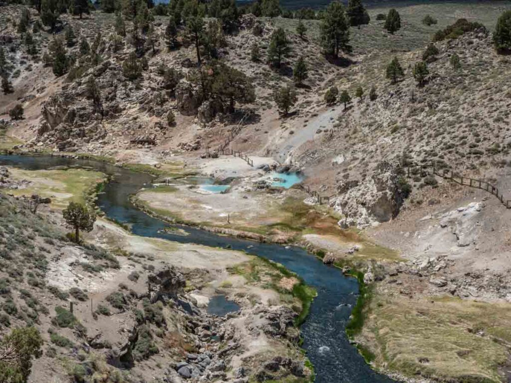
- Hot Creek Geologic site. The mineral water is a crazy blue color and the site sits in a lovely gorge. This is also accessed via a well-graded dirt road.
- June Lake Loop. This offers a short, lovely detour and then head up to Lee Vining.
- Bodie Ghost Town. It’s one of the most interesting and well-preserved ghost towns in the area and good if you have an extra 1/2 day. Get more info using our Bodie State Park guide.
More resources for this area include: a Highway 395 itinerary and guides for Bishop and a Lone Pine.

Tips for Visiting Death Valley
For the full scoop on how to plan your trip, you should refer to our extensive Death Valley Guide. It’s gives an insane amount of detail regarding park logistics, camping, lodging, where to eat and itinerary suggestions. That said, here are some answers to commonly asked questions about the park.
Where is the Death Valley Entrance?
There is no single entrance into Death Valley, but there are three main entrances that most people use. The first is from Highway 395 through Lone Pine. The second is to come up the Panamint Valley Road from Ridgecrest. The third enters west into the park from Death Valley Junction.
Is Driving in Death Valley Safe?
Yes. All of the main park sites are accessed from paved or well-graded dirt roads. There are 4×4 roads in the park, which are clearly marked on a Park Service map that you can pick up at the visitor center.
Is there Cell Service in Death Valley?
The park has very poor cell service. Your service provider may tempt you with a bar or two, but don’t plan on consistent service– certainly not in the more remote areas in the park or while hiking in the canyons. Print our guides and cache your Google maps before you go.
Better yet, get the Benchmark California Road Atlas. I love this atlas. It has a lot of detail, showing state parks and campsites as well as both paved and dirt roads.
Is there Gas in Death Valley?
Yes. There are gas stations in Furnace Creek, Stovepipe Wells and Panamint Springs. But fill up before you go because the gas in the park is expensive and the gas stations can (and sometimes do) run out of gas.
When is the Best Time to Visit Death Valley?
The short answer is February/March for pleasant temps and (maybe) wildflowers. Mid-October through December is also very pleasant. The long answer can be found in our when to visit Death Valley article. It includes a temp and precip chart, advice on how to visit in the hotter months and more detail about less busy months.