Death Valley National Park is 5,200 square miles. So exploring the whole territory in a two days would be challenging. But don’t worry, I’ve got you covered. This two day Death Valley itinerary features a highlights tour of the most lavish landscapes in the park paired with practical planning tips.
About Death Valley
Death Valley is named as such because of the doomed efforts of pioneers who were desperately seeking passage through the southern Sierra Nevada mountains. This hot dry landscape is an unforgiving place for a lost wagon train. But the pioneers persevered and after the establishment of California, Death Valley became a borax mining boom-town in the 1880’s. Then, in the 1920s the Pacific Coast Borax Company began lobbying the National Park Service and the general public about the need to preserve of the area’s natural resources. It was a rare and generous act of corporate philanthropy for Pacific Coast Borax to advocate turning their cash cow into a conservation area. Fortunately they succeeded and the area was designated a National Monument in 1933. Mining continued in the area until the region received official National Park designation in 1994.
Pacific Borax knew what you’ll find out on your Death Valley trip, which is that this landscape has a lot of surprises. What appears beige and bleak at first glance is actually a study with extremes with sharp topography, mineral colored cliffs and a wide range of altitudes.
And all the better if you’re willing to get up at dawn and stay up past dusk.
Learn even more about the park with these 10 cool facts about Death Valley.
Get the Death Valley Vacation Guide: It’s got the full scoop for planning your Death Valley Trip. The guide has additional routing suggestions, practical planning tips, a broader list of things to do and packing tips.
Top Things to Do in Death Valley
I live in California and have been to the park multiple times, usually for two days stints. So, I know you can pull this off…if you are willing to get up early and go back out at dusk.
All of these sights are baked into the detailed itinerary below. While you can do off-roading in the park, this is more of a normy itinerary, and everything on this list is do-able in a normal passenger car.
Day One: Zabriskie Point, Dante’s Peak, 20 Mule Team Canyon, Artists Palette Drive, Golden Canyon hike (or Sidewinder), Harmony Borax Works, Badwater Basin.
Day two: Mesquite Dunes, Mosaic Canyon hike, Ryolite Ghost Town, Ubehebe Crater.
Note that I’m NOT recommending The Racetrack. I’ve seen it on other itineraries but it’s not practical for a 2-day trip. You need both serious 4×4 and a whole day to do it.
If you are in a hurry and don’t have a full two days, check out this itinerary for how to do a day trip from Death Valley from Las Vegas. And consider adding the park to a longer road trip that includes the Highway 395 corridor. Or do a 2-fer and do a Death Valley to Joshua Tree road trip.
Death Valley Itinerary: Day 1
Day one of this itinerary spends more time in the centrally located Furnace Creek area, giving more time to pop out of the car for great views and medium distance hikes. Total drive time: 2.75 hours.
Zabriskie Point at Dawn
Distance from Furnace Creek: 5 miles
Time on-site: 20 minutes to an hour
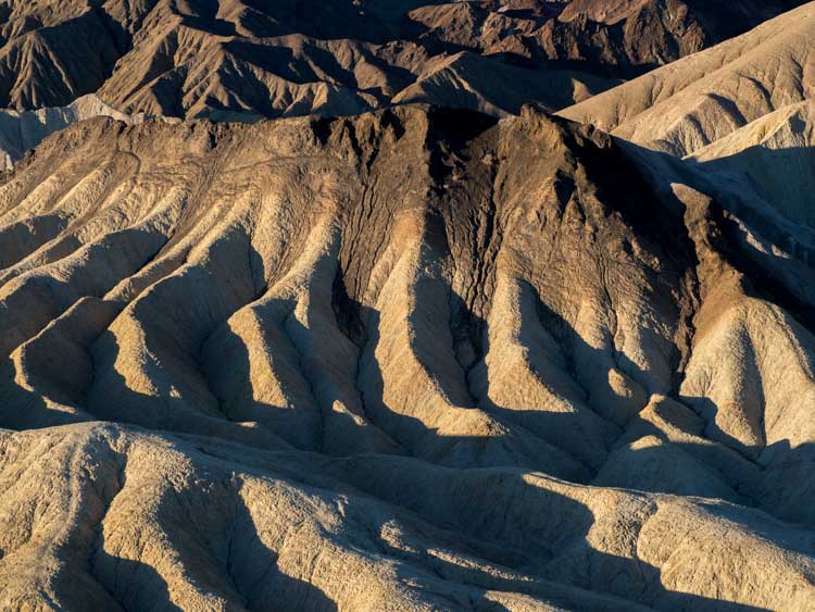
I’m usually reluctant to label something a “must see”, but at dawn, Zabriskie Point is absolutely that. The point has generous folds of sandstone in the foreground with the Panamint Mountains for a backdrop. Dawn is pretty enough with the morning sun lighting up the Panamint mountains in pink, but things get really interesting about 20 minutes later when the sun rises a bit more and starts throwing shadows onto the sandstone canyon below.
From there, you can head down into the canyon for the Badlands Loop hike, which is a 2.7 mile loop.
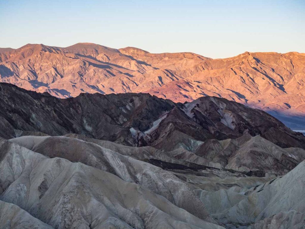
Dante’s View
Distance from Furnace Creek: 25 miles
Time on site: 20 minutes to an hour
Head 35 minute south to Dante’s View. At a height of 5,400 feet, you’ll get wide angle panoramic views of the Badwater Basin and the Panamint mountain range. You’ll can also get nice sunrise light on the Panamint range, but I prefer sunrise at Zabriskie for the texture– and Dante’s View in full light for a wide-angle look at the basin.
Getting up to the view is on a switchback road, which isn’t suitable for long RVs. There’s a easy access viewing platform at the parking lot and you can also walk out onto the spine of the overlook, which I’m doing in the above pick.
The other cool thing about Dante’s View is that it’s the same view the Luke, Obi Wan, C3PO and R2D2 had when they were headed into Mos Eisley. And if you are a Star Wars nerd, the Twenty Mule Team Drive, Golden Canyon, Desolation Canyon, Mesquite Dunes and Artist’s Drive were also filming locations. May the force be with you.
Twenty Mule Team Canyon
Distance from Furnace Creek: 6 miles
Time on-site: 15-30 minutes
Head 19 miles back north to get to the canyon.
This is a 2.5 mile 1-way scenic drive through some of the same geology that you can see at the Zabriskie Point overlook. It’s a dirt road, but can be done in a passenger car, as long as the park hasn’t had one of its infrequent rains.
The road is pretty tight, but there are a few spots where you can pull over and scramble around.
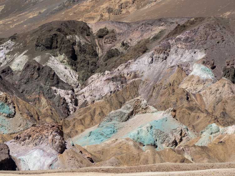
Artists Palette Drive
Distance from Furnace Creek: 14 miles
Time on site: 30 minutes to 1.5 hours
Getting to Artist Palette Drive from Dante’s View will take about an hour. This one-way, 9 mile drive will take you through an amazing geologic rainbow. You can simply do the drive and get a quick view of the eye candy. But I recommend that you can stop at the multiple pull-outs along the way.
Golden Canyon (or Sidewinder Canyon)
Distance from Furnace Creek: 3.5 miles
Time on site: 1.5-2.5 hours
Since you only have two days for Death Valley, you probably won’t have time to do both of these hikes.
The trailhead for Golden Canyon is just north of the exit for Artists Palette Drive. It’s a three mile out and back trip (or 5.3 if you add on the Gower Canyon loop, which we recommend). The hike wanders through a lovely red rock slot canyon.
The parking lot gets very full, so try to get there early. Here’s our Gower Gulch Golden Canyon hiking guide.
An alternative would be to drive 27 miles further south and do Sidewinder Canyon. The canyon is ~5 miles round trip with 800 feet of elevation gain. There are a series of slot canyons off the trail that you can explore at leisure. This is a nice hike because it’s more off the beaten path and it will be less crowed if you’re visiting on a busy Death Valley weekend trip.
Here’s our guide for the Sidewinder Canyon trail.
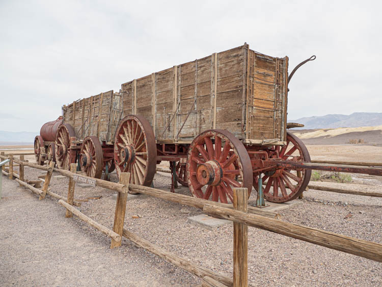
Harmony Borax Works
Distance to Furnace Creek: 2 miles
Time on site: 20 minutes
Borax is a compound used in many detergents and other household products. It’s not as sexy as gold, but during the late 1800’s it was a major part of Death Valley’s mining operations. The Harmony Borax Works offer a quick history lesson on Death Valley’s mining history. It’s located just a few minutes north of Furnace Creek.
The historic site is located just north of Furnace Creek and is easily visited later in the afternoon or on you way back to Stovepipe Wells.
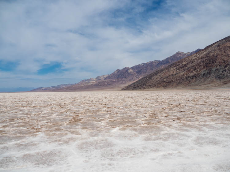
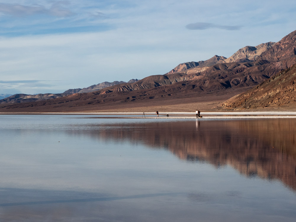
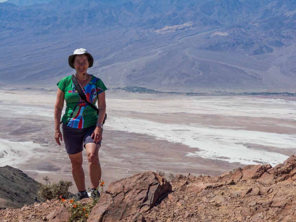
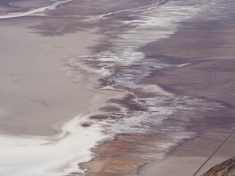
Badwater Basin at Dusk
Distance from Furnace Creek: 18 miles
Time on site: 20-45 minutes.
Badwater Basin is the vast drainage aquifer for Death Valley, covering nearly 200 square miles of daunting salt flats. It’s called “badwater” because a surveyor found that his mule wouldn’t drink the extremely salty water.
You can visit anytime of day, but the valley is particularly beautiful at dusk, when the sun is setting over Telescope Peak to the west. You never know what you’re going to get in the basin. In one of the pics above, the basin was dry-as-a-bone normal. But on my most recent trip, unusual rains had actually filled the basin with water.
If you want to be there at dusk, go early because the parking lot is small.
Death Valley Itinerary: Day 2
Day two’s activities involve a somewhat more driving than day one. The first day covered the central locations. But now we’re sending you into the more scattered reaches of the north-central part of the park. Total drive time: 4 hours.
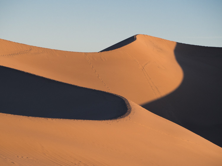
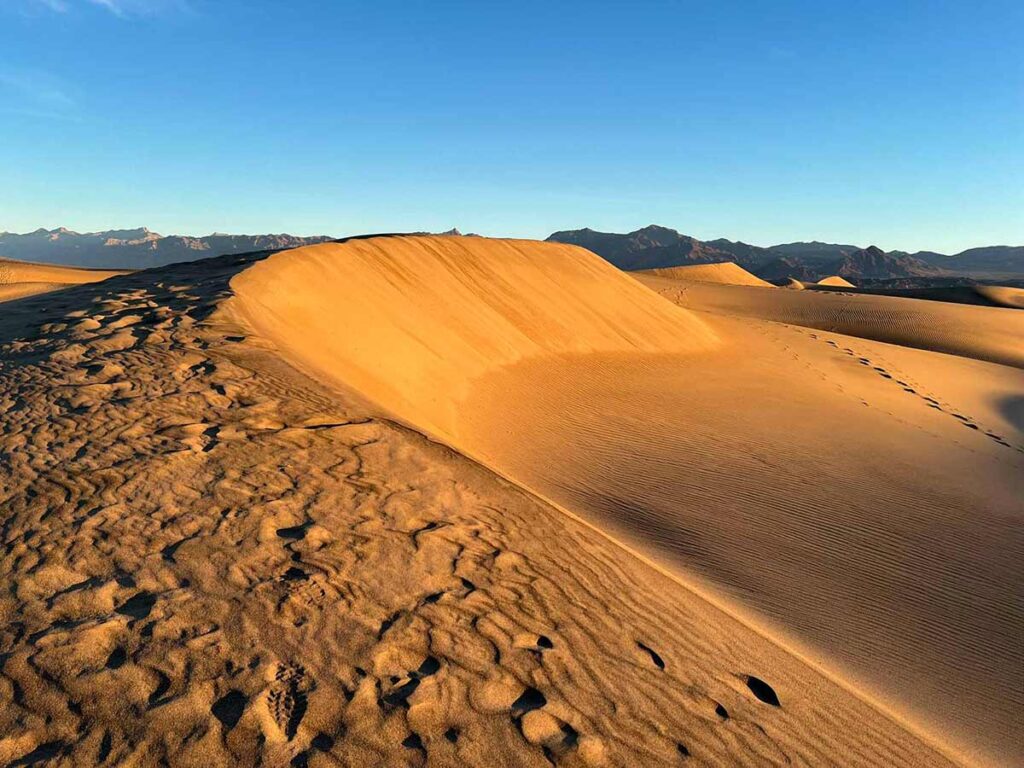
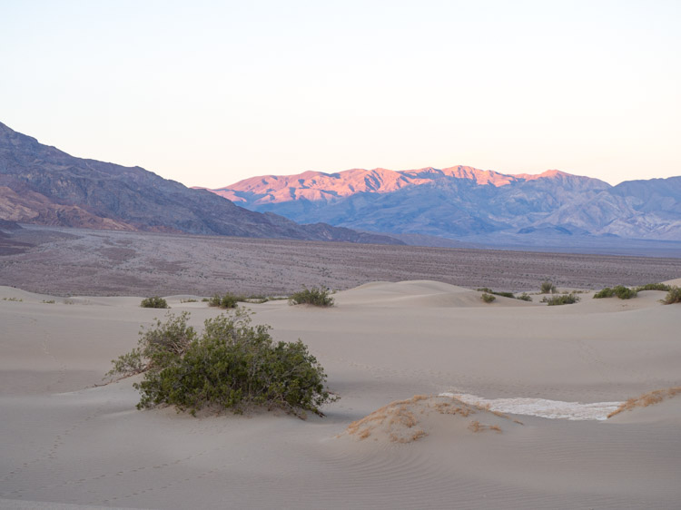
Mesquite Dunes at Dawn
Distance from Furnace Creek: 23 miles
Time on site: 30 minutes to 1.5 hours
Take a hard look at those two eye candy pics above. THIS is why it’s worth getting up at dawn in Death Valley. Well, that and because in warmer weather, the dunes get hotter than hell at midday.
These dunes in the early light are so inspiring! There isn’t really a trail. You just park and head north into the dunes and explore at random. You can climb the taller dunes to see the sun spark up the mountain range. Or you can explore the lower dunes to experience the their unique textures.
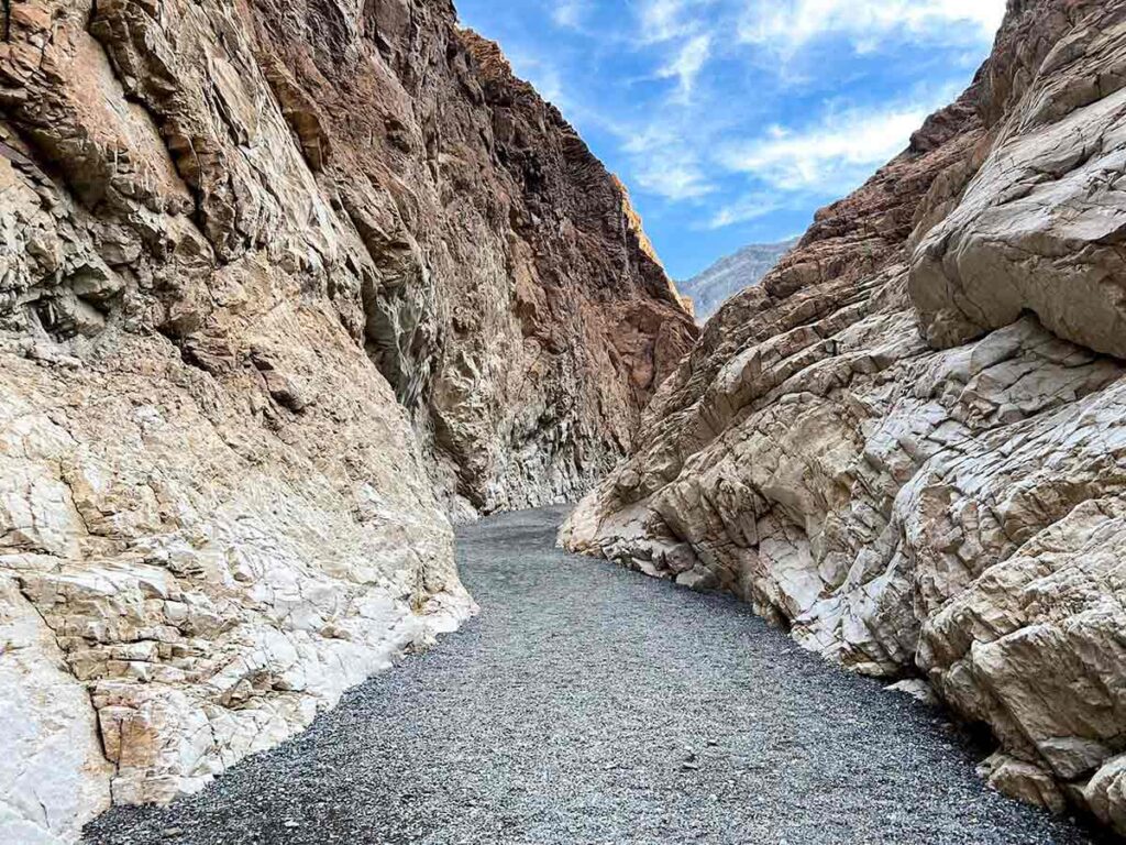
Mosaic Canyon
Distance from Furnace Creek: 27 miles
Time on site: 1-2 hours
Just five miles up the road (and just barely past Stovepipe Wells), take the short dirt road to the parking lot for Mosaic Canyon.
This 3.5 mile, 984 foot hike takes you through yet another slot canyon with quite a variety of rock textures. If you’re short on time, you can simply wander partway into the canyon and then head out for your next adventure.
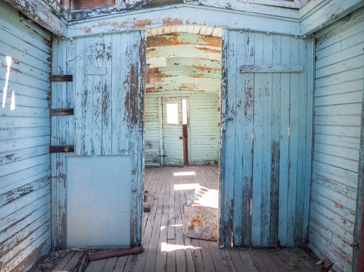
Ryolite Ghost Town
Distance from Furnace Creek: 42 miles
Time on site: 45 minutes -1 hour
Rhyolite is actually just outside of the park, over the border into Nevada. But it’s worth visiting, because the crumbling infrastructure offers a great lesson on California’s unpredictable mining history. The town went from boom to bust in just 20 short years. On site, you can poke around the building ruins, old rail cars and a cool building make of soda bottles. Here’s some history and practical info on visiting Rhyolite.
Nearby, you’ll also find the offbeat Goldwell Open Air Museum sculptures.
If you like things dusty and deserted, here’s our complete list of Death Valley ghost towns and a larger list of ghost towns throughout California.
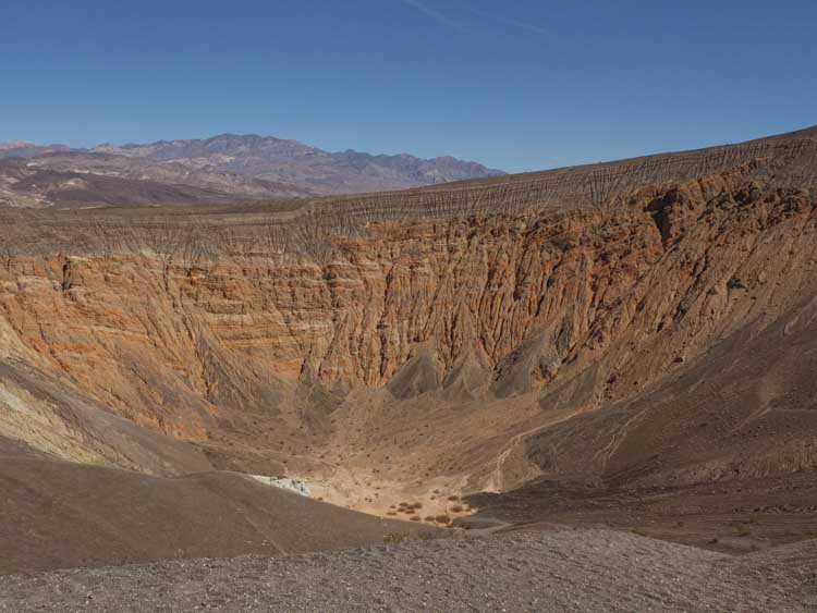
Ubehebe Crater
Distance from Furnace Creek: 56 miles
Time on site: 1 hour
Heading over to the crater will take about 1.5 hours from Ryolite. This unique formation is a 600-foot deep inverted volcano. It was was formed when gases and magma built up and then exploded all over the surrounding desert floor. The resulting geology has created layers of colorful and textured rock deposits.
While there, you can circumnavigate the 1.5 mile rim and/or walk down to the bottom of the crater.
Death Valley Trip Planning Information
Where to Stay in Death Valley
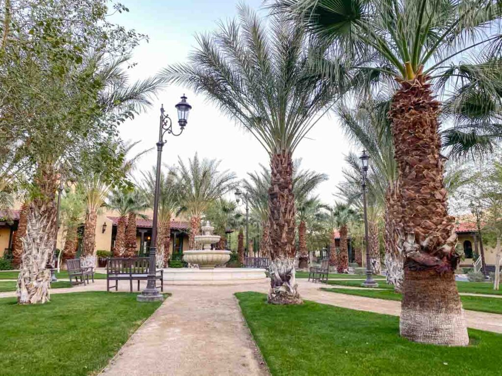
There are three hotel/motels in Death Valley. They range in quality and, frankly, none are a fabulous deal for the money. But if you aren’t camping, it’s worth staying at one of these three places because the nearest lodging outside of the park is 60 miles away. However, book early as these lodges fill up during the high season.
Staying inside the park can be pricey. So, if you are on a budget, check out our Death Valley lodging guide, which also has advice on some budget options.
- The Inn at Death Valley is a fancy historic inn, with lovely grounds and a nice restaurant. Reviews and pricing here.
- The Ranch at Death Valley is a centrally located family-friendly place in Furnace Creek. Reviews and pricing here. This is my favorite place to stay for its central location.
- The Stovepipe Wells Village Hotel is a perfectly serviceable motel. They don’t have a lot of amenities, but there is a restaurant and small store onsite. Reviews and pricing here.
If you have an RV or like roughing it, there are nine campgrounds located within Death Valley. You can use our insanely thorough guide for all of the Death Valley campgrounds to figure out your best location. It lists all of the campgrounds with costs, amenities and nearby things to do. But I would recommend one of the campgrounds near Furnace Creek for the most central access for this itinerary.
When to Visit Death Valley
The short answer is February/March for pleasant temps and (maybe) wildflowers. Mid-October through December is also very pleasant. The long answer can be found in our when to visit Death Valley article. It includes a temp and precip chart, advice on how to visit in the hotter months and more detail about less busy months.
Whatever you do, try not to go during the summer. It’s often 115′ during July and August. That sort of heat will prevent you from being able to do much of the recommended hiking and sightseeing.
Visitation Logistics
The visitor’s center in Furnace Creek is usually open daily from 8am-5pm.
There is a $30 vehicle fee for visiting the park and its good for 7 days. You can also purchase a pass in advance. If you’re are planning to visit even two other parks this year, may be worth it to get an annual national park pass.
There are restaurants of various price points in both Stovepipe Wells and Furnace Creek. All of the motel rooms have refrigerators and I advise you to take your own lunch supplies. Driving distances between the sites can be far in Death Valley and you’ll definitely want to have lunch on the road or while hiking.
You should also bring plenty of drinking water. Figure out how much you think you’ll need, then double it. One again, this is a forbidding desert landscape and you don’t want to suffer the same fate as those hapless pioneers.
Stovepipe Wells and Furnace Creek each have a gas station, general store and gift shop. But gas up at the nearest town on your way into the park.
Cell service in all of Death Valley is dreadful. Do not count on any kind of cell service to get you around or coordinate with others in your travel party. Pick up a park map at the visitors center or print one in advance from the website.
If you are flying, check out our resource for finding airports that are closest to Death Valley.
For more awesome California road trips, check out our guide for the Pacific Coast Highway and the scenic drive from San Francisco to Yosemite.
Fabulous! Love the travel planning guides and the lovely images… It’s in my bucket list for 2017!