Sure, Yosemite’s mountains are showy and California’s redwoods are towering, but Death Valley isn’t trying to be your best friend. It’s going to challenge you. The park presents a stark, sharp landscape that rewards visitors who are looking for something more edgy.
If that’s you, then read on because this guide will help you plan your Death Valley visit. I aim to be helpful, so this guide is stuffed with practical tips about the park, suggested things to do, an accommodation guide and packing ideas.
(This article contains affiliate links. This means that if you choose to purchase, I’ll make a small commission.)
You can trust me to give you accurate Death Valley travel planning tips because I actually live in California and visit Death Valley at least every other year. I encourage you to scroll the whole article. But if you have particular questions, use this handy table of contents to skip around.
- Why visit Death Valley
- Info on the Death Valley Visitors Center
- How to get to to Death Valley
- How many days do you need for Death Valley
- Top things to do in Death Valley National Park
- The best time to visit Death Valley
- Where to stay in Death Valley
- Food, gas and cell service
- Guided tours
- What to pack
Why Visit Death Valley
Death Valley is named for the doomed efforts of pioneers who, in 1849, were desperately seeking passage through the southern Sierras. This hot, dry landscape is an unforgiving place for a lost wagon train, but the pioneers persevered. After the establishment of California, Death Valley became a borax mining boom-town in the 1880’s.
In the 1920’s the Pacific Borax Company engaged in a generous act of corporate philanthropy when they lobbied the US government and local citizens to to turn their cash cow into a protected space. The area was designated a National Monument in 1933, and then a National Park in 1994.
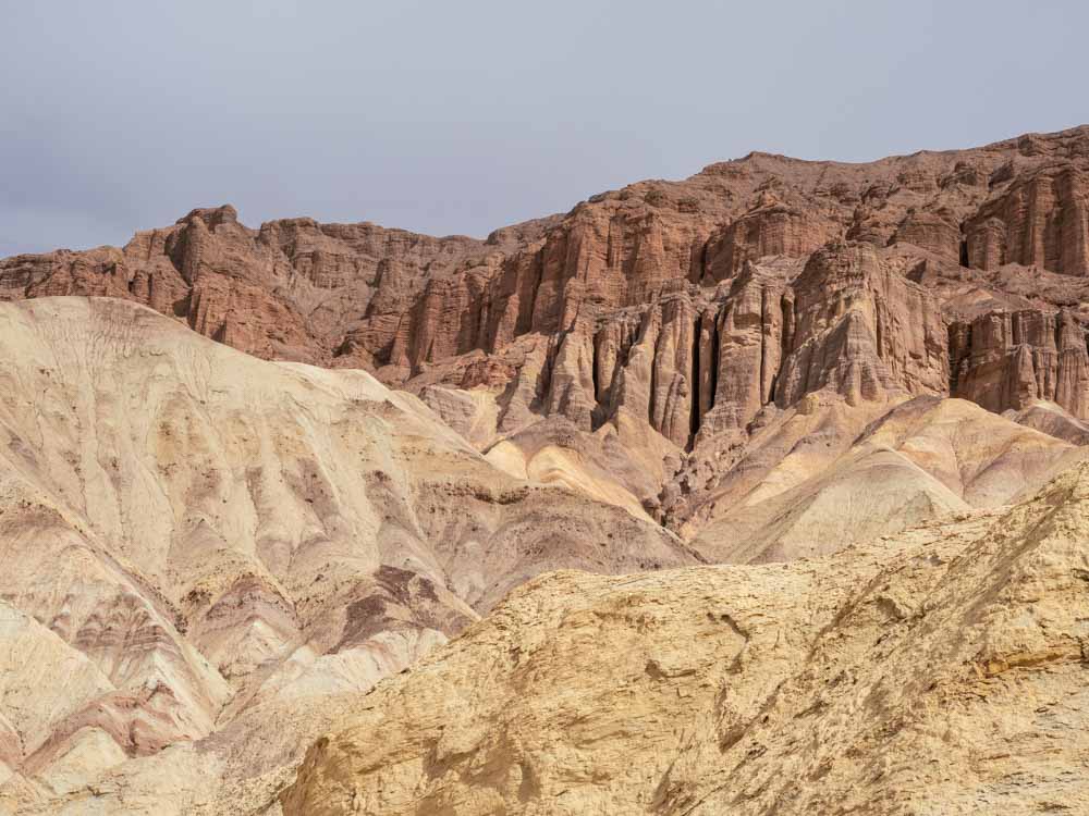
Death Valley’s topography includes a vast salt lake bed, which is the lowest spot in the US at -282 feet. In stark contrast, the lake bed is dwarfed by the 11,000 foot Telegraph Peak. There are eroding sandstone cliffs, canyons, volcanic craters and cliffs “painted” with mineral deposits.
The lonely remnants of Death Valley’s mining boom also add historical interest to the park. This forbidding landscape and hard scrabble history has a lot of stories to tell, which is why visiting Death Valley National Park is such a treat.
For more background, check out some of our fun facts about Death Valley.
Death Valley National Park Visitor Center & Fees
Death Valley actually covers 5,200 square miles of the Mohave Desert. But many of the top things to do in Death Valley are located in a centralized area near Furnace Creek, which is also where the Visitor Center is located.
At the Visitor Center you can also check in for the nearby campgrounds, get advice on how to visit the park’s attractions, get hiking suggestions (with maps), and visit the bookstore. They also have museum exhibits on the park’s history and geology. And you can sign your kids up for the Junior Ranger program.
The Furnace Creek Visitor Center is open most days from 8a-5p.
Death Valley Passes
Death Valley has 5 roads that enter the park and none of them are gated. Access into the park is open all of the time. But you do still need a pass to visit. And the only way to get a park map, is to buy the pass.
The entrance fee for Death Valley is $30 per vehicle for a 7-day pass. Motorcycles are $25 and people traveling on foot (who does that in Death Valley?) or bike (ditto!) are $15. An annual pass to Death Valley is $55.
You can also use the $80 America the Beautiful National Parks annual pass, the free Military and Veterans pass or the $80 Senior lifetime pass to access the park.
How to Get to Death Valley
How Far is Death Valley from Los Angeles?
LA to Death Valley: 271 miles, 4.75-5.25 hours.
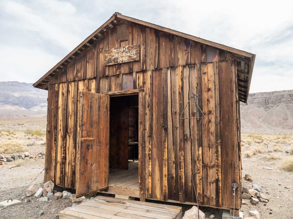
The fastest route is via Ridgecrest and the Panamint Valley. If you go that way, stop at Ballarat Ghost town on the way in.
You can take an a bit of extra time and go in via I15 through Baker and Death Valley Junction. That route allows you to detour down to Dante’s View.
You can even combine Death Valley with a road trip to Joshua Tree National Park. This is a routing that we recommend on our list of the top 20 scenic road trips in CA.
How Far is Death Valley from San Francisco?
SF to Death Valley: 502 miles, 7.5-8.5 hours.
The most reliable way is down I5 or Hwy 99 down to Tahachapi and then into the park via Ridgecrest. I prefer Highway 99 to I5 because there’s less truck traffic and you drive past some pretty orchards along the way. Check out our looping route between SF and Death Valley which has some interesting stops around Ridgecrest and the Central Valley.
The scenic way to get from San Francisco to Death Valley is west on Highway 120 through Yosemite/Tioga Pass to Highway 395. This route has amazing scenery. Make time for extra stops, or even better, add on extra days using our Highway 395 road trip itinerary.
This route requires a Yosemite entrance fee and it’s not open in the winter. The closure is usually from November to late-May, but check the Yosemite National park site for status.
How Far is Death Valley from Las Vegas?
Las Vegas to Death Valley: 111-142 miles, ~2 hours.
Las Vegas is actually the closest airport to Death Valley. There are several ways to do the routing. One takes you near Dantes View and the other comes in further north and goes past Rhyolite Ghost Town.
This guide for doing Death Valley as a day trip from Las Vegas, explains the options and offers key stops.
How Long is the Death Valley Road?
People Google this question but it’s a difficult one to answer because there are many roads in the park and none of them are called “Death Valley Road”.
That said, Highway 190 is the major northeast-to-southwest thoroughfare through Death Valley. It runs 187 miles from Olancha (south of Lone Pine) to Death Valley Junction.
Where is the Death Valley Entrance?
There is no single entrance into Death Valley, but there are three main entrances that most people use. The first is to come in from Highway 395 at Lone Pine. The second is to come up the Panamint Valley Road from Ridgecrest. The third enters west into the park from Death Valley Junction.
There are two less popular but scenic routes. There’s Highway 178 which goes north from Shoshone into Badwater Basin. The other takes the narrow high road on Immigrant Canyon Road, which goes over a 5,300 foot pass.
Is Driving in Death Valley Safe?
Yes. If you are worried about road conditions, all of the top sights listed here are accessible from paved roads. Some of the dirt roads are graded and accessible for normal passenger cars but others are only recommended for all 4×4 vehicles with clearance. The Park Service map has very clearly marked guidance on roads.
How Much Time do You Need for Death Valley?
Is one day enough for Death Valley? Not really. It’s the largest national park in the continental US and there is a LOT to do and see. That said, some of the most popular sights are centrally situated. With the help of our Death Valley day trip guide, you can see many of the highlights in one day if you don’t mind scurrying around.
Two days will allow you to visit Death Valley’s top sites with time for some longer hikes. Here’s our two-day itinerary.
And a three day Death Valley vacation will allow you to add in yet more hikes in the park.
Top Things to Do in Death Valley
There are so many cool things do to in Death Valley, it’s hard to figure out how to prioritize. We recommend doing a mix of scenic vistas, hikes and historic sites. That way, you’ll get a great sense of what the park is all about.
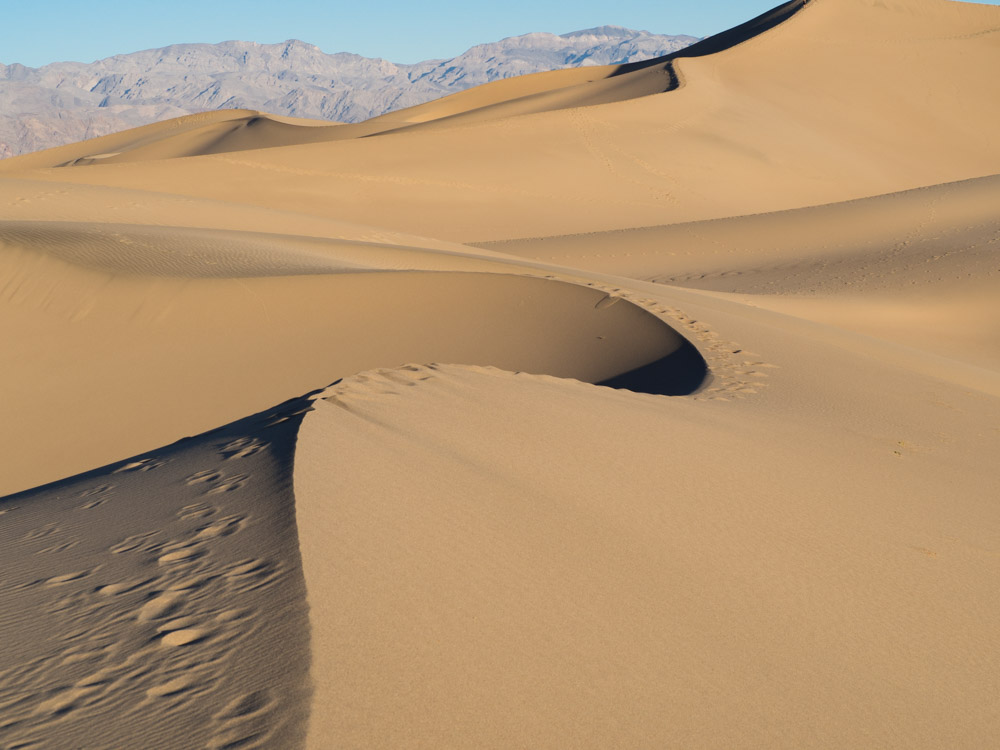
Mesquite Dunes at Dawn or Dusk
One of the best ways to get your awe inspired in Death Valley is to get up and out before dawn. The warm light against the orange sand is a beautiful wake-up call and this is a fantastic spot for an early morning photo shoot.
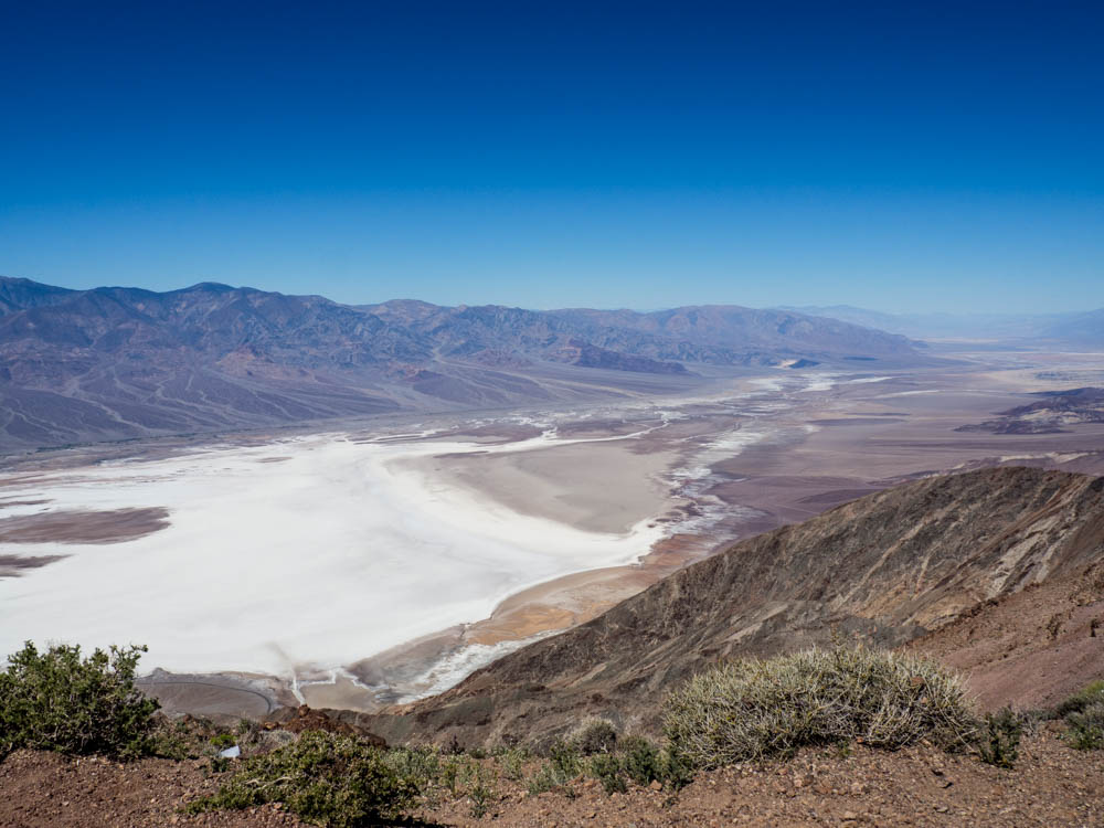
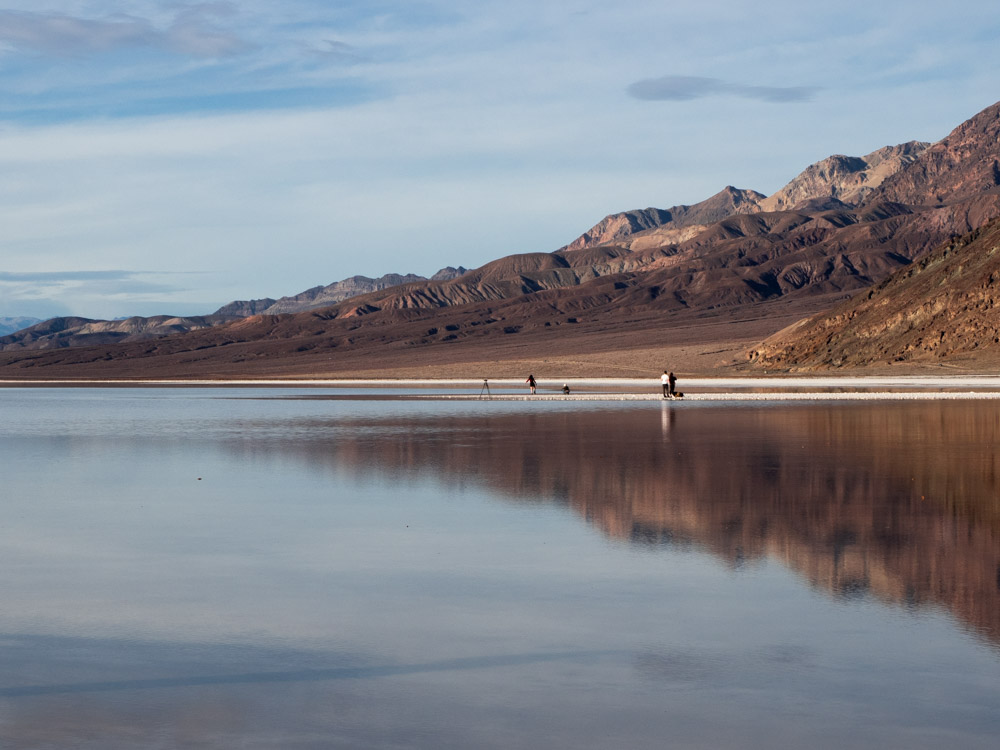
Badwater Basin
Badwater basin is the vast drainage aquifer for Death Valley, covering nearly 200 square miles of daunting salt flats. At -282 feet, it’s the lowest spot in the United States. You can visit anytime of day, but the valley is particularly beautiful at dusk, when the sun is setting over Telescope Peak to the west.
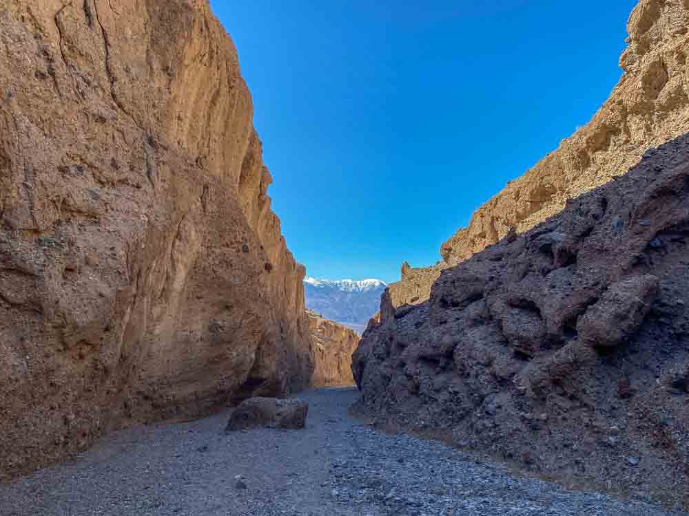
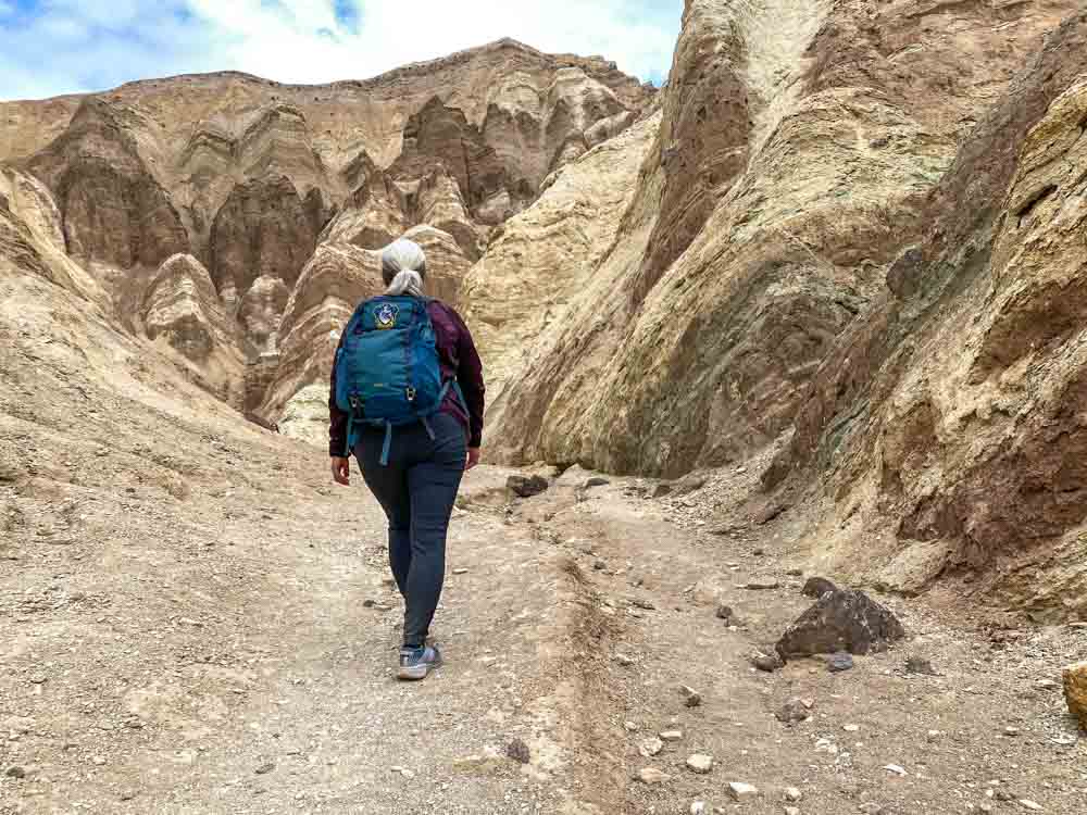
The Golden Canyon Gower Gulch Hike
The Golden Canyon trail in Death Valley is popular…and for good reason. While hiking you enter an ancient portal into Death Valley’s unique geology. You leave the flats of Badwater Basin behind and enter the canyon’s narrow runway, flanked by yellow and red rock formations and intriguing tentacles along Golden Canyon’s side shoots.
Here’s my full guide for hiking Golden Canyon and my recommended add-on for Gower Gulch.
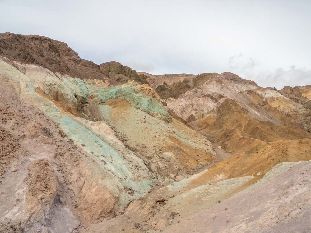
Artists Palette Drive
This scenic drive is located in the Badwater Basin, so you can add it on before or after doing the Golden Canyon hike or Badwater Basin viewpoint. The Artists Palette one-way, nine mile drive will take you through an amazing geologic rainbow.
You’ll be rewarded if you get out of the car and hike closer to these multi-hued rock formations. The second pullout has particularly good access for getting into the colorful side canyons.
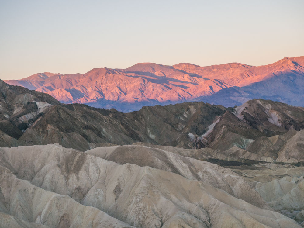
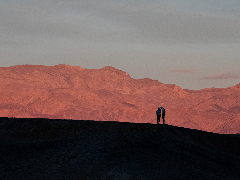
Zabriskie Point at Dawn
I don’t really like recommending “must see” sights, but I do make that exception for Zabriskie Point at dawn. The point has generous folds of sandstone in the foreground with the Panamint Mountains as a backdrop. Be sure to wait 20 minutes after sunrise because the light starts throwing shadows onto the sandstone canyon below. From there, you can head down into the canyon for the 2.7 mile Badlands Loop hike. Zabriskie Point is a short ten minute drive from Furnace Creek.
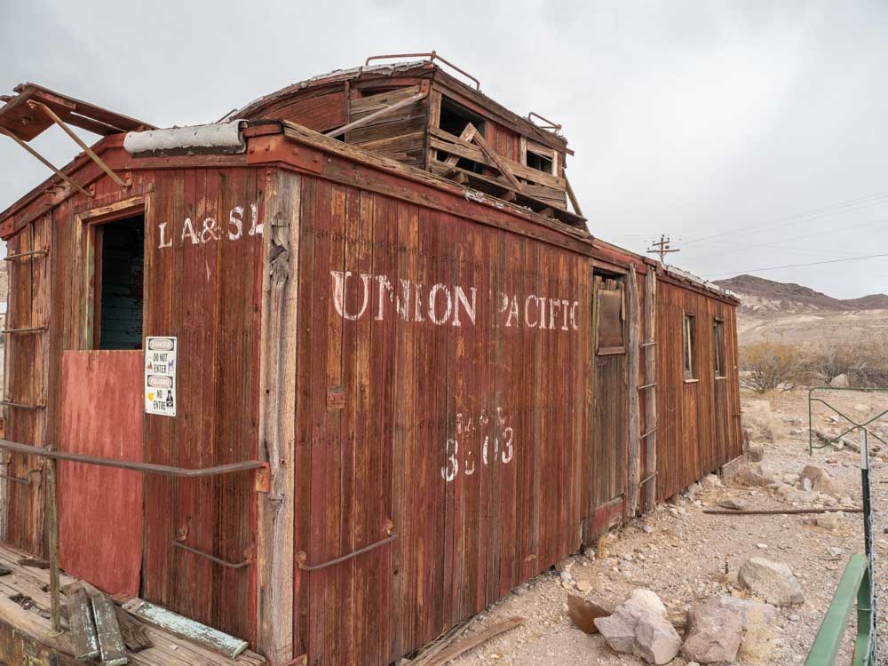
Ryolite Ghost Town
Technically, Rhyolite is just outside of the park boundary. But since mining was such an important part of Death Valley’s history, it’s worth visiting. Rhyolite’s crumbling infrastructure offers a great lesson on California’s unpredictable mining history. The town went from boom to bust in just 20 short years. On site, you can poke around the building ruins, old rail cars and a cool building make of soda bottles. You should also visit the nearby Goldwell Sculpture garden.
If you like dusty and abandoned spots, check out this guide to California ghost towns. It includes a few others that are near Death Valley.
Dante’s View
Dante’s View is 25 miles southeast of Furnace Creek. At a height of 5,400 feet, you’ll get wide angle panoramic views of the Badwater Basin and the Panamint mountain range.
The other cool thing about Dante’s View is that it’s the same view that Luke, Obi Wan, C3PO and R2D2 had when they were headed into Mos Eisley. And if you are a Star Wars nerd, the Twenty Mule Team Drive, Golden Canyon, Desolation Canyon, Mesquite Dunes and Artist’s Drive were also filming locations.
May the force be with you.
If You Have Extra Time
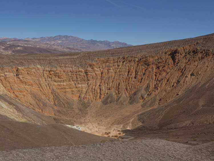
Ubehebe Crater
The Ubehebe Crater is 58 miles north of Furnace Creek. Death Valley visitors who are in a hurry quite often don’t make the time for it, but I found the crater fascinating. This unique formation is a 600 foot deep inverted volcano. It was formed when gases and magma built up and then exploded all over the surrounding desert floor. The resulting geology has created layers of colorful and textured rock deposits. While there, you can circumnavigate the 1.5 mile rim and/or walk down to the bottom of the crater.
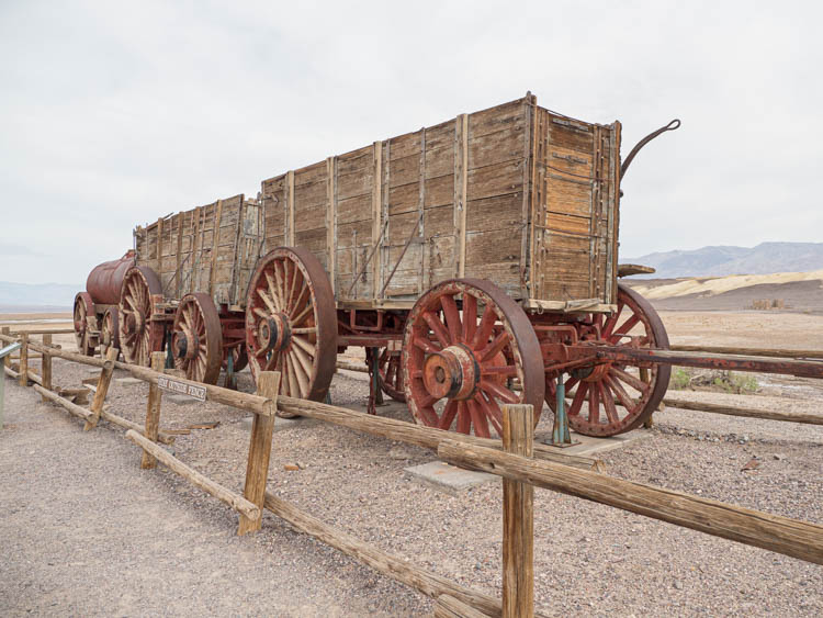
Harmony Borax Works
Borax is a compound used in many detergents and other household products. It’s not as sexy as gold, but during the late 1800’s it was a major part of Death Valley’s mining operations. The Harmony Borax Works offer a quick history lesson on Death Valley’s mining history. It’s located just a few minutes north of Furnace Creek.
20 Mule Team Road
This 2.5 mile one way dirt road takes a drive into the landscape below Zabriskie Point. The short drive takes you through an eroded spare landscape and there is a short .3 mile hike to a nearby overlook.
Sidewinder Canyon Hike
This hike isn’t as popular as Golden Canyon, but it’s quite rewarding for the patient hiker. It’s billed as a 4 mile out and back hike, and the attraction is exploring the four slot canyons that branch off of the main route. Here’s my Sidewinder Canyon hiking guide.
Mosaic Canyon
This 3.5 mile hike takes you through yet another slot canyon with quite a variety of rock textures. If you’re short on time, you can simply wander partway into the canyon and then head out for your next adventure.
Natural Bridge
This 2 mile out and back will take you to a lovely red rock arch. It’s located in Badwater Basin.
The Best Time to Visit Death Valley National Park
The short answer is February/March for pleasant temps and (maybe) wildflowers. Mid-October through December is also very pleasant. The long answer can be found in our when to visit Death Valley article. It includes a temp and precip chart, advice on how to visit in the hotter months and more detail about less busy months.
Where to Stay on Your Death Valley Trip
There are 12 private and public campgrounds in Death Valley, dispersed across the 5,200 square miles of the National Park. Use our guide to all Death Valley campgrounds and find the right option for you. Hint: I prefer one of the campgrounds near the Furnace Creek visitor center for the central location.
If you prefer a hotel stay, there are three located within the park. They range in quality and, frankly, none are a fabulous deal for the money. But if you aren’t camping, it’s worth staying at one of these three places because the nearest lodging outside of the park is 60 miles away. However, book early because during high season, these lodgings fill up fast.
Our Death Valley hotel guide also offers some practical and budget-friendly places to stay outside of the park.
- The Inn at Death Valley is a fancy historic inn, with lovely grounds and a nice restaurant. Reviews and pricing here.
- The Ranch at Death Valley is a centrally located family-friendly place in Furnace Creek. Reviews and pricing here. This is my favorite place to stay for its central location.
- The Stovepipe Wells Village Hotel is a perfectly serviceable motel. They don’t have a lot of amenities, but there is a restaurant and small store onsite. Reviews and pricing here.
Can you rent a cabin or Airbnb in Death Valley?
There are no cabins for rent in the park. And the closest Airbnbs to central Death Valley are in Pahrump, which is an hour from Furnace Creek. There are also a few listings in Shoshone, Beatty, Lone Pine and yet more in Ridgecrest.
Death Valley Travel Tips: Food, Gas & Cell Service
Is There Cell Service in Death Valley?
You’ll be tempted with a bar or two, but don’t expect much. And forget about it on the more remote areas of the park or while hiking in slot canyons.
So, cache or print this guide in advance of visiting. Use offline Google maps, Alltrails maps and pick-up paper maps and visitor guides in Furnace Creek (or print them in advance).
Where to Get Gas in Death Valley
There are three places within the park boundary to get gas: Panamint Springs (on the west side), Stovepipe Wells Village (north/central) and Furnace Creek (next to the Visitor’s Center). Keep your tank topped up, because they sometimes run out of gas. In addition, Furnace Creek is the only gas station in the park that sells diesel and premium fuels.
There are also gas stations in the towns along the major gateway roads into the park.
Where to Get Groceries in Death Valley
There is no proper grocery store in Death Valley. You can get snacks, treats and light grocery items like sandwich makings at the Panamint Springs store, Stovepipe Village and the Ranch at Furnace Creek.
Where to Eat in Death Valley
The Inn at Death Valley is the fancy hotel in the park. Their main restaurant has breakfast, lunch and dinner. Their dinner offerings are quite good and reservations are recommended. They also have a poolside cafe with sandwiches, wraps and the like.
The Ranch at Furnace Creek has The Ranch restaurant which offers breakfast and dinner. They also have the Last Kind Words Saloon which has a lovely wood bar and serves drinks, steaks, salads and burgers. The Coffee & Cream is open from 1-7p and has casual food, pizza, sandwiches and ice cream. The 19th Hole has burgers and a full bar (but it closes at 6pm).
Stovepipe Wells Village has the Toll Road which offers a breakfast buffet and a dinner menu. You can also eat in their Badwater Saloon.
I’ve eaten at all of these concession venues and can say that they’re fine but overpriced for the value. You’re a captive audience in Death Valley. So if you are on a budget, bring a cooler and pack as much of your own food as you can.
Death Valley Guided Tours
The National Park sometimes runs guided ranger tours or talks for Golden Canyon, Mesquite Dunes, Badwater and Harmony Borax Works. Check their calendar to see if anything is scheduled for your Death Valley visit.
If you are staying in Las Vegas, you can book onto one of several different Death Valley guided day tours. All of them are approximately 10 hours and will pick-up from Las Vegas hotels and Airbnbs. They are all ~$250 per person for the full day, which includes a guide, national park fee, lunch, snacks and water.
The tours differ by which stops they make and whether or not you can customize your options. Check out these four choices and click on the link to get more info, read reviews and book.
- The Death Valley Day Trip from Las Vegas: This is a basic “best-of” tour. It adds a stop for the Devil’s Golf Course and doesn’t go to Dante’s View.
- Small-Group Death Valley National Park Day Trip from Las Vegas: This tour does stop at Dante’s Peak and Pahrump, but it doesn’t go to the Mesquite Dunes.
Explore More California National Parks
- If you are also got an equally thorough guide for visiting Joshua Tree National Park.
- Here’s a guide for visiting Yosemite in the winter, how to road trip it from San Francisco, and what to pack (whatever the season).
- North Coast Redwoods road trip with 9 stops, including Redwoods National Park.
- Our complete list of ALL California national parks (with map). And we have a similar one for all California State Parks too.
- Exploring national park sites in San Francisco’s Presidio.
I never considered Death Valley a worthy destination, but you’ve changed my mind. I truly love your writing style- thanks so much for sharing all the great tips!