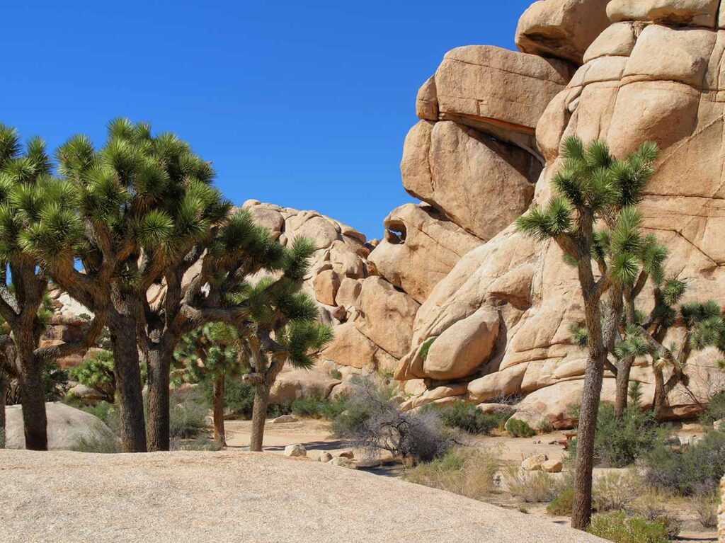
Joshua Tree National Park has a lot of hiking trails, which very widely in difficulty, distance and visual interest. This baker’s dozen features what I think are the best hikes in Joshua Tree, running the gamut from easy nature trails, longer hikes with epic landscapes and even trails that explore the park’s mining history.
So, pick your interest (and your distance), and get hiking in Joshua Tree when you next visit the park.
(This article contains affiliate links. This means that if you choose to purchase, I’ll make a small commission.)
This article has four sections, each of them worth spending some time reading. First, I have a full FAQ with tips for hiking in Joshua Tree. Then there is a section of easier hikes, which are under two miles. There’s a map for these hikes and each has a description and tips on how to do it. There is another section (with map) of harder hikes, all of them over 2 miles.
And at the bottom, there are some general tips for planning a trip to Joshua Tree, which includes some of my favorite accommodations.
Tips for Hiking in Joshua Tree National Park
How Do I Need a Joshua Tree Trail Map?
The Park Service has a slick 4 color brochure map, which shows most hikes and all campgrounds and picnic sites. But at key sites, you’ll also see a larger map at some of the info kiosks. These sometimes have more detail regarding the trails. So if you see one, take a picture of it. Here is their map page
We recommend that you stop into the Visitor’s Center to get the most updated information.
You can also save the maps we’ve provided below or use AllTrails to cache the maps offline.
Can I Use Google Maps or AllTrails in the Park?
Yes…BUT…cell coverage is non-existent in the park. So, don’t count on mapping your hike on the fly. Be sure to download and cache anything you need before you leave town.
Can I Take a Dog Hiking in Joshua Tree?
No. Dogs are not allowed on any trails in the park. They are confined to parking lots and campground and anything paved
Which Joshua Tree Entrance is Best?
The northwestern entrance is best for visiting some of the core park sites and many of the shorter hikes. It also has the larger of the Visitor Centers. But you can certainly use the southern entrance or the one that goes south of Twentynine Palms, just get your trail map in advance.
What is the Best Time of Year to Hike Joshua Tree?
October to May is the best time to visit generally and certainly for these hikes in Joshua Tree. I like March for the pleasant weather and chance of seeing blooming cacti. The summer temperatures are volcanic and the park has little shade, so the Parks Service doesn’t recommend extended hiking during that time.
For more detail, check our article on when to visit Joshua Tree, which includes a temp chart and seasonal information.
3 Safety Tips for Hiking
- The park is sunny…with very very little shade. So bring it with you in the form of a hat or hiking umbrella.
- The park is hot…even in the fall and spring. This becomes a big deal on the longer, harder hikes. Plan to get out early, or hike later in the day.
- The park is dry…all the time. Bring twice as much water as you think you may need.
Are There Stores or Restaurants Inside the Park?
No. There are no concessions in the park. Some of the campgrounds have water, but not all of them. So, plan to pack in all of the water, food and sunscreen that you’ll need for your hike.
Do I need Hiking Shoes for Joshua Tree?
I love hiking in sport sandals, but don’t recommend them for any of these hikes as the terrain is pretty spikey! For the easy Joshua Tree hikes and nature trails, you can get away with tennis shoes.
But for any hike longer than 2 miles or that has elevation gain, you should wear at least a trail runner for better grip. If you are doing higher elevation hikes, hiking poles are also a good options.
When Does Joshua Tree Open?
The park gates are always open. This means that you can get an early start for hitting the Joshua Tree Trails.
The 13 Best Hikes in Joshua Tree
These hikes are listed in order of length and difficulty. So, you can mix a harder hike with an easier one in order to see the most of Joshua Tree’s amazing landscape.
Map for hikes under 2 miles:
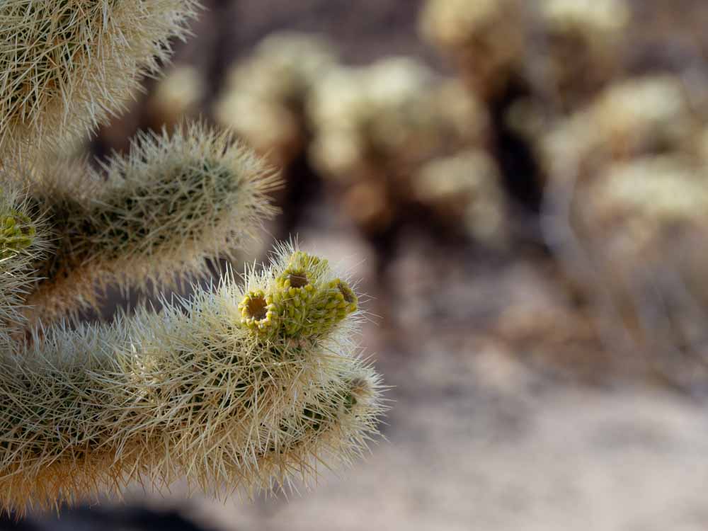
1. Cholla Cactus Nature Trail
Distance: .2 miles
Elevation Gain: 9 feet
Difficulty: Easy
Look, you aren’t going to burn a ton of calories on this short nature trail, but it’s worth doing, especially if you are coming or going from the southern entrance to the park.
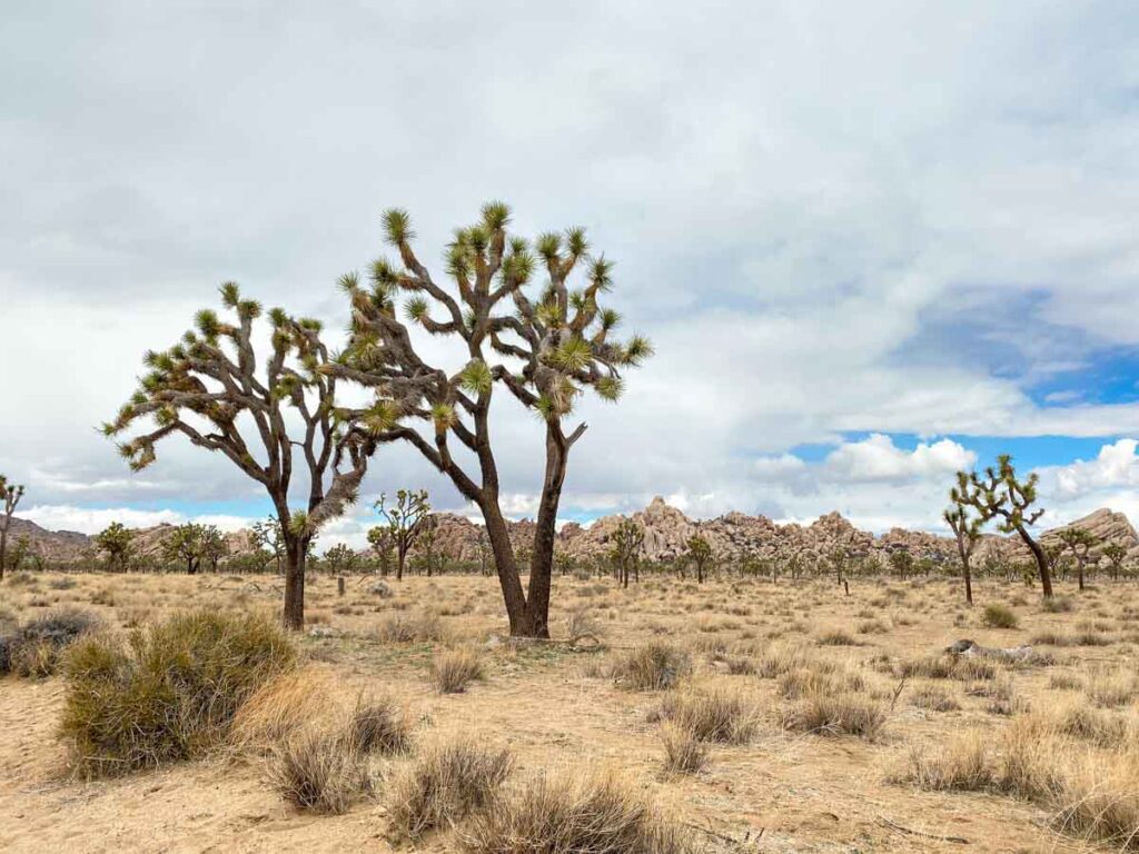
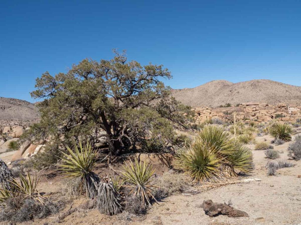
Joshua Tree is actually comprised of two different deserts: the Mohave Desert (in the north and also part of Death Valley), and the Sonoran Desert (in the southern part of the park). These cacti are endemic to the Sonoran part of the park.
The nature trail takes a short lap around a large cluster of the cacti and the whole experience is otherworldly. Also keep an eye out for the Ocotillo cacti. And if you are visiting in early spring, you may get lucky and see both types in bloom.
There is plenty of parking in the lot and along the nearby road. And the area is really pretty at sunset and after the stars come out.
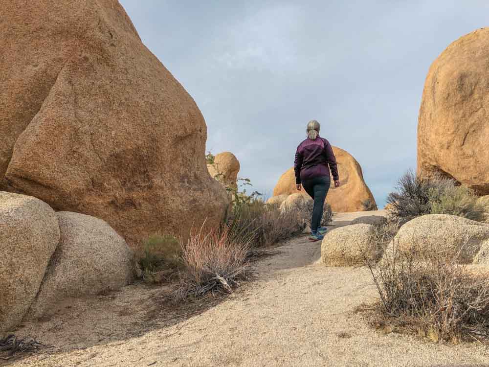
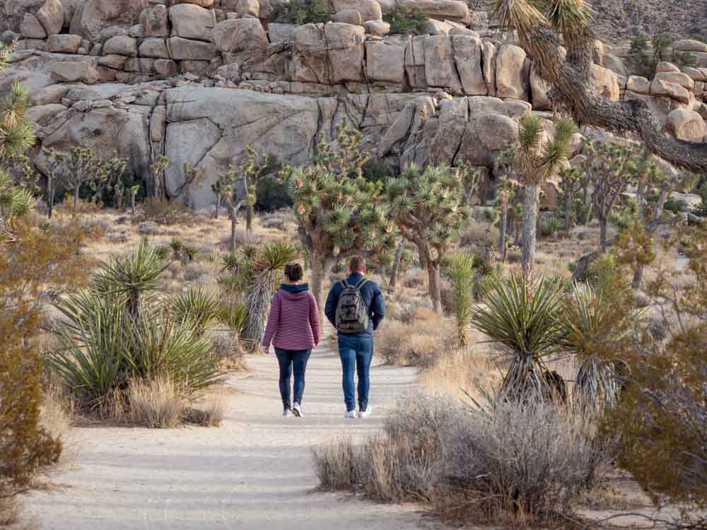
2. Hidden Valley
Distance: 1 mile loop
Elevation Gain: 114 feet
Difficulty: Easy
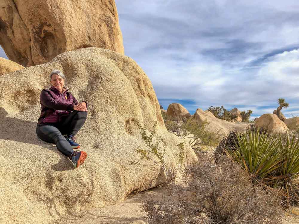
The Hidden Valley trail is a great little walk for newbies and families with smaller kids. The trail takes a fairly easy loop around some of Joshua Tree’s most enormous stacked boulders. In fact, at the Hidden Valley campground across the road, you can often spot people rock climbing the taller formations.
The trail has a lot of explanatory signs, which make for a helpful intro to the park. It also has a fairly large parking lot and some picnic tables. Although, those same picnic tables mean that the trail is particularly busy at lunchtime, so try to go at a different time of day.
And if it is crowded, take the trail in the counter-clockwise routing.
3. Minerva Hoyt Trail
Distance: 1.2 mile one way
Elevation Gain: negligible
Difficulty: Easy
This easy off-the-radar hike is right in the heart of the park and you can easily combine it with the Hidden Valley loop for something longer. It’s not noted on the All-Trails app, nor is it listed on the National Park website, but you will see the parking lot on the map. It’s right off park boulevard, just south of the more crowded Hidden Valley parking lot. The hike is named for Minerva Hoyt, who was an avid naturalist. She advocated hard for the establishment of the national park.
I like this hike for the flat terrain that meanders through the namesake Joshua Trees. Walking it south to north in the late afternoon light is quite lovely and because so few people think to walk here, you’ll have the place to yourselves.
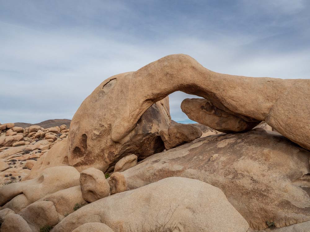
4. Arch Rock
Distance: 1.2 miles
Elevation Gain: 88 feet
Difficulty: Easy
The Arch Rock loop is one of the hikes which is not well marked on the glossy brochure.
The landscape on this nature trail is a bit more reminiscent of southern Utah with its red rocks and graceful arch. The trail starts out pretty flat, but once it reaches the rocks, there is plenty of opportunity to scrambling around and doing some 101-level bouldering.
The trail is very easy and a great option for families with smaller kids. And you can add on another .5 mile by heading east toward heart rock.
To get to the trailhead, park at the Twin Tanks parking lot and then follow the signs across the road. Then, take an immediate right (which isn’t well marked) and head toward the rock cluster.
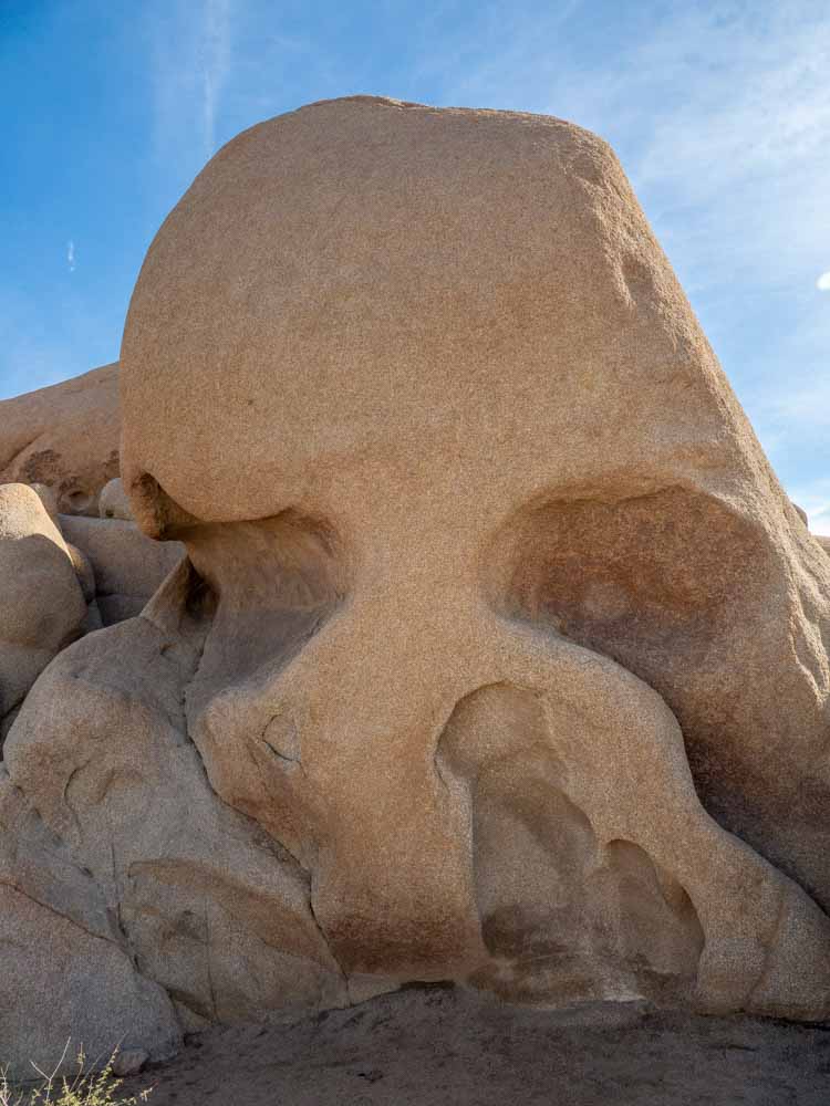
5. Skull Rock
Distance: 1.7 miles
Elevation Gain: 160 feet
Difficulty: Easy
The Skull Rock is one of the creepiest features in the park and it’s worth a visit. You can see the skull from the road, so even if you don’t do this trail, be sure to stop for a picture.
Or better yet, do the 1.7 mile trail which, in addition to Skeletor, includes a ton of other rock clusters and funky geology. This hike is really fun for curious kids
There is limited parking at Jumbo Rocks campground and more along the road. You can even park once and do three hikes. Add to Skull Rock by doing the Discovery Nature Trail (.7 miles) and/or Split Rock (2.4 miles)
One thing to note is that folks like to go off-trail and wander around this area. This means that the official trail can be hard to follow, so keep your eyes open for the trail. And also keep an eye our for the jackrabbits, coyotes and snakes that inhabit the area. The last time I was in the area, a coyote was just wandering down the road like it owned the joint…which of course it does!
6. Barker Dam
Distance: 1.3 miles
Elevation Gain: 62 feet
Difficulty: Easy
Barker Dam is one of the best hikes in Joshua Tree because it’s easy and very family friendly. The hike is notable because not only do you see the lovely desert landscape, but you can also learn about Joshua Tree’s mining history.
During the late 1800’s and early 1900’s, cattle ranching was an important part of the the region’s economic activity. The dam was built to provide year-round water for the cattle. Today, you may or may not see water behind the dam, but when it’s there, it attracts the local wildlife.
There is a 1.3 mile interpretive loop that has nature markers. Be sure to take the small spur, which leads to to Native American cave paintings.
Barker Dam and nearby Wall Street Mill are among the top hikes in the park. This means that parking can be a challenge, particularly during the middle of the day. So, go early or late to avoid the crowds.
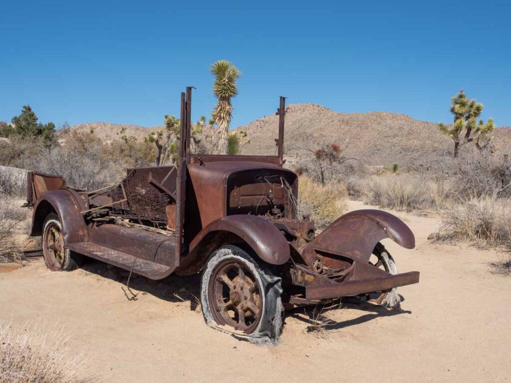
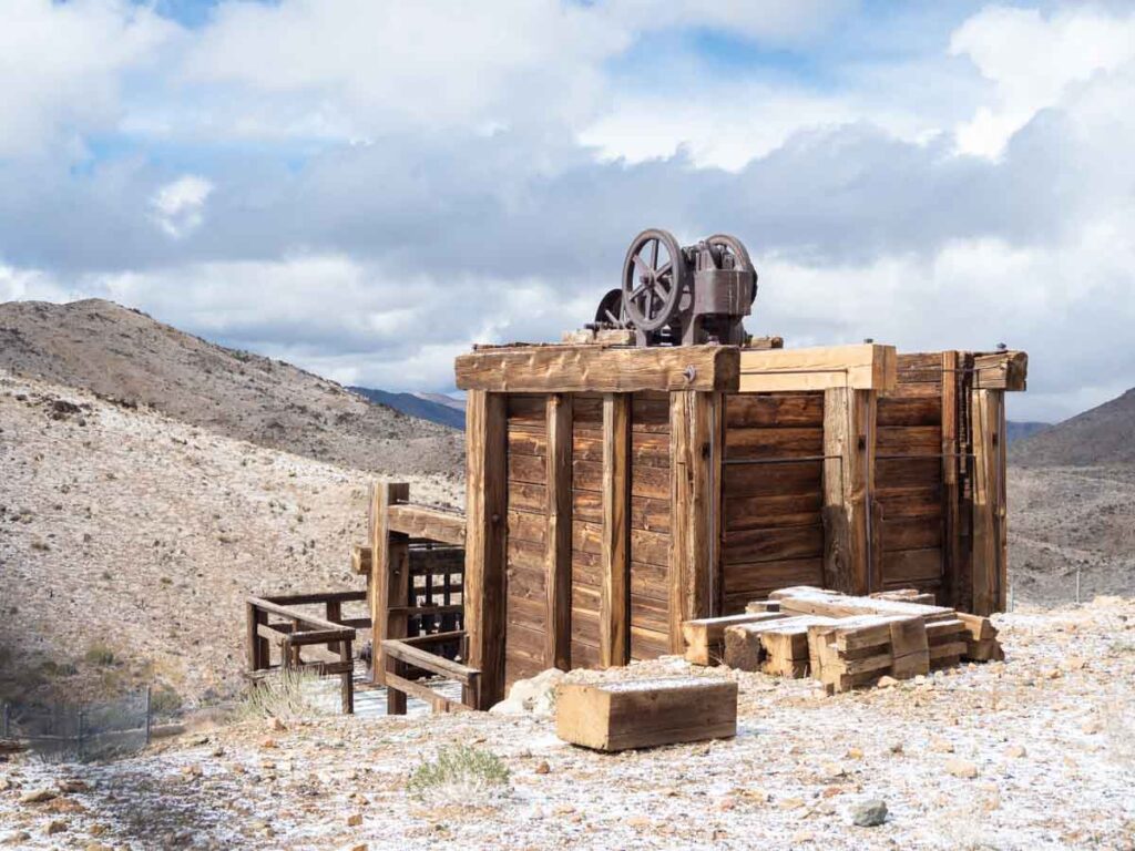
7. Wall Street Mill
Distance: 2.4 miles
Elevation Gain: 88 feet
Difficulty: Easy
If you like rusty relics and abandoned buildings, then this is the hike for you. In addition to the vast landscape, this section of the park was home to a lot of mining activity. The easy, sandy trail it littered with the rusting remains of cars, mining equipment and the Wall Street mine itself.
Bill Keys worked the mine and developed some proprietary methods for crushing the ore. The explanatory signs along the trail provide some of the backstory on Keys and the mine.
Like Barker Dam, this hike is very popular and parking can get crowded.
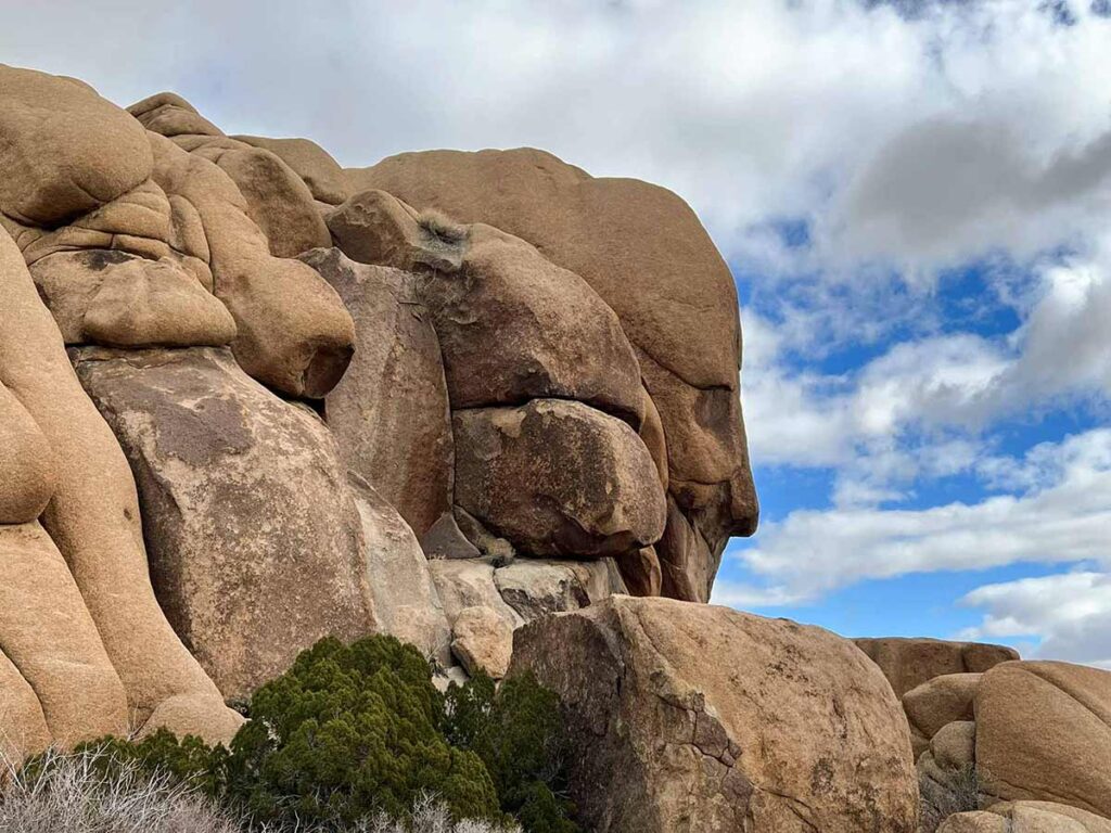
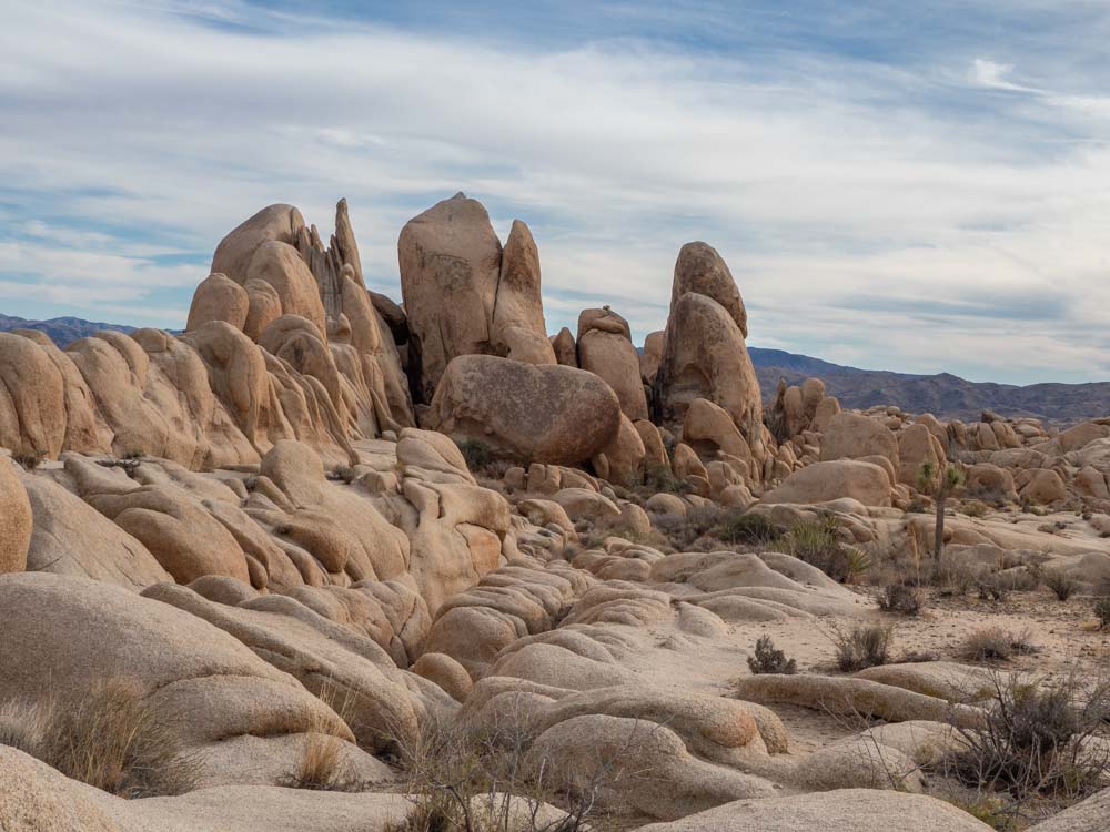
8. Face Rock/Split Rock Loop
Distance: 3.1 miles
Elevation Gain: 275 feet
Difficulty: Moderate
I love this lovely loop trail and it really highlights the cool geology in the park. This includes Face Rock, which looks like an actual fact from the right angle, and Split Rock, which looks like how it sounds. And in between the two, you meander through the rocks, down an arroyo and through the landscape. Keep your eyes peeled because the last time I was on this trail, I saw a desert tortoise.
There are two ways to access the loop. You can park across from Skull Rock, take the Discovery Trail and follow signs to Face Rock, then get on the loop there. Or you can park at the Split Rock parking lot (which is off the main road) and access the loop from there.
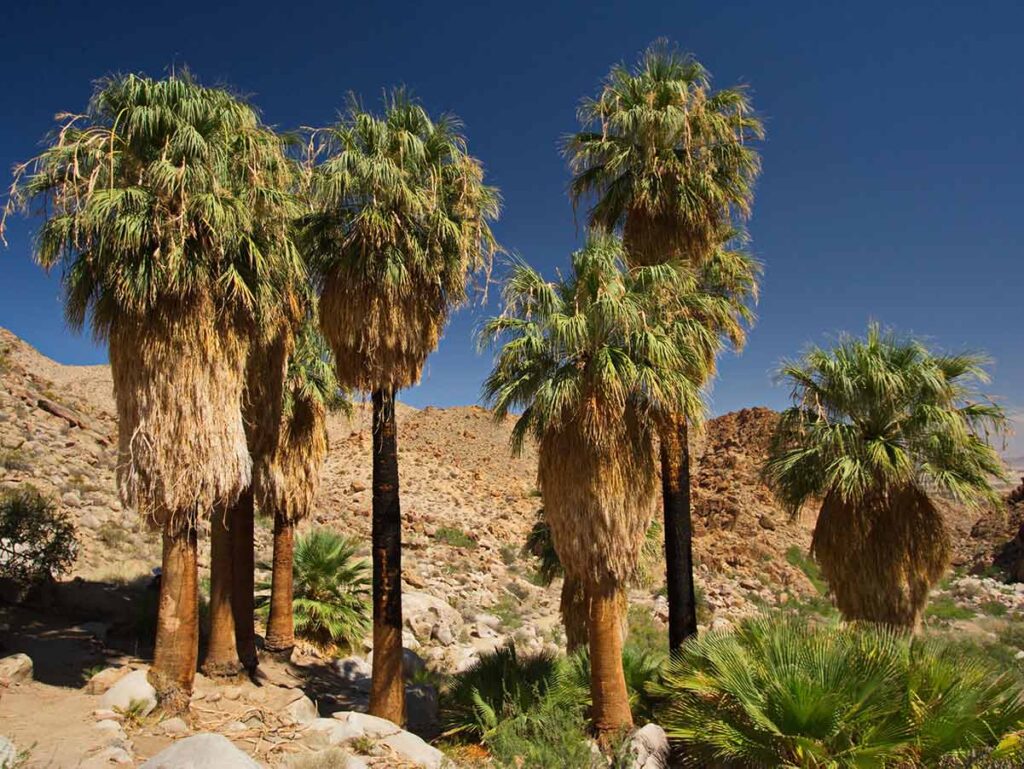
9. Fortynine Palms Oasis
Distance: 3.1 miles
Elevation Gain: 636 feet
Difficulty: Moderate
Are there actually 49 palm trees at this oasis? Hmmm, hard to say. But it is true that during the 1900’s miners planted the trees there to mark the watering hole.
One thing I like about this trail is that it’s accessible from the north part of the park near Twentynine Palms, allowing you to avoid the crowds and parking clusters that happens in the heart of the park. That said, the parking lot is small.
The trail itself isn’t very long, but it’s rated moderately challenging because you have to climb up the ridge, before descending down into the valley which houses the oasis. Take care to mind your feed on the rock “stairs” during the ascent and descent. Hiking poles are a good idea for this trail.
If you are lucky, you may even be able to spots a desert tortoise or some Chuckwalla and Desert Collared Lizards. And if you are extra extra lucky, maybe even some bighorn sheep.
10. Desert Queen Mine and Eagle Cliff Boulder House
Distance: 3.4 miles
Elevation Gain: 580 feet
Difficulty: Moderate
The Desert Queen Mine had a long history. It was in operation from 1895-1961 and was one of the most productive in Joshua Tree. The mine consists of a series of tunnels and shafts, and while the shafts are closed for safety, visiting the site is remarkably hands-on with the Boulder House ruin and old equipment laying around.
The hike itself skirts along the edge of the canyon wall and part of it is a loop. Doing the loop to the mine is easy enough, but if you want to visit the Boulder House ruin, be sure to download the map coordinates onto your phone’s hiking app as the trail is not well marked.
The trailhead sits on the Desert Queen Mine dirt road. This is actually a lovely, well graded dirt road that makes a great scenic short-cut between the Skull Rock and Barker Dam hikes noted above.
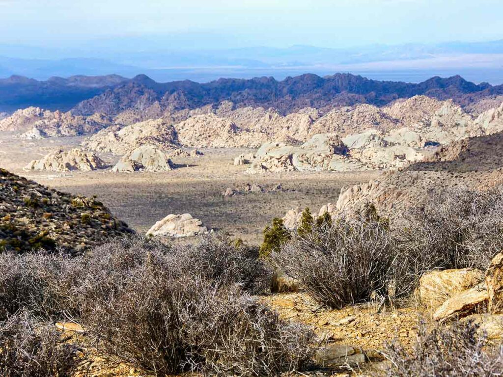
11. Ryan Mountain
Distance: 3 miles
Elevation Gain: 1,069 feet
Difficulty: Moderate-to-Strenuous
Ryan Mountain is one of the more popular Joshua Tree hiking trails. It’s a 3 mile out and back with 1,069 of elevation gain. The gain was worth it for me if only for the 360′ views that I got from the top.
To the south you get Palm Desert. To the west you can see Mount San Jacinto and Mount San Gorgonio mountains. And to the north you get vast views of Joshua Tree’s very particular landscape.
Ryan mountain makes for a great sunrise hike because you’ll be in the shade during the steep uphill segment. Sunset also brings great views, but bring a headlamp. And layers, because it gets windy up there!
The parking area is right off the road between the Ryan and Big Sheep campgrounds.
12. Pine City Trail
Distance: 4 miles
Elevation Gain: 147 feet
Difficulty: Moderate
This is another off-the-radar hike that doesn’t get a ton of traffic. So, it’s great if you are visiting on a busy weekend. That said, the parking lot also serves the Queen Valley mine trail and overlook, so parking can get tight. But once on the trail, you’ll have plenty of elbow room.
I did the hike to explore the pine trees that are clustered toward the interior of the hike. Pine trees are very rare in Joshua Tree, especially as the mid elevations. If you are doing the hike in the spring, you’re also likely to see flowering cacti.
13. Lost Horse Mine Loop
Distance: 6.8 miles
Elevation Gain: 882 feet
Difficulty: Moderate-to-Strenuous
This may be my favorite Joshua Tree trail and the last time I did it, it snowed on me!
You can actually do this trail as an easier 4 mile out-and-back that just goes to the mine, or you can do the full loop.
During its heyday from 1895-1905, this mine produced an astonishing amount of precious metal, netting 10,000 ounces of gold and 16,000 ounces of silver. So, hiking this loop will give you a big dose of Joshua Tree’s mining history in addition to the lovely natural landscape views.
Hiking the trail, counterclockwise, takes you through a wash of yucca and Joshua Tree. You soon hit a saddle with high level views over the valley floor. You then come along the mining ruins and follow the trail out on the old mining road.
The trailhead is accessed from the Keys View road and you have to travel for a short while on a dirt road, which is graded and accessible for most normal cars.
Plan Your Trip to Joshua Tree
In addition to the Joshua Tree hiking trails, there are a lot of other cool things to do in in and around the park. Here are a few suggestions for you.
- Be sure to leave some time for sightseeing in the nearby town of Joshua Tree. It has a very artsy culture and you can explore cool sculpture gardens, an old wild west film set, UFO sightings and even a strange POW cabin from an alternative dimension. Here’s the guide for Joshua Tree town.
- Plan your whole trip using our Joshua Tree travel guide.
- Explore beyond the hikes with a visit to Key’s Ranch, do sunset at Key’s View and see other natural sights using our Joshua Tree day trip guide.
- Learn more about the landscape with these fun facts about Joshua Tree— like how the Joshua Tree isn’t really a tree, how it got such a biblical name and who murdered who (and got away with it).
- If you are planning to fly, use this guide to figure out which airport is the most convenient for Joshua Tree.
- Add to your itinerary with this road trip from Joshua Tree to Death Valley.
Where to Stay in Joshua Tree
Hiking is an energetic business and you’ll want to make sure that you get a good night sleep for it. If you are camping, be sure to reserve sites well in advance because the park is popular and sites are limited. Use our Joshua Tree campground guide to find the perfect spot.
If you want to get an early start on your hikes, we recommend staying near the park’s northwestern entrance in the towns of Joshua Tree or Twentynine Palms.
Nearby 29 Palms and Joshua Tree have a range of accommodation from inexpensive motels to nice lodges. Options include the kitchy Pioneertown Motel, cheap and cheerful High Desert Motel, basic chain hotel Spark by Hilton, high design with Mohave Sands, or self-catering cabin rentals.
We hope that you’ve been inspired by this list of the 10 best Joshua Tree hikes. Enjoy your outing and happy trails!
Explore More of California’s National Parks
- Check out our epic list of ALL California National Park sites.
- Get our complete guide for Death Valley National Park.
- Take a road trip from San Francisco to Yosemite.
- Visit Redwoods National Park in northern California.
So the location of the Wall Street mill trailhead is COMPLETELY wrong in this post. It’s a 50 minute drive from wonderland of rocks.
You are absolutely right. Thanks for catching the mis-statement. It’s been fixed.
This whole article is farce. Do you see the amount of ad crap and marketing for certain services (booking.com for instance)? I won’t be falling for this again…
All websites, not just this one, cost time and hard cash to create. The ads and booking links generate revenue which supports those expenses. It’s no different than a travel magazine or your local newspaper. I appreciate the previous commentor because he called out that I had mis-labeled a trailhead, and I promptly corrected the mistake. But these ads…they aren’t a mistake, they are my livelihood.
Love your writing and quirky sense of humor. Thanks for the great tips when planning my trip to Joshua tree.