If you are embarking upon a San Francisco to Las Vegas drive, the most direct route is 8.5 hours of mind-numbing interstate and asphalt. But the direct way isn’t always the best way. If you’re willing to leave really early, or add on some days, you can break up your drive with some cool stops that explore California’s natural wonders and singular historical sites.
We are nothing if not helpful here at California Crossings, so we have options for you. This guide will give you four different routing ideas which will get you from San Francisco to Las Vegas…eventually. They each have very different stops, and each has its own special season, but they all offer spectacular scenery. In fact, some of these routes make our list of California’s most scenic drives, which you should definitely check out for future road trips.
Of course, you can also reverse any of these itineraries and drive from Las Vegas to San Francisco. Better yet, do a round trip and choose different routing in each direction so that you can maximize what you see along the way.
(This article contains affiliate links. This means that if you choose to purchase, I’ll make a small commission.)
Prepare For Your San Francisco to Las Vegas Drive
If you need a rental car, find your best pricing by comparing all of the different rental car providers on Rentalcars.com.
In addition to topping up your fluids and checking your tires, you may also want to bring a roadside safely kit which includes things like a warning triangle, jumper cables and the like. These kits also make a thoughtful, if tragically practical, Christmas or birthday gift. You should also pack a plug-in cooler, which uses your car’s 12 volt plug to keep lunch items and drinks cold.
You’ll encounter both California State Parks and National Parks on these SF to Vegas driving itineraries. So, look into getting the annual California State Parks Poppy Pass (which is $125 and good at almost all CA state parks). But California also has 11 other discounted passes, so use our guide to find a park pass that is right for you.
You should also look into a National Parks annual pass ($80). In addition to the parks, it also works in National Forest fee areas and usually allows you to score a discount on campgrounds.

Google Maps is fine and all but sometimes an old school map is better for finding backroads and byways. We love the Benchmark California Road Atlas. It has a lot of detail, showing state parks and campsites as well as both paved and dirt roads.
#1: The Fastest SF to Las Vegas Route
- Active Drive Time: 8.5 hours
- Miles: 619
- When to Go: Anytime, but it’s hot in the summer.
- # of Stops: 3
Routing & Stops
San Francisco south on Highway 101 to south Highway I-5 >> Cut over to Highway 43 south to Colonel Allensworth State Park >> south on Highways 99 and 58 through Tehachapi >> East I-40 to Barstow/Calico >> Kelbaker Road through the Mohave Reserve and Kelso Dunes >> East on I-15 to Las Vegas
Taking I-5 and I-15 may be the fastest way to drive from San Francisco to Las Vegas, but it doesn’t have to be boring. If you are willing to get up really early, you can make a few stops and still have time to get into Vegas for a nightcap. The following stops are either right on the route or a slight detour.
Visit Colonel Allensworth State Park in the Central Valley. This little known historic town was a social experiment developed in 1917 by Allensworth, who was a well respected African American civil war veteran. His vision was to develop a town specifically for African Americans where they would seek economic prosperity and control their destinies. The park shows an interesting side of California history and you can cover it in an hour.
Your next stop is Calico Ghost Town in Barstow. This kitschy attraction makes our list of favorite ghost towns in California and it has a series of oldy-timey western buildings, a mining site and old rail cars.
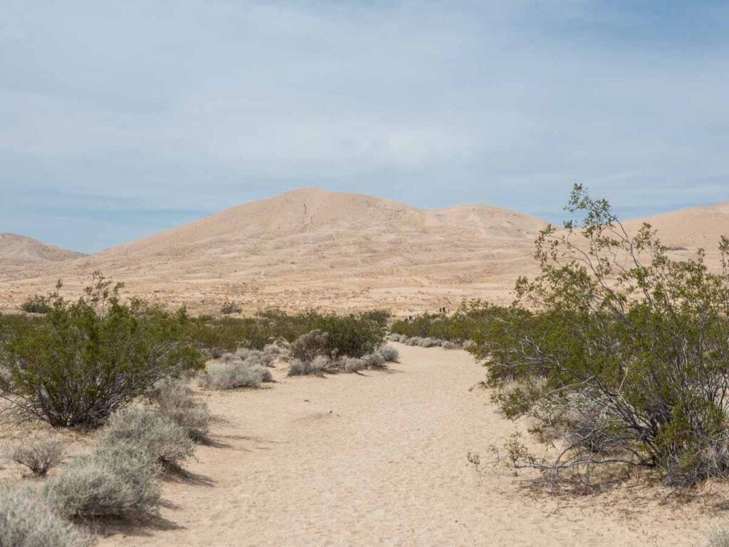
Detour south a bit and spend some time in the Mohave National Reserve. This is an off-the-radar spot just southwest of Barstow. Drive south-to-north through the reserve and be sure to take a detour to hike the Kelso Dunes.
Read More: Get the full downlow on all CA parks with our complete California State Parks list (with map).
#2: SF to Las Vegas Through the Sequoias
- Active Drive Time: 11.5 hours
- Miles: 670
- When to Go: Late spring through late fall
- # of Stops: 4
Routing & Stops
San Francisco south on Highway 101 to south Highway 99 >> Highway 180 east from Fresno into Kings Canyon National Park >> General’s Highway south through Sequoia National Park >> Highway 65 and 58 through Tehachapi and Barstow >> east I-15 to Las Vegas.
Sequoia National Park is famous for their giant Sequoia trees and Kings Canyon is the deepest canyon in North America. The park planners for Sequoia and Kings Canyon National Parks very thoughtfully planned a scenic route connecting the two parks. The Generals Highway covers the best-of Sequoia National Park and Highway 180 covers the best-of Kings Canyon.
You could simply bomb through the General’s Highway and do a quick scenic tour of Sequoia National Park. But— there are tons of look-outs, hikes and redwood groves to explore. Drive the Kings Canyon road to Zumwalt meadow for a hike. Then double back to the General’s Highway and enter Sequoia National Park. Be sure to stop at the General Grant tree, which is one of the oldest living trees in the world. Then get in some views at Morro Rock.
You may want to consider slowing it down through this segment and spending the night in Three Rivers. There are a number of motels and inns there.

#3: SF to Las Vegas via Tioga Pass & Highway 395
- Active Drive Time: 10.5 hours
- Miles: 590
- When to Go: May/June through November
- # of Stops: 7
Routing
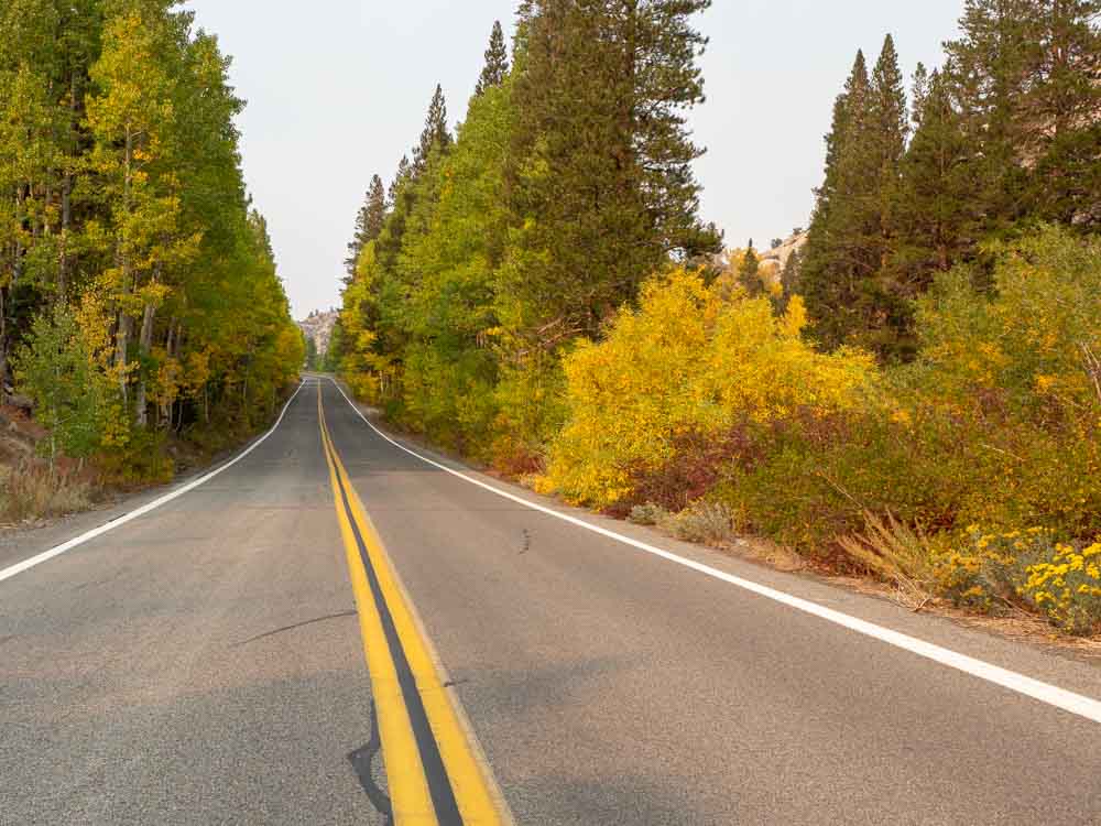
San Francisco east on I-205 and Highway 120 to Yosemite >> East over Tioga Pass on Highway 120 to Lee Vining >> South on Highway 395 through Lone Pine >> Highway 190 east through Beatty >> Highway 95 south to Las Vegas.
This isn’t a great routing for the winter, because Tioga Pass is always closed during the snowy months and the road conditions on upper Highway 395 can be tricky. But once Tioga opens (and especially in the fall), this is a fantastic San Francisco to Las Vegas drive. The mileage on this route is is shorter than your other options and the views are far better. There are so many stops along Highway 395, we’ve written a whole 5 day itinerary for it.
As you drive over Tioga Pass, be sure to slow it down and take advantage of the pull-outs for viewpoints.
Nowhere will you see the majestic operations of nature more clearly revealed beside the frailest, most gentle and peaceful things.
John Muir (more quotes here)
You won’t have time to do everything in the Eastern Sierras, but we suggest that you take a few quicker scenic stops and short hikes. Start at eerie Mono Lake, which is landlocked mineral lake with truly funky geologic tufas. Divert from 395 and take the June Lake Loop, which is a scenic drive that covers three lovely alpine lakes. Then stop at Convict Lake for the short 2.5 mile loop trail. The lake is famous for a shoot-out between some escaped convicts and the posse who perused them. But now it’s quite peaceful and it has killer fall color.
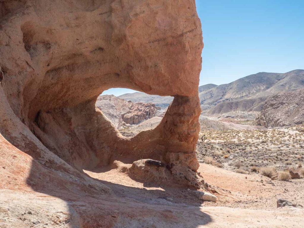
Spend the night in Bishop, where you’ll find a wide range of lodging and a lot of food options– we liked the Mountain Rambler Brewery for beer and burgers. In the morning, stop into the Schaat’s Bakkery, because they have amazing breads and sweets. Then visit the Laws Railroad Museum, which is a remarkably realistic replica town that represents this region in the early 1900’s. Once you get down to Lone Pine, take a drive into the Alabama Hills for the 1-mile Mobius Arch trail and some cool red rocks.
This routing will take you through northern Death Valley to Beatty Nevada. In Stovepipe Wells, stop at the Mesquite Dunes, then carry on east to the Rhyolite Ghost Town before getting to Beatty.
#4: SF to Las Vegas via Death Valley
- Active Drive Time: 10.5 hours
- Miles: 644
- When to Go: October through April
- # of stops: 7
Routing & Stops
San Francisco south on Highway 101 to south Highways 99 and 58 through Tehachapi >> Highway 14 to Ridgecrest then Trona Road north and east >> Highway 190 east and south to Furnace Creek then Pahrump >> Highway 160 to Las Vegas.
This San Francisco to Las Vegas routing is a perfect a winter drive. It takes advantage of the warm desert weather, which is always the best time to visit Death Valley. Like the Eastern Sierras, there’s also a LOT to do in Death Valley. If you can spare two nights in the park, use our 2-day Death Valley itinerary and our hotel guide to build your trip.
If you only have one night to spare, use our Death Valley-to-Las Vegas day trip guide. It has a quickie tour of the park with several routing options to Las Vegas. If you are planning this drive as a one way car rental from San Francisco, Las Vegas is actually the closest airport to Death Valley.
This routing takes you through Ridgecrest, but before you get there, stop into Red Rock Canyon State Park. The short 1.5 mile Hagen Canyon trail is right off the road and has lovely red rocks of the sort you’d find in Utah. Hit up Ballarat Ghost town, which used to be an old mining supply stop and hang out for creepy Charles Manson. Stop at the Mesquite Dunes before spending the night in either Stovepipe Wells or Furnace Creek.
You should definitely book ahead for any lodging in the park as it’s very limited, or use our camping guide. It’s only 2.5 hours to Las Vegas from Death Valley, so if you get up early, you can see quite a bit of the park. Get up at dawn for Zabriskie Point, then head down to Badwater Basin for the Artists Palette Drive and either the Golden Canyon hike (shorter) or the Sidewinder Canyon hike (longer).
Regardless of which San Francisco to Las Vegas driving route you take, be sure to have fun in Vegas. You can keep on going with the nature theme and visit Red Rocks State Park or go all in with the kitsch and explore vintage downtown Las Vegas. Enjoy your road trip, and in the immortal words of Elvis– ““Viva Las Vegas with your neon flashin’ and your one arm bandits crashin’.”
Happy trails!
More California Road Trip Ideas
- Explore the whole state by taking these great CA road trip itineraries.
- Take 5 days to do the SF to LA Pacific Coast Highway drive.
- Or another 5 day trip from San Francisco to the redwoods in far northern California.
- Or just do a shorter Big Sur day trip.
- Take the scenic drive around Lake Tahoe and get advice on the best way to get from San Francisco to Tahoe.
Amazing help for planning a tour in California. Was very difficult for me to find suggested route from San Francisco to Las Vegas and here I found 4 options to choose from. Thank you very much.
Hanna Orr-Ziv
San Diego, CA