When San Francisco’s Park Presidio was transferred to the National Park system in 1994, it not only preserved the history of this former military base, but it also enshrined public access to some of SF’s best greenspace. At 1,400 acres, the Presidio is the world’s largest urban national park. And with 24 miles of trail, there’s no shortage of hiking in the Presidio.
We have a whole article on things to do in the Presidio, so be sure to check that out if you want to spend a whole day there. But if you’re just looking for a great walk, we’ve curated this list of our favorite Presidio trails to optimize epic views, interesting history and art. We’re recommending park trails that range from an easy 2 miles to longer 4.5 mile hikes.
Some Background in the Presidio
San Francisco’s Presidio has seen California through colonization, the Mexican annexation, the Spanish American War, the Civil War, WWI, WWII and the Cold War. The site became redundant for the military in 1970, but the land and its history were worth preserving. So in 1994, The Presidio became part of the National Park system.
The whole Presidio is a National Historic Site, and Fort Point under the bridge is also a National Historic Site. So we have a Russian nesting doll of national park sites right in the heart of San Francisco. In fact, the Presidio is one of are 12 National Park sites within the Bay Area.
The Presidio is also part of the Golden Gate National Recreation Area (GGNRA), which administers a large and diverse set of natural and historical assets. The GGNRA isn’t an official national park, and yet, it’s the most popular “park” in the US, receiving 15 million visits in 2020. In addition to the Presidio, the GGNRA also manages sites stretching 40 miles north into Marin County and 20 south into San Mateo County. Top spots include: the Marin Headlands, Ocean Beach, Fort Funston, Sweeny Ridge, Phleger Estate, the Fitzgerald Marine Reserve, Fort Mason and Lands End (which is also worth hiking).
This dedication to greenspace and conservation is what makes the Presidio such a special place for urban hiking.
How to Get to the Presidio Trails
If you’re driving and want to do a trail that’s near the Golden Gate bridge use our parking guide for the Golden Gate Bridge to find spots. There is free (but limited) parking at Baker Beach (which is a trailhead for the Batteries to Bluffs trail), and a mix of free and paid spots throughout the Presidio. There is a large paid lot at the Main Post which can serve access to the Ecology Trail and Crissy Field. And if you are walking on a weekday, you can score free parking at Crissy field.
If you don’t have a car, you can use MUNI buses or the free PresidiGO shuttle. The shuttle makes a few key stops in SOMA and the Financial District, then it transits along Union Street before making stops at six places in the Presidio. You can find the map and schedule here. The shuttle runs a loop every 30 minutes or so.
If you are primarily interested hiking hear bridge, take the MUNI #28 bus.
5 Top Spots for Hiking in the Presidio
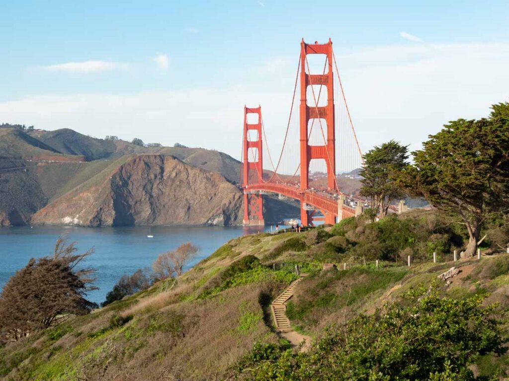
1. Batteries to Bluffs Trail
- 2.3 miles
- 435 feet of elevation
The trailheads for this hike are at either Baker Beach (to the south) or at the Langdnon parking lot (to the north). The “official” version follows the blufftop from Baker Beach to the old gun batteries near the Langdon lot. This is one of our favorite walks in San Francisco. And it’s also one the best Presidio hikes for the epic views of the Golden Gate Bridge, so try to go on a clear day. We recommend taking the detour down to Marshall Beach. It’s the loveliest beach in SF and it’s a nice spot for an extended beach stroll before you head back up the bluff.
We also recommend adding onto the hike by continuing past the Langdon lot to the southern base of the bridge. It will add another mile or so and will allow you to crawl around Batteries Boutelle and Marcus Miller and also get those great views of Angel Island, Alcatraz and the bay from the east side of the bridge.
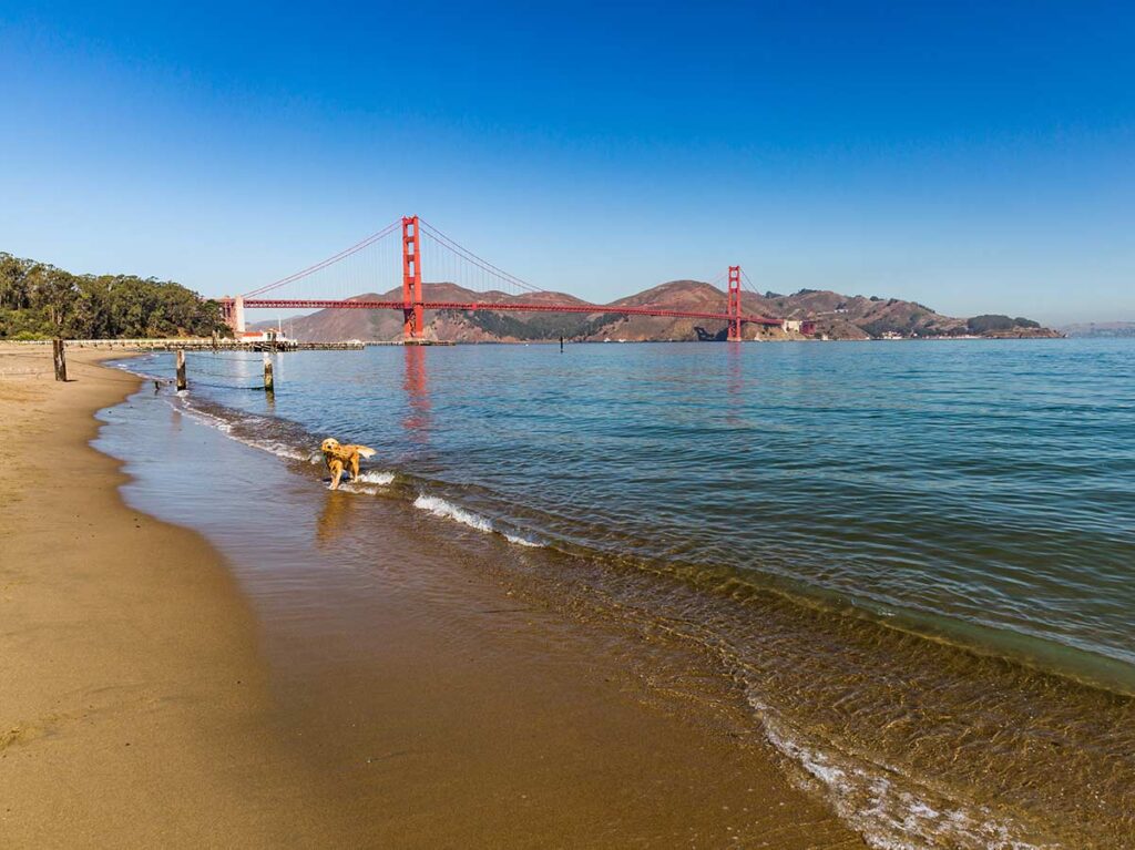
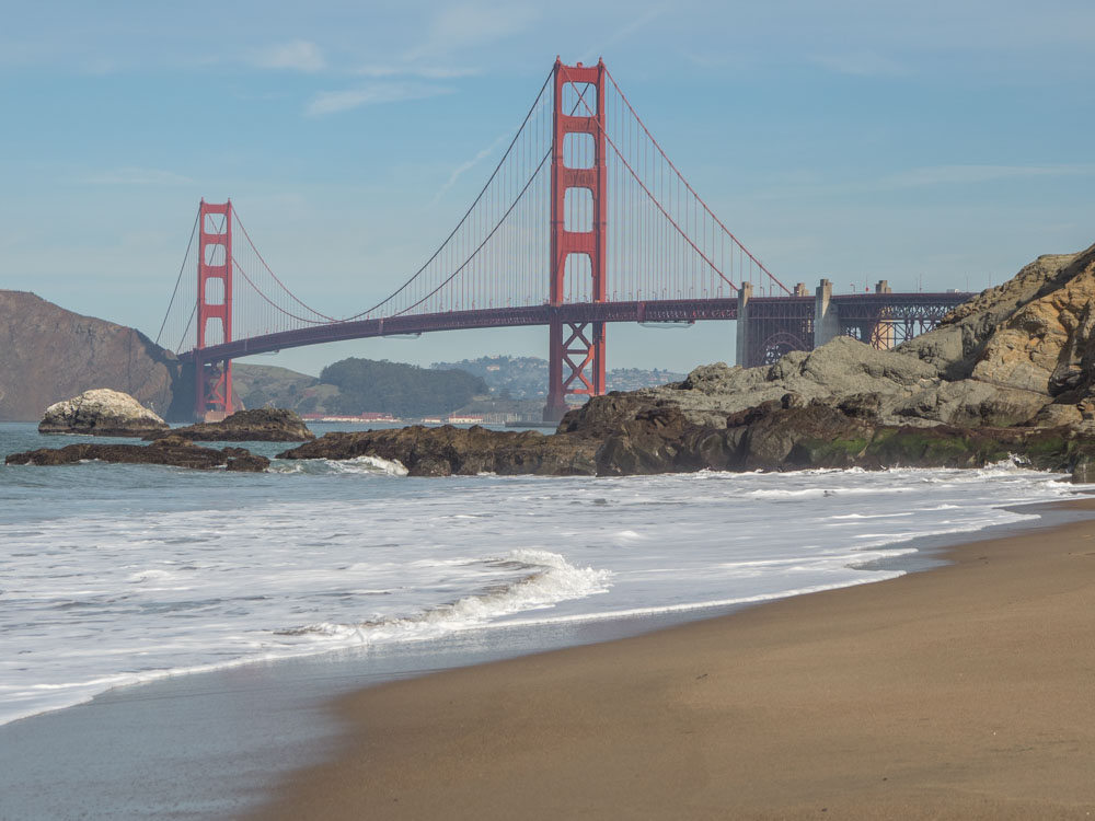
2. Crissy Field/Palace of Fine Arts Loop
- 3.9 miles
- 32 feet of elevation
This Presidio hike is a really nice leg stretcher and it’s very dog friendly. It follows a loop around the dunes and shoreline of Crissy Field and around the Palace of Fine Arts. It has nice down-low views of the bridge and bay, and dogs are allowed on the beach at Crissy Field. You can also add ~3/4 of a mile by extending the walk to historic Fort Baker, which sits directly under the bridge.
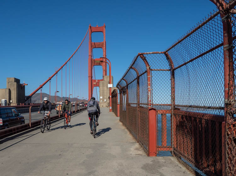
3. Golden Gate Bridge Walk
- 4 mile out and back
- Negligible elevation
The Golden Gate bridge is SF’s most iconic landmark…and also one of the most popular walking spots. On a clear day, you can see Angel Island, Alcatraz Island, SF’s Marina district and even the Bay Bridge. Although doing it in the fog also offers cool photography opportunities. And while doing it as an out and back is fun., there are also a lot of other Presidio trails that connect to the bridge for a longer hiking experience.
We have a whole guide on how to walk the bridge which features details for walking extensions. Some of our favorites include walking up from Fort Point on the Battery East trail, doing the Batteries to Bluffs as a one-way and then adding the bridge, or walking over the bridge and into Sausalito.
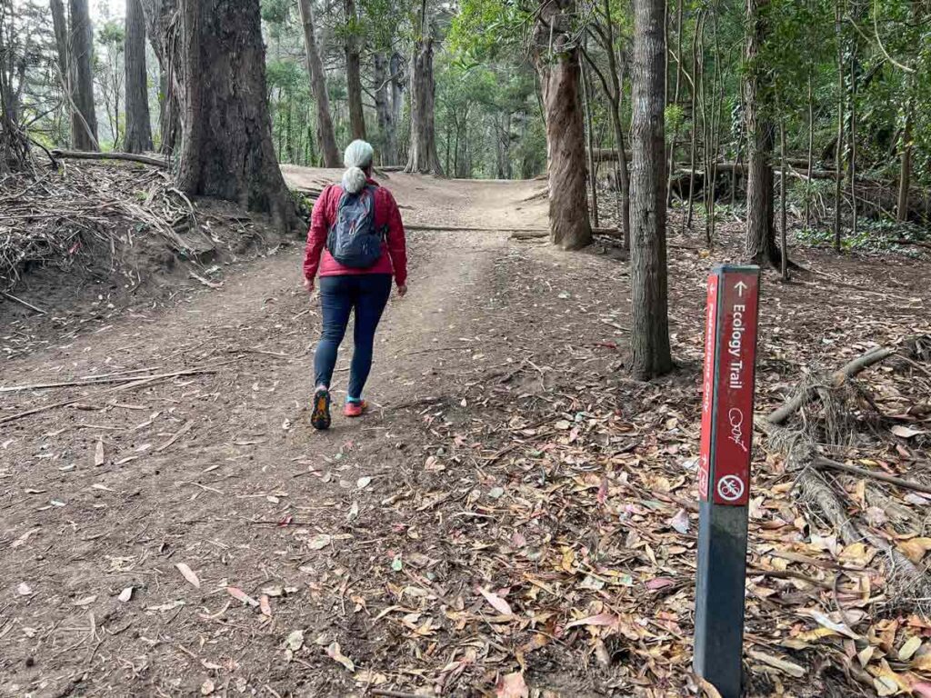
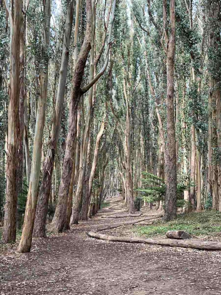
4. Ecology Trail/Lover’s Lane Loop
- 2 mile loop
- 295 feet of elevation
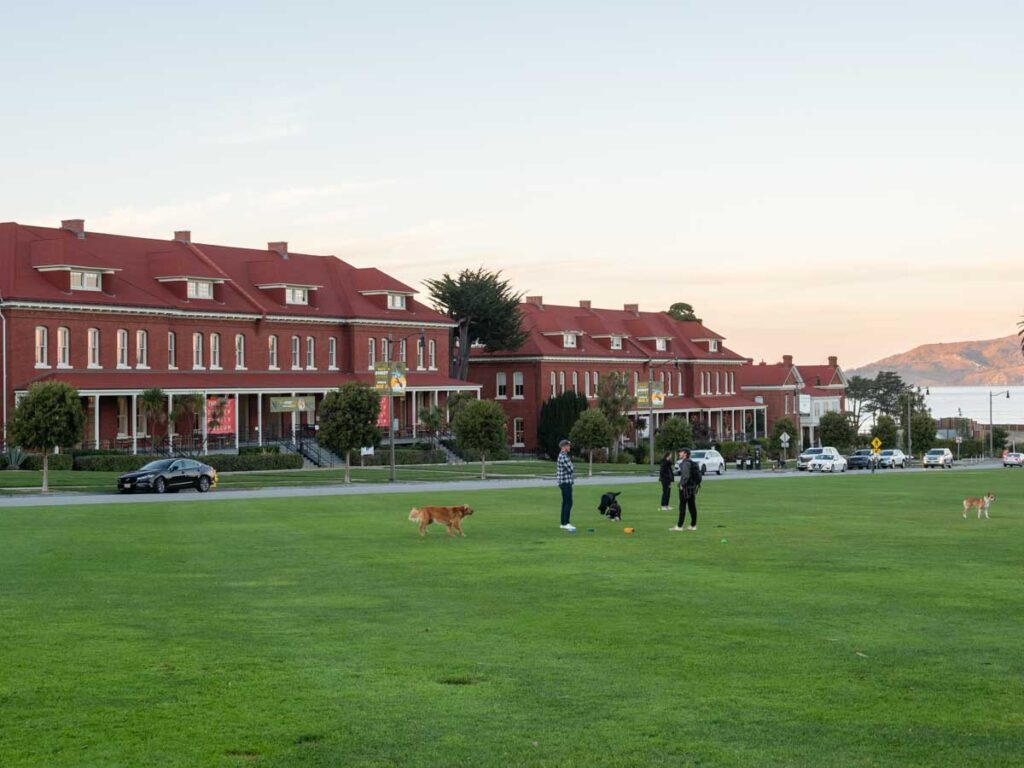
This loop trail transits the heart of the Presidio. It starts and ends at the Main Post, where you can hang out at the Tunnel Tops park or grab something to eat at the daily food truck stands. There are several detours that you can make from that trail which are really worth doing.
The first is a visit to El Polin Spring, which is a natural spring and wetland which has been restored to a (somewhat) natural state. Be sure to make a small detour up to Inspiration Point for nice east-facing views of the Presidio and the bay. And once you get to Lover’s Lane, head over just a smidge to the east and walk down through the Goldsworthy Lines. It’s an interactive art installation with graceful logs flowing down the hillside.
5. Presidio Promenade Loop
- 4.5 miles
- 425 feet of elevation
This Presidio park trail does an extended circuit around some some of the key historic areas in the park. It touches upon the Main Post, historic buildings, the cemetery and the Korean War memorial. You could make some short detours to the the following: Lucasfilm office building for the Yoda statue (which features on our list of offbeat things to do in SF), the Goldsworthy Lines, Inspiration Point, the Goldsworthy Spire and Tunnel Tops.
Do More Walks in the Bay Area
- Take a historic stroll through SF’s most notorious gold rush neighborhood on the Barbary Coast trail.
- Get off the beaten path on the Crosstown Trail, which is a 17 mile transit from the southeast to the northwest corners of the city. Our guide offers tips for doing the whole thing, or breaking it up into sections.
- Get more epic views with a side of history on the Land’s End trail.
- And then yet more epic views and even more history by hiking on Angel Island.
- Or visit the Coastside and do one of our favorite hikes in Half Moon Bay.
Explore More of San Francisco
- Hit up one of SF’s best bookstores.
- Get 20+ SF trip planning tips.
- Stroll the Mission District murals.
- Discover the city’s pretty mosaic staircases.
- Figure out where to stay in SF.