San Francisco’s Lands End hike is one of the best walking experiences in the city. It serves up the perfect mix of killer ocean views, history and urban exploring. This guide for hiking Lands End will tell you everything you need to know for the hike including cool detours, must see stops, a map and parking suggestions.
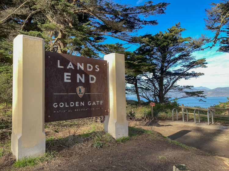
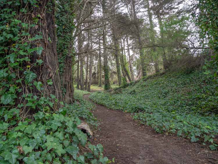
San Francisco is a very walkable city. You can stroll along the Embarcadero, walk across the Golden Gate Bridge, find nature in Glen Canyon and epic views in Bernal Heights. That said, the Lands End trail is one of the best hikes in the SF. It’s tucked away in the far northwest corner of the city and is part of the Golden Gate National Recreational Area (GGNRA).
The GGNRA is is the largest urban park in our National Parks system. It encompasses natural sites like 60 miles of fragile coastline and Muir Woods, but also California historic sites like The Presidio, Alcatraz Island, the Golden Gate Bridge and Fort Point. Lands End is also part of the California Coastal trail, a patchwork of trails that will ultimately make all of California’s coastline walkable. You can also check out the Devil’s Slide in Pacifica, which is also part of the trail network. Lands End is also part of SF’s new Crosstown trail, which is a 17 miles walk from the southeast corner of the city to the northwest edge of Lands End.
Lands End is special because it features a mix of both natural beauty and historic interest, all free and within easy reach.
FAQ for the Lands End Hike
How Long is the Lands End San Francisco Hike?
The basic loop trail is 3 miles, which you could easily cover in an hour. However, this guide recommends detours, scenic lookouts and memorials. If you do all of the stops suggested below, it you will cover ~4.5 miles and it will take 2.5-3 hours. This is a loop trail so you can start and end at nearly any point on the hike.
Is the Hike hard?
The Lands End hike is not very difficult. There are some ups and downs, which you will need to be prepared for, but the trail isn’t technical. The section between the Lincoln Hwy parking area and the Labyrinth is narrow and cliffy, so take care there. But the other sections are fairly wide.
Is Lands End Dog-Friendly?
Yes! It’s one of very few National Park areas that welcome Fido. Keep keep your dog on a leash and clean up after them.
Are There Bathrooms on the Hike?
Not many. There are some port-o-potties in the parking lot near the SS San Francisco memorial. There are also bathrooms in the Legion of Honor museum.
How do I get to the Lands End Trailhead?
If you are taking public transportation, the #1 bus will take you to the Legion of Honor or the #38R Geary express bus can drop you at 48th St, near the Sutro Baths parking lot. If you are driving, see the map below for parking lot locations.
When to visit Lands End
San Francisco has mild weather and you can go anytime. However, if there has been heavy rain, the trail will be quite muddy. In the summer, it’s often foggy in SF, so pay attention to the weather. If you are keen to photograph the trail or Sutro baths, morning is better as the west facing coastline can cause a lot of glare in the afternoon.
Lands End Trail and Parking Map
The following map includes the full Lands End trail loop with all nine stops plus parking.
Key Stops on the Walk
Don’t be in a hurry to do Lands End. There are nine detours, lookouts and memorials that are all worth spending some time exploring. Here’s a bit about each:
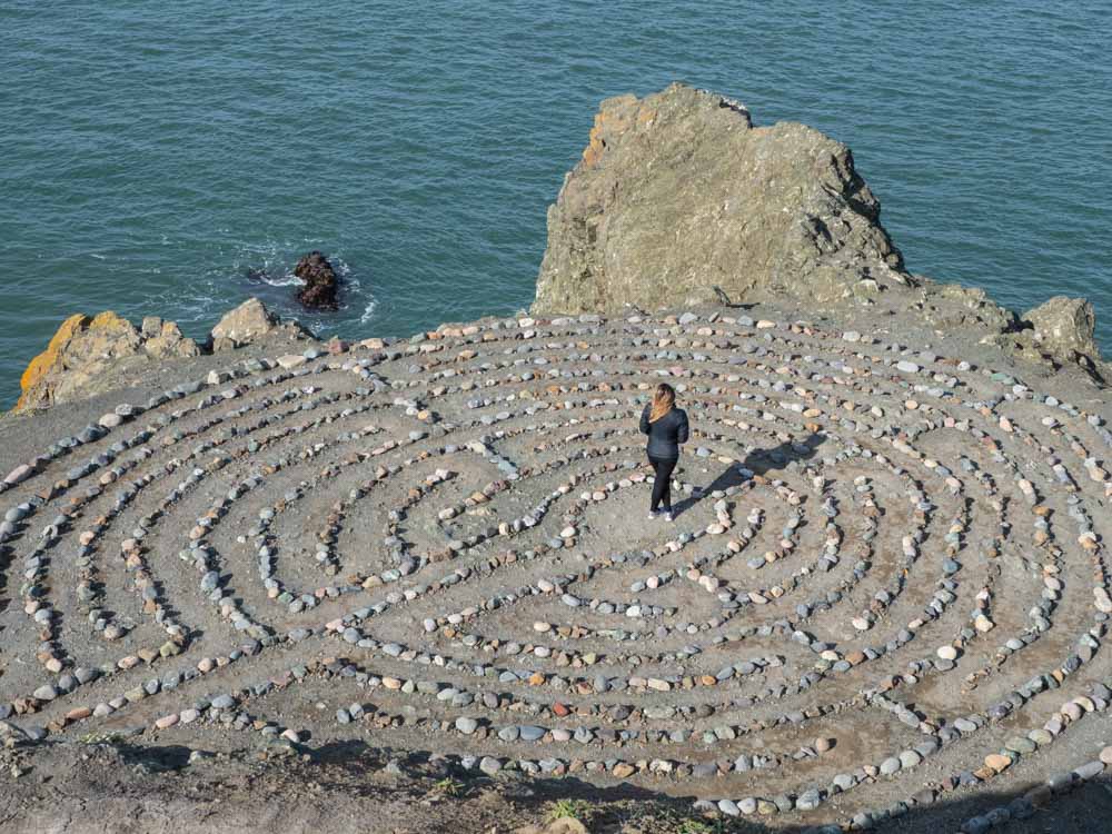
The Labyrinth, Mile Rock Beach Detour
This .8 mile round trip detour takes you off the main trail down to beach level. The Labyrinth was built by artist Eduardo Aguilera as a shrine to “peace, love and enlightenment”. A new-age sentiment if ever there was one, which is why SF is one of the most hippie towns in California. The Labyrinth is cool though and it’s worth spending a few minutes doing the full circuit. If you are with a companion, they can take a picture of you in the Labyrinth from the rock above.
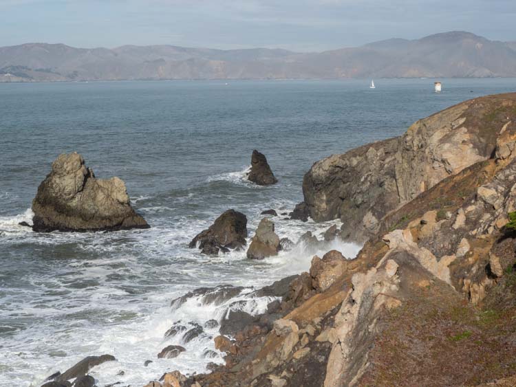
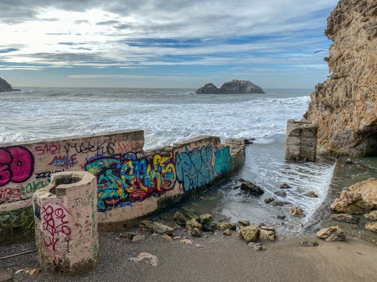
Mile Rock Beach is a small beach located just below the Labyrinth. It’s covered in driftwood and rocks and is quite lovely at low tide. Once you are back up on the main trail, keep an eye out for shipwrecks. There are 20 wrecks on this volatile coastline and at low tide, you can sometimes see bits of two sunken ships along this stretch.
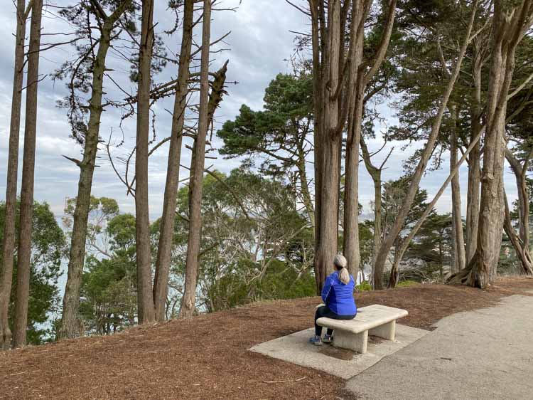
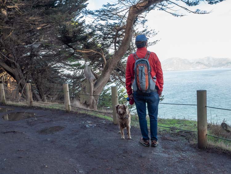
Eastern Coastal Overlook
This overlook has lovely views of the ocean and the Marin Headlands in the distance. This section of the Lands End hike is quite wide and flat. That’s because there used to be an electric street car line running from Sutter street out to the Sutro Baths. The El Camino del Mar road also extended through this area. But both the railway and the road were ultimately done in by landslides and now only the hiking trail remains.
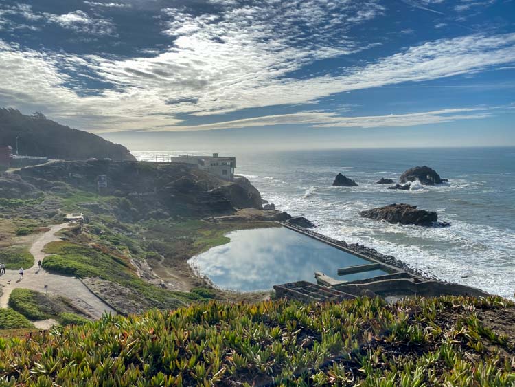
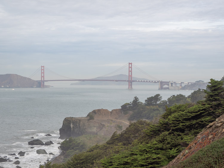
Point Lobos
Detour off the main trail town to Point Lobos and the Sutro Baths. The Land End lookout at Point Lobos is a great spot for not only ocean views but also a high level scan of the old Sutro Baths ruin. This is also a good spot to keep an eye out for migratory whales. The humpbacks migrate in the summer and gray whales go south in Oct-Dec and north in Apr-May.
Sutro Baths Detour
The baths were originally built in 1894 by an eccentric self-made millionaire who had a dream to provide healthy, inexpensive swimming for the masses. It was built to house 10,000 people at a time. People did use it in the beginning but the ambitious scale was its ultimate undoing. As the popularity of the baths began to wane in the early 1900’s the expenses outweighed the income and it ultimately fell to ruin.
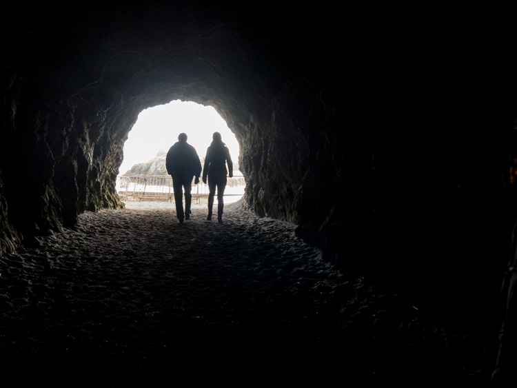
You can creep around the ruins, but just keep an eye on the tide. At the very bottom, toward the north end, you can walk through a short tunnel which leads to water-level views of the surf. If you want to hike later in the day, Sutro Baths is also a great spot for sunsets.
Lean into this offbeat side of city. The Labyrinth and Sutro Baths are just two of many unusual things to do in San Francisco.
Lands End Visitor Center
The visitor’s center is open most days from 9-5.
USS San Francisco Memorial
This spot memorializes the SS San Francisco and the 100 sailors and 7 Marines killed in action during the WWII Battle of Guadalcanal in the Pacific theater.
Battery Chester Detour
The Golden Gate has always been a strategic military site for the US and there are old forts and gun batteries scattered through Lands End, the Presidio and Marin Headlands. Check out this guide for great Golden Gate Bridge views, because it includes many of them. Battery Chester was built in 1899 and was in use until it was abandoned after WWII.
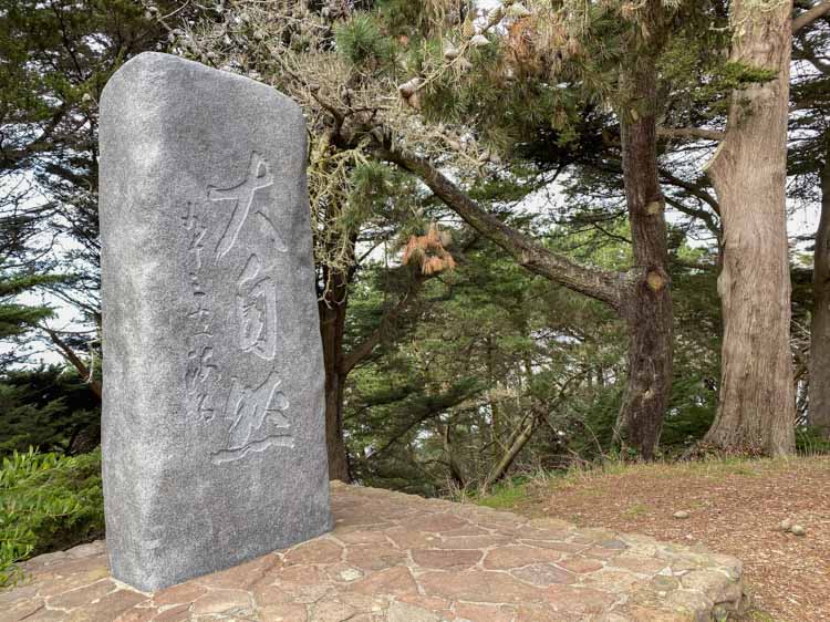
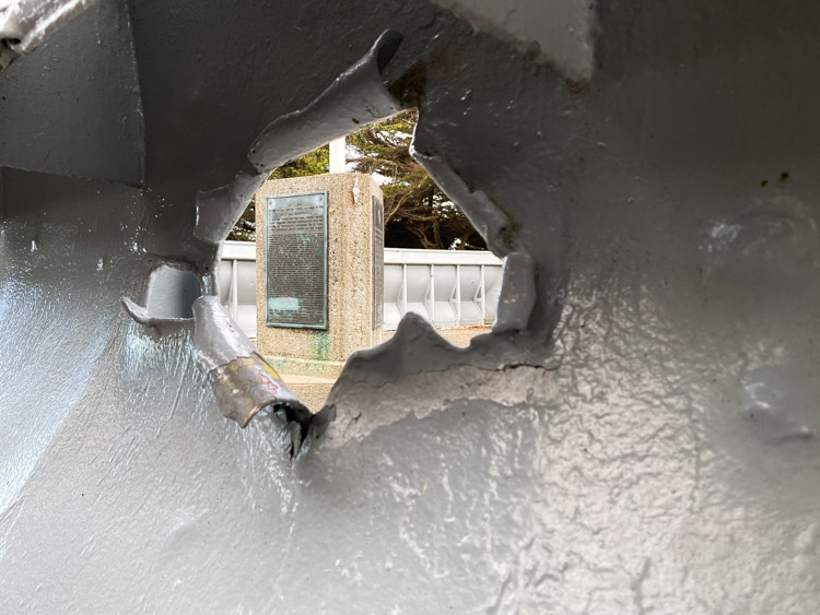
Memorial for Peace
This touching memorial balances all of those military sites in the GGNRA with some thoughts on peace. It reads in part “…we recognize once again the true fundamental of the human soul that pursues the truth, implements the good and creates beauty…”
How to Find Lands End Parking
There is actually quite a bit of parking available for Lands End, but on a sunny Saturday, it will fill up fast. The Sutro Baths parking lot holds ~75 cars and there is also some limited street parking above it near the Cliff House. There are ~140 spots along western El Camino Del Mar and into Fort Miley, which is where the SS San Francisco Memorial is located. There is also a lot of street parking on eastern El Camino del Mar near the Legion of Honor and onto Lincoln Highway as far as 32nd street.
Car break-ins have become a huge problem in SF, so don’t leave valuables in your car.
The ocean and the landscape are always changing and this is a hike worth repeating frequently. Have fun and happy trails.
(This article contains affiliate links. This means that if you choose to purchase, I’ll make a small commission.)
Things to Do Near Lands End
If you’d like to make a longer day of it, here are a few suggestions for things to do in the northern part of the city:
- Take a walk on the trails near the Golden Gate Bridge.
- Visit the nearby Lincoln St. mosaic staircase, which is one of 4 mosaic stairs in SF.
- Hang out in the Presidio.
More Great Walks in SF
- The 17 mile crosstown walk.
- The gold rush tour of the Barbary Coast.
- Our 5 favorite places to hike in the Presidio.
Take a walking tour in SF: