In the 1840’s, San Francisco was a sleepy little shanty town. But in 1849, gold was found in them thar hills and the rush was on. In short order, SF was transformed from a remote outpost into a fast-growing city of 10,000. Mind you, most of those folks weren’t considered upright citizens by today’s standards. The wealth from the Gold Rush brought in miners, sailers and thugs– and the businesses that served them, which was primarily grog houses, music halls, brothels and opium dens.
These business establishments extended along Pacific street and bled up and down the city’s hills. The area became known as the Barbary Coast and it comprised what is now parts of Union Square, Jackson Square, North Beach and Chinatown. The Barbary Coast Trail is one of the best San Francisco walks for history lovers. It meanders through downtown with historical markers noting one of San Francisco’s most notorious periods.
This guide to the Barbary Coast walk will give you some history on the neighborhood’s notoriety and a guide for doing the trail, which includes a map and some things to do at key stops.
Some History on the Barbary Coast
The miners were the first to arrive, hoping to score big in the goldfields. And with them, SF’s port grew, attracting sailors who were ferrying immigrants and supplies. Following them were the criminal gangs, most notably ex-convicts from Australia and New York. And, to further heat the stew, during this time SF had no civic infrastructure and what little began to develop, was heavily driven by corruption.
There was a lot of greed and hunger in the air in the 1850’s, and a whole series of businesses sprung up to take advantage of it. Over time Pacific Avenue, which straddles what is now Chinatown and North Beach, became a notorious strip that was completely stuffed with brothels, ale houses and “drug stores” selling opiates.
The area was so dangerous, that it was nicknamed Barbary Coast, in a nod to North Africa’s Barbary Coast. In North Africa, the coast was notorious for piracy and slave trade. In SF, it was more about robbing, thieving, drinking, pickpocketing and gambling. San Francisco’s port was also a hub for the practice of “shanghaiing” unsuspecting dancehall patrons. They would be drugged and sold into an unwilling form of indentured servitude to outbound ships, which were often headed to Shanghai. Fun!
“The Barbary Coast is the haunt of the low and vile of every kind. The petty thief, the house burglar, the tramp, the whoremonger, lewd women, cutthroats, murderers, all are found here […] Licentiousness, debauchery, pollution, loathsome disease, insanity from dissipation, misery, poverty, wealth, profanity, blasphemy, and death are there […] And Hell, yawning to receive the putrid mass, is also there.”, Benjamin Estelle Lloyd, 1876.
Tell us what you really think, Ben.
By the 1870’s there were some policeman, but vigilante justice was much more common. And what few police did exist during that time were woefully underprepared for the constant crush of the Barbary Coast’s various entertainments. The neighborhood hit peak drunk in the 1890’s with over 3,000 licensed (and 2,000 unlicensed) bars.
The party continued until 1906, when the earthquake devastated not only the Barbary Coast, but most of the rest of SF as well. When the neighborhood was re-built, it was done with the intent to upscale the entertainment. Pacific was renamed Terrific Street and there were more music halls and jazz clubs than before.
By 1913, San Francisco had grown up quite a bit and the civic infrastructure had matured to the extent that it was ready to deal with its more notorious (and illegal) businesses. Red light zoning and alcohol licensing closed many of the brothels and bars. And then Prohibition put a nail in the coffin.
If you enjoy exploring history with your feet, we also suggest that you check out our article on The Presidio. It’s a National Park site and former military base. It’s the south anchor for the Golden Gate Bridge and it houses cool trails, epic bridge views, the Disney family museum and even a touching pet cemetery. We also have a guide for the Lands End trail. In addition to offering lovely views of the Pacific, the trail has a series of historic markers, some old military bunkers and the Sutro Baths ruin (which we love as one of the more unusual things to do in SF).
Taking the Barbary Coast Trail
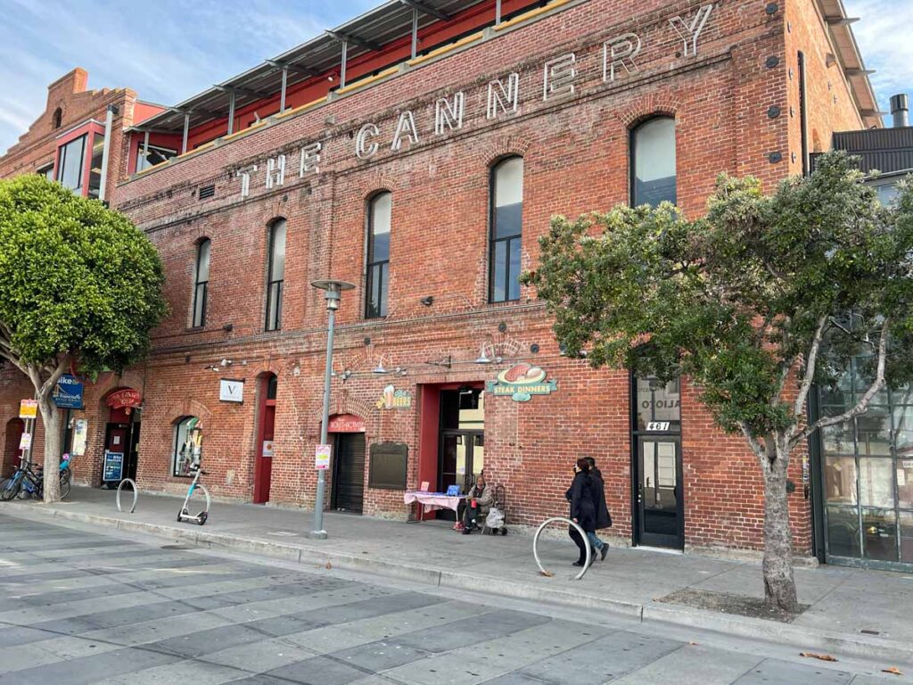
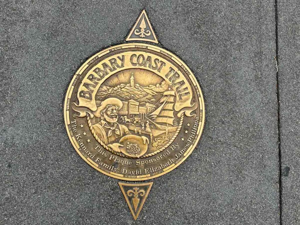
The Barbary Coast Trail was the brainchild of historian Daniel Bacon. He was inspired by the Boston’s freedom trail to create something similar in SF. He worked with the San Francisco Historical Society, raising money and getting permitting (no easy feat in SF) to install what are now 180 medallions on the walk. The trail encompasses the history of SF, primarily between the Gold Rush through the earthquake. In addition to the Barbary Coast neighborhood, the trail also includes America’s first Chinatown, Fisherman’s Wharf and SF’s Maritime National Historic park.
To do the trail, you can buy a guide or take a guided tour from the Barbary Coast organization. Or you can DIY it using our suggested key stops and the map below.
The official walk is 4.3 miles, but it will be closer to 5 if you take our recommended Coit Tower detour. Don’t be in a hurry, plan to spend a half a day and leave yourself plenty of time for eating, drinking and sightseeing.
Here are the key neighborhoods and some important stops.
The Mint & Union Square
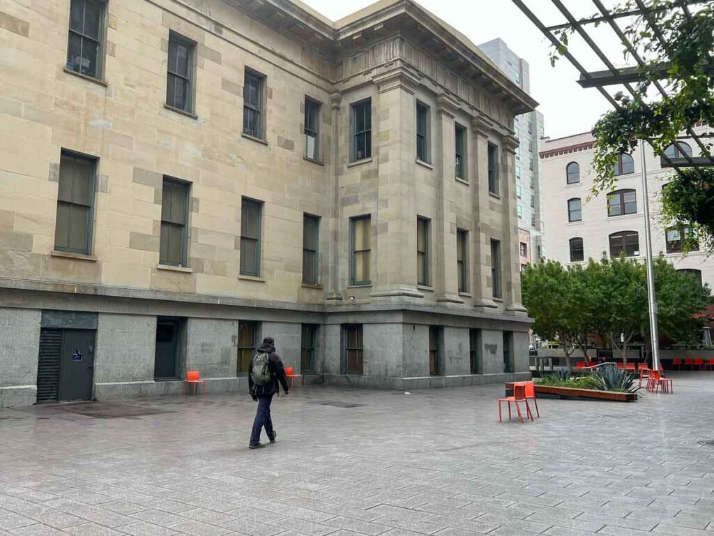
The trail starts at the old San Francisco Mint. It opened up on 1854 to service all of the money and gold that was flowing in from the rush. The trail then heads up to Union Square. This former sand dune was set aside in 1850 to become a public park. It was named after the civil war Union rallies that were held there. During the gold rush, it also functioned as a campground. Nearby Maiden Lane (formerly Morton Street), was the location of some ribald brothels.
Here are three things to do in the area today:
- Hang out in Union Square. It’s a nice leafy park and perfect for a picnic lunch. During the summer they have daytime concerts and in the winter, there is often a skating rink.
- Do some shopping therapy. This area houses many of SF’s tony shopping stores. There’s a flagship Macys along with Neiman Marcus, Hermes, Gucci, Burberry and others.
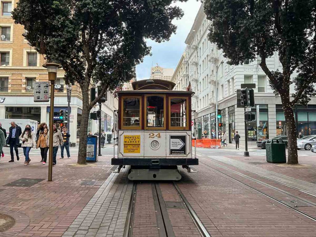
- Take the Powell Street cable car. You can use the cable car as a 1-way shuttle to or from the beginning of this walk. Here’s our guide to how to ride the cable cars.
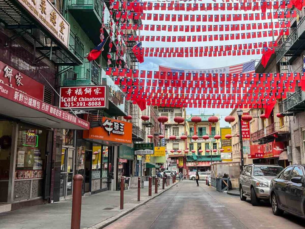
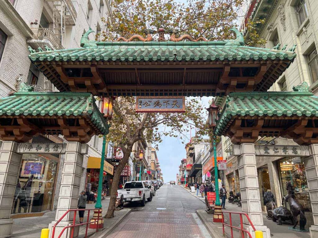
Chinatown
This neighborhood is the oldest Chinatown in the US. It was established in 1848 and was an epicenter of growth for both the gold rush and the western railroad expansion. Even today, it’s one of the largest Chinese enclaves outside of Asia. This is not some sort of Disnified touristy Chinatown. It’s a living, breathing neighborhood brimming with Chinese culture and small businesses.
Here are three things to do in Chinatown that are right on this route:
- Eat Eat Eat. This neighborhood is stuffed with great restaurants and there some really good ones right on the route. Try Wong Lee Bakery for egg tarts (732 Jackson), New Woey Loy Goey Restaurant for rice dishes (699 Jackson) or Hon’s Wun-Tun House for noodles (648 Kearny).
- Visit the Golden Gate Fortune Cookie Factory: Get fresh cookies and some good luck.
- Stop into Old St. Mary’s Cathedral. This Greek Revival style church was built in 1854. It was CA’s first cathedral and even managed to survive the earthquake.
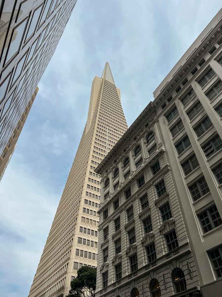
Jackson Square
In addition to the towering Transamerica building, this neighborhood houses some buildings that date back to the original gold rush days. It was SF’s original central business district.
- Stroll the Alleyways: This neighborhood is great for strolling and has lovely, low-slung brick buildings.
- Get a Coffee: The Bluebottle coffee on Montgomery at Pacific serves up some seriously strong hand-poured coffee (and the pastries are delish too!)
- Gallery Stroll on Montgomery Street: The stretch of Montgomery between Washington and Pacific has a series of galleries including: William Stout Architectural Books, Simon Breitbard Fine Arts and Gallery Japonesque.
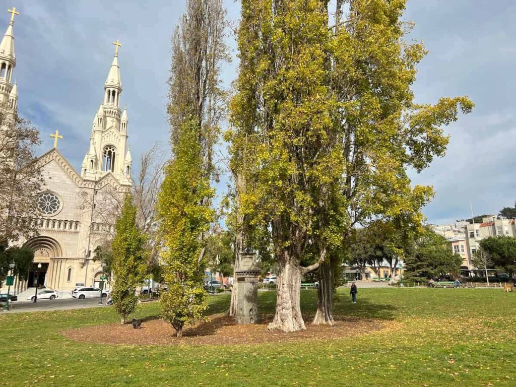
North Beach
Historically, North Beach is SF’s Little Italy. It transitioned into a culturally Italian neighborhood during reconstruction after the 1906 earthquake. But during the Barbary Coast time, the neighborhood house some seriously dive-y dance halls. And it still housed quite a few strip clubs deep in the 2000’s. In the 1950’s North Beach became ground zero for the Beat Poet movement.
Here are three things to do there:
- Stop into City Lights Bookstore: It’s one of SF’s oldest bookstores (and one of many great indy bookstores in SF). They provided space for those beat poets, and they still have a poetry room upstairs.
- Jack Kerouac Alley: Right next to City Lights is a short alleyway this celebrates Jack Kerouac with quotes embedded into the ground.
- Get some good eats: If you didn’t already stuff yourself in Chinatown, this is another great neighborhood for foodies. The Molinari deli has great sandwiches made with their own home made salami, North Beach Pizza is an institution for a quick slice out the door, and the Caffe Trieste is a cozy traditional Italian cafe.
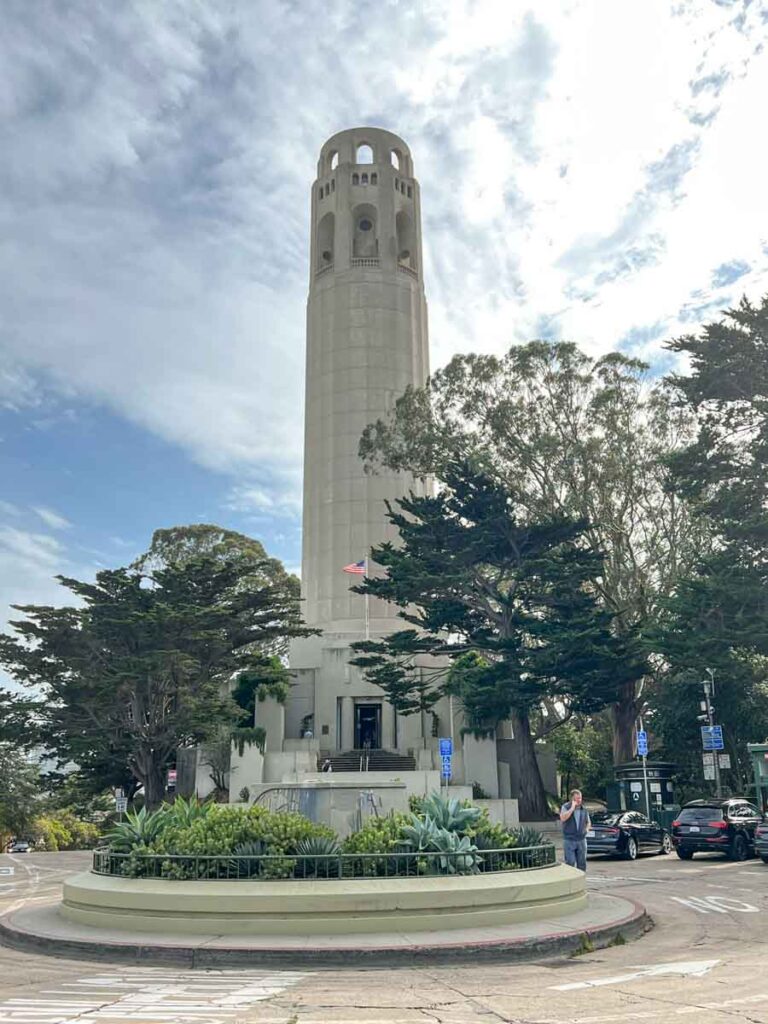
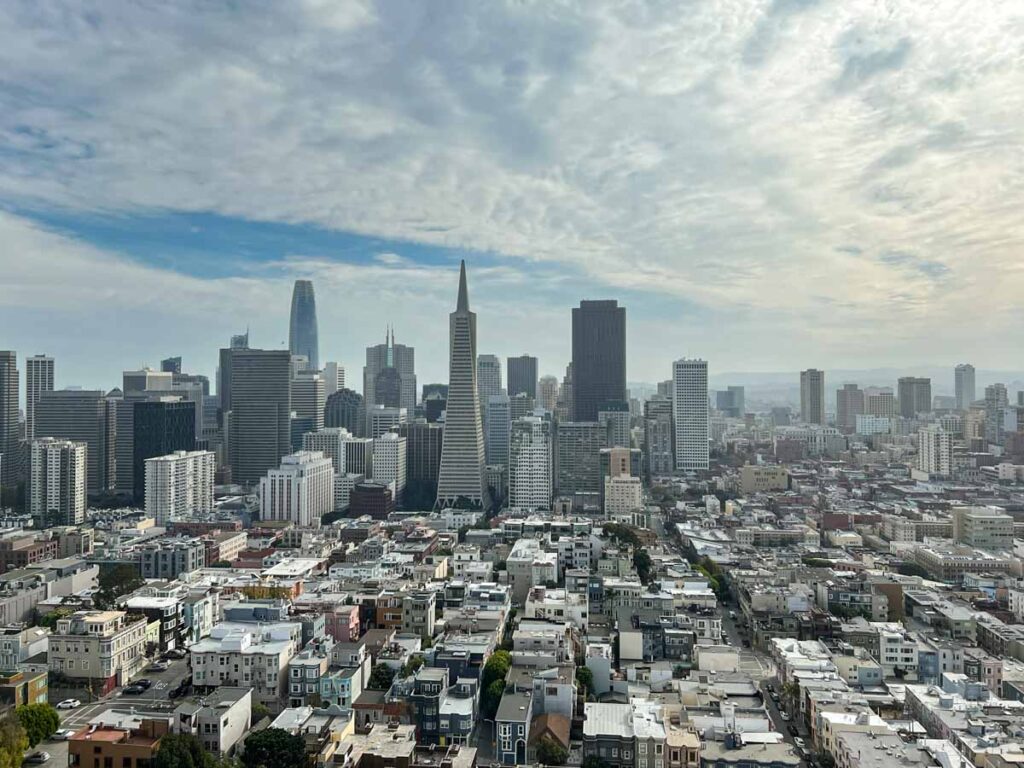
Coit Tower Detour
The Coit Tower was built in 1932 and came well after the decline of the Barbary Coast. So, it’s not on the official Barbery Coast trail. But it’s worth taking a detour to the tower for the following three reasons:
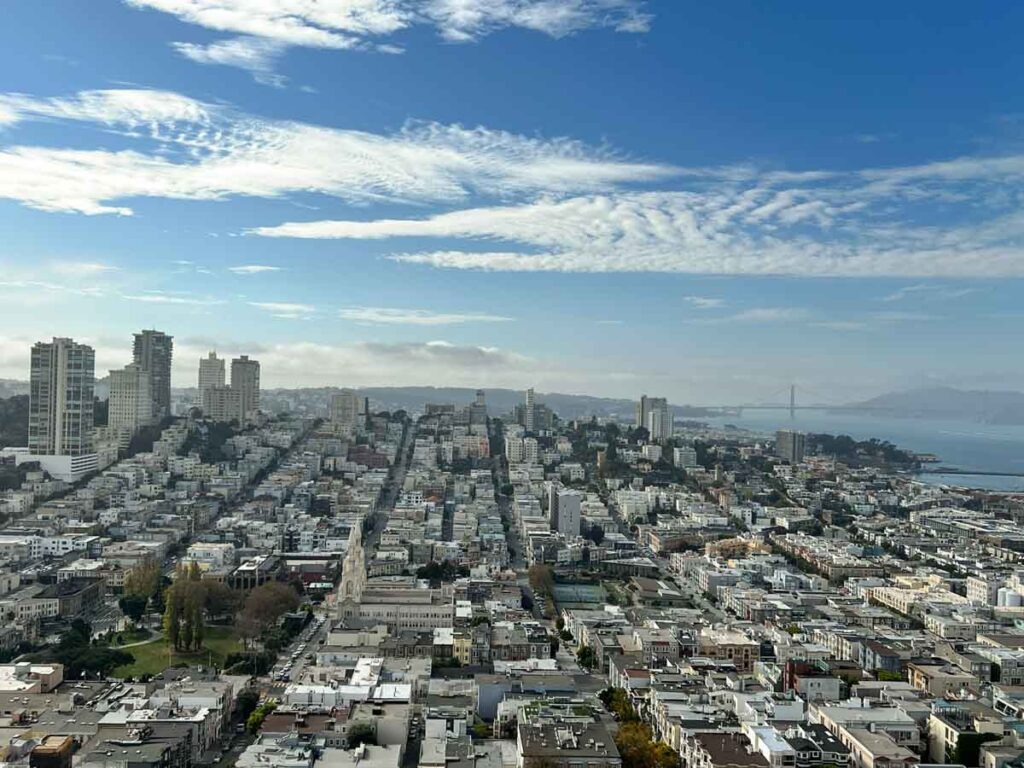
- Killer views of SF: The tower isn’t SF’s tallest building, but it’s location at the top of Telegraph Hill affords it wide-open 360′ views of SF and the Bay.
- Lovely Art Deco Architecture: For an unpainted concrete cylinder, this tower manages to be a stunningly graceful example of the 1930’s Art Deco period.
- WPA Murals: The tower’s interior includes some colorful examples of American Social Realism murals. They were commissioned as part of the WPA and tend to focus on workers, industries and socialism. There’s an incorrect rumor that Diego Rivera did the murals. But many of his friends did participate in the program and you can see his influence in the works.
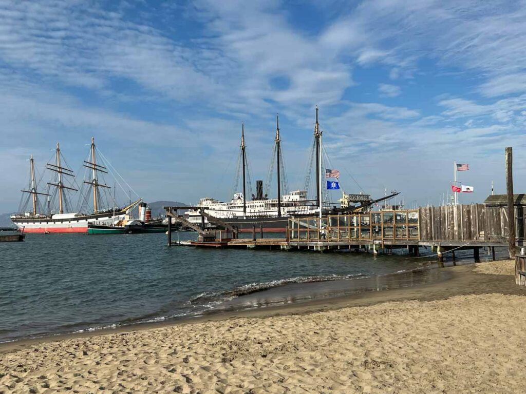
The Piers
When the gold rush hit, SF immediately became a major maritime city. This section of shoreline had originally been swampland. But between 1878 to 1924, landfill, dredging and a series of seawalls turned this area into a major port. The Clipper ships brought goods and immigrants from the Far East along with exports of metals and agricultural products to the rest of the world. Today, Pier 39 is one of San Francisco’s most popular tourist stops.
But it’s pretty tourist-trappy and there are some other cool things to explore in the area:
- San Francisco Maritime Historic Park Museum: This repurposed bathhouse is another example of Art Deco architecture and it also contains some WPA murals. It also features exhibits on maritime history. The Hyde Street pier is also part of the Maritime Park. They have 7 historic schooners, ferry boats and tugs which you can tour.
- Visit the Sea Lions: We aren’t overly fond of Pier 39, but it’s always worth going out to the edge of the pier to see the resident sea lions.
- Visit Ghirardelli Square: Now that your Barbary Coast tour is over, you deserve some ice cream! Ghirardelli started making chocolate in 1852. In 1893, they purchased this entire block and used it as their HQ. And today, you can stop into their store and get piles of their delicious chocolate and ice cream.
Barbary Coast Trail Map
Take a Guided Walking Tour in SF
Other Fun Stuff to Do in SF
- If you are visiting from out of town, be sure to use our SF accommodation guide to figure out where to stay. And use our SF tourism tips to plan your trip.
- Find SF’s pretty mosaic staircases.
- Explore history and hiking at Angel Island State Park.
- Check out street art in the Mission.
More Cool Walks and Hikes in the Bay Area
- Do more walking on some or all of the 17 mile Crosstown Walk.
- Our guide for 5 ways to hike in the Presidio.
- Hike the Devil’s Slide trail.
- Hike in Quarry Park.
- 11 amazing hikes in Half Moon Bay.