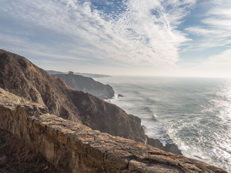
The Devil’s Slide Trail is an easy coastal walk situated between Pacifica and the Half Moon Bay’s Coastside. It’s not a particularly long hike, nor a technical one, but it has some of the best ocean views of any hike in the Bay Area. This guide for the Devil’s Slide will tell you how to get there, where to park and what to keep your eyes open for while on the trail.
California’s Devil’s Slide hike is part of a patchwork of trails comprising the California Coastal trail. The Coastal trail is part of an ambitious plan to make the entire coastline of California walkable. About 50% of the trail is complete and sections in the Bay Area include the Golden Gate Bridge, through the Lands End hike and down through Ocean Beach. There are bits and pieces of it through Pacifica, until the trail lands firmly once again at the Devil’s Slide.
The Devil’s Slide Trail FAQ
Where is the Devil’s Slide?
The northern edge of the Devil’s Slide starts in southern Pacifica, just before Highway One enters the Tom Lantos tunnel. The southern end Devil’s Slide is where the Highway One emerges from the tunnel, just before nearby Gray Whale Cove State Beach Park (which is a little jewel of a beach and worth a visit).
How Long is the Devil’s Slide Trail?
The walk is 1.2 miles one way or 2.4 miles round trip from the north end parking lot to the south end parking lot.
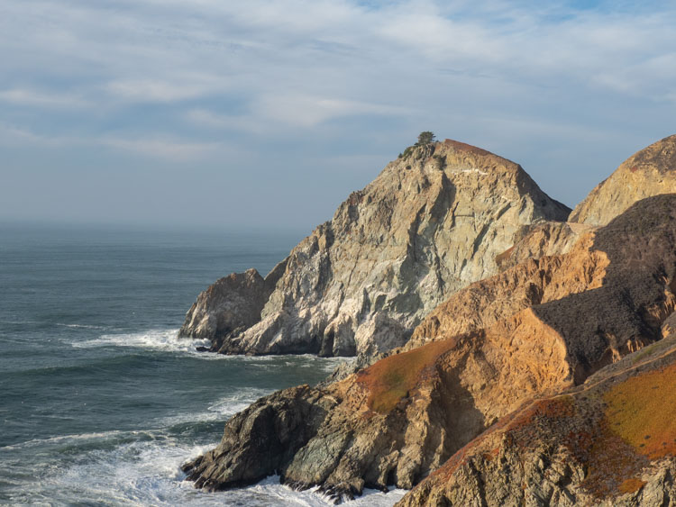
Why is it Called the Devil’s Slide?
The Slide is positioned between San Pedro Ridge and Montara Mountain. It’s a steep 900 foot cliff consisting of shale and sandstone with a soft sedimentary layer. This makes the rock very prone to erosion, which happens with devilish regularity due to the Pacific Ocean’s relentless wind and wave action. Mudslides occur in this area like a German train, which is to say frequently and on a reliable schedule.
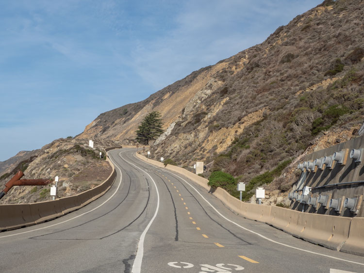
Man’s many efforts to engineer the Slide have been met with one diabolical slap-down after another. There was the failed railway which started in 1905, but it was wiped out by a slide triggered by the 1906 earthquake. They rebuilt by 1908, but the railway couldn’t make a go of it and closed down in 1920.
Highway One was blasted into the hillside in 1937 and the first major landslide occurred in 1940. 1995 saw a two year closure and the road closed again for over five months in 2006. These long closures and many shorter ones wreaked havoc on Coastside traffic. So, a long-discussed (and much argued over) tunnel finally began construction. In 2013, the Tom Lantos tunnel opened and the old roadway was converted into the Devil’s Slide trail.
Where to Park at Devil’s Slide?
There are 13 parking spots on the north end of the trail, and 24 spots on the south end. So, parking is tight, especially on sunny weekends. There isn’t room to park on the road shoulder at either and of the trail. Go early or late to get a spot. The lots are open from 8am to roughly dusk.
Can I Take the Bus to Devil’s Slide?
Yes, but it’s inconvenient. The county website recommends taking the #17 Samtrans bus on busy weekends as a solution to the tight parking situation. The 17 runs between Pescadero and Linda Mar in Pacifica. However, it only runs every two hours on the weekend, making it an impractical choice.
4 Things to Watch Out For While on the Trail
While walking California’s Devil’s Slide is nice in and of itself, the whole point of doing it is to take advantage of the ocean views and nature environment. Here are a few things to look out for:
- Nesting Sea Birds: There are Peregrine Falcons, Pigeon Guillemots, Brandt’s Cormorants, Common Murres, and Western Gulls who nest along the cliffs above and below the trail. You should also keep your eyes open for hawks, falcons and vultures swooping in for the kill.
- Marine Mammals: The whole California coastline is a watery highway for migratory Gray and Humpback Whales. The Grays migrate down the coast in December/January and back up in mid-March to early May. Humpbacks migrate to Central California from April to December, but are very visible in the summer. There are also Elephant Seals, Sea Lions and Common, Rissos, and Pacific White-Sided Dolphins.
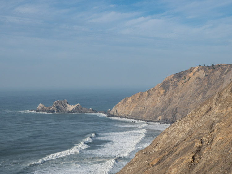
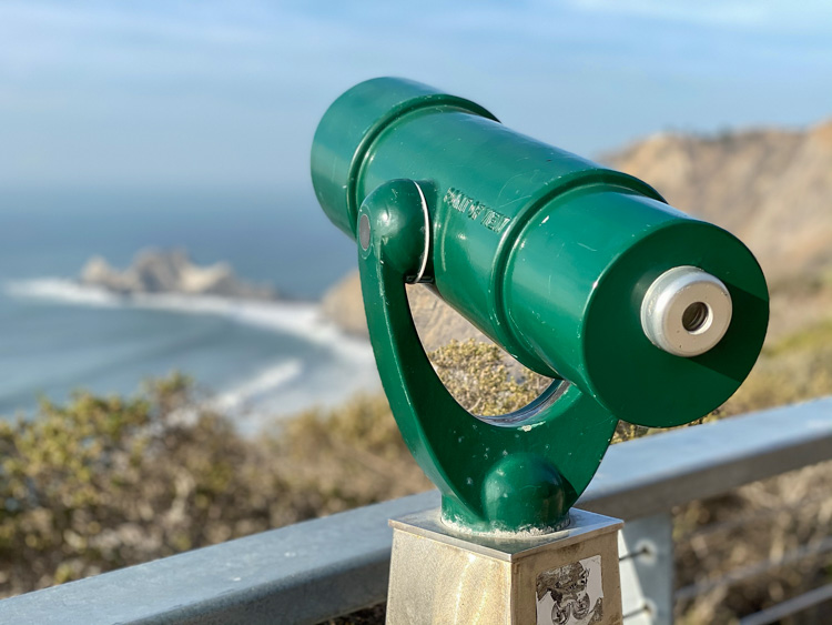
- Watch the Waves: There are several areas along the trail with benches and lookout scopes and it’s worth stopping frequently to admire the water. The waves are quite strong on this part of the coast and watching them is a very mesmerizing experience.
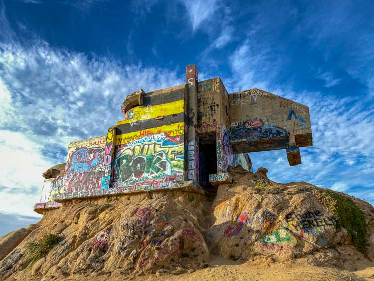
- WWII Bunkers: Just south of the parking lot is an old WWII air defense bunker. Much of it has been eroded by the wind and the rest has been painted up with graffiti. It’s a cool pop of urbex color on the natural landscape. The signs specifically say that the cliffs are not stable and advise against going up to the bunker. However, it’s not fenced off.
More Fun Things to Do in Half Moon Bay and the Coastside:
- Find more hikes using our Half Moon Bay trail guide.
- Plan your Half Moon Bay weekend getaway with our complete guide.
- Get more beach action by checking out one of the three beaches that are part of the Half Moon Bay State Beach Park or check out Pescadero State Beach.
- If you are visiting in the fall, be sure to check out the Half Moon Bay pumpkin patches.
- Book a beach stay at one of these amazing Half Moon Bay Airbnb rentals.
More Great Walks & Hikes in the Bay Area
- Stroll SF’s historic Barbary Coast trail.
- 5 epic hikes on the Presidio.
- SF’s epic 17 mile Crosstown Trail.
- Hiking and history at Angel Island State Park.
Does anyone know about the car crash that is visible from the walking trail near the North end of the tunnel?
I seem to remember going to Devil’s Slide in the early 70’s because it was a nude beach. Have I got it mixed up with some other nude beach? I’m sure nude beaches have long been outlawed even in California.
Gray Whale Cove is just south of Devil’s Slide and part of it is a nude beach…sometimes.